MyTopo
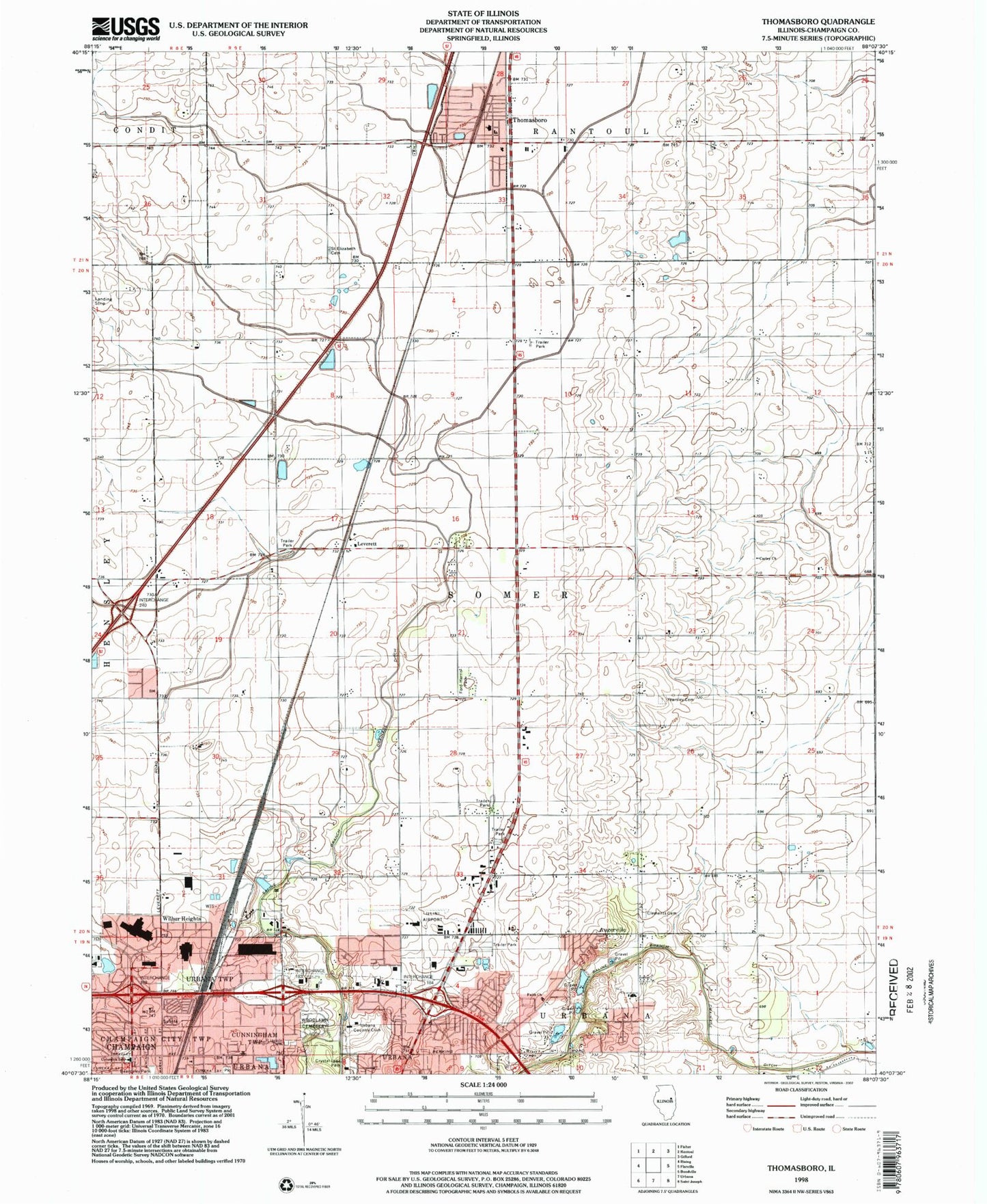
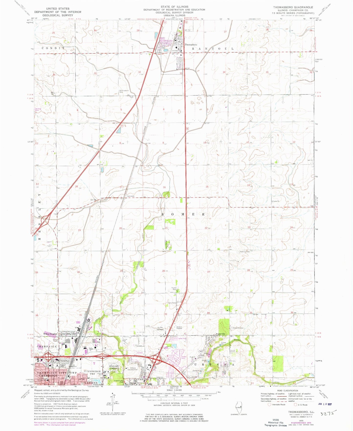
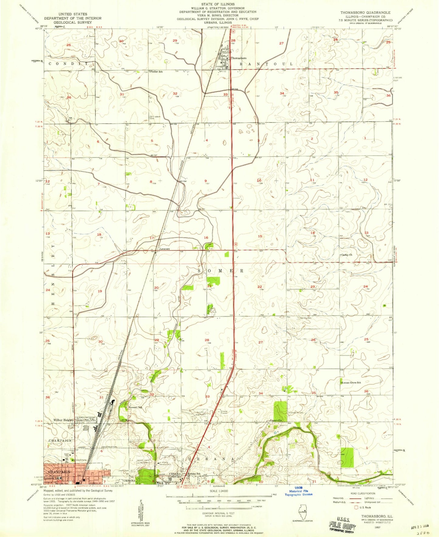
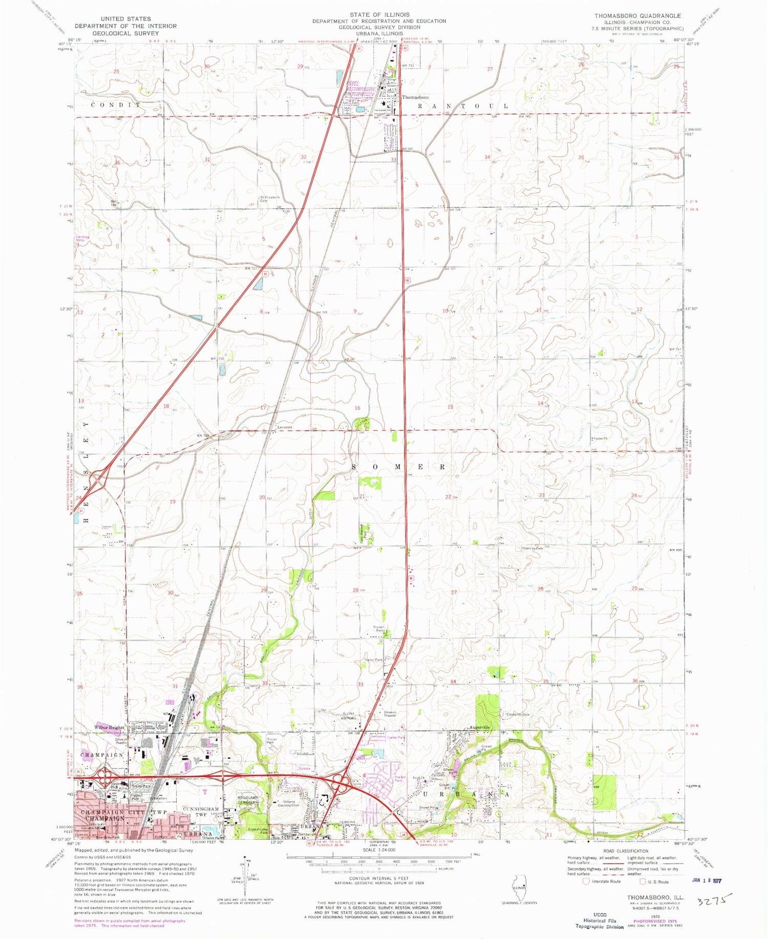
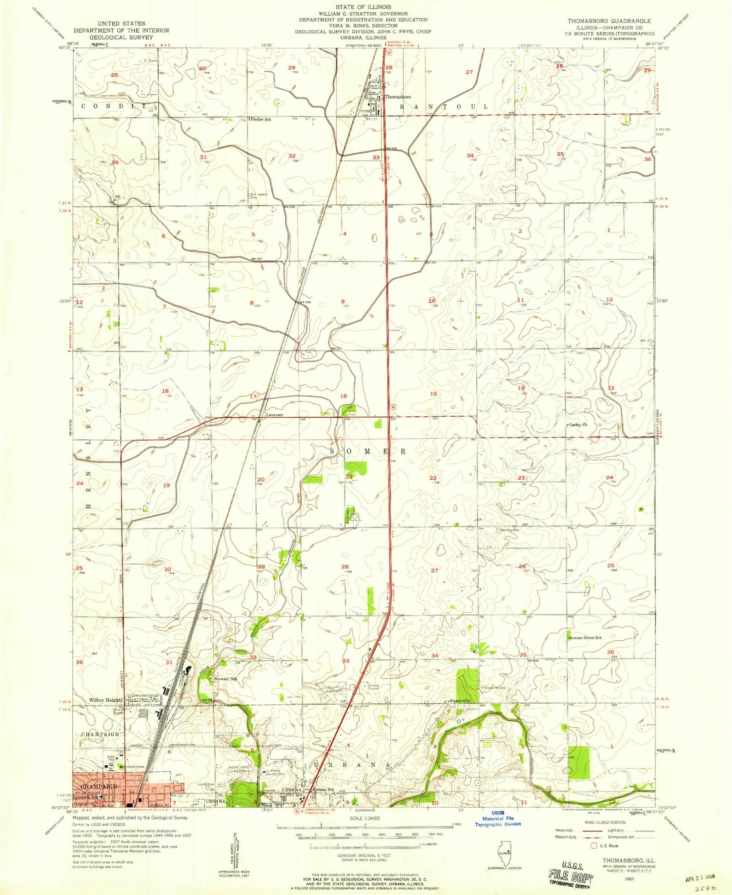
Classic USGS Thomasboro Illinois 7.5'x7.5' Topo Map
Couldn't load pickup availability
Historical USGS topographic quad map of Thomasboro in the state of Illinois. Map scale may vary for some years, but is generally around 1:24,000. Print size is approximately 24" x 27"
This quadrangle is in the following counties: Champaign.
The map contains contour lines, roads, rivers, towns, and lakes. Printed on high-quality waterproof paper with UV fade-resistant inks, and shipped rolled.
Contains the following named places: Augerville, Beardsley Park, Boneyard Creek, Busey Woods, Carley Church, Carroll Fire Department, Champaign County, Clements Cemetery, Columbia Elementary School, Eastern Prairie Fire Protection District, Faith Church, Fiedler School, Ford-Harris Park, Frasca Field, Frasca Field Industrial Park, Hazel Park, Illini Airport, Leverett, Lincoln Memorial Gardens, Locust Grove School, Market Place Business & Technical Center, Market Place Mall Shopping Center, Market Street Industrial Park, North Lincoln Industrial Park, Perkins School, Saint Elizabeth Cemetery, Saline Branch Drainage Ditch, Stewart School, Thomasboro, Thomasboro Fire Protection District, Thomasboro Grade School, Thomasboro Post Office, Thomasboro Village Police Department, Township of Somer, University of Illinois Experimental Forest, University of Illinois Research Forest, Urbana Country Club, Urbana Fire Rescue Services North Station, Village of Thomasboro, Wilbur Heights, WLTM-FM (Rantoul), Woodlawn Cemetery, Yearsley Cemetery, ZIP Codes: 61802, 61878