MyTopo
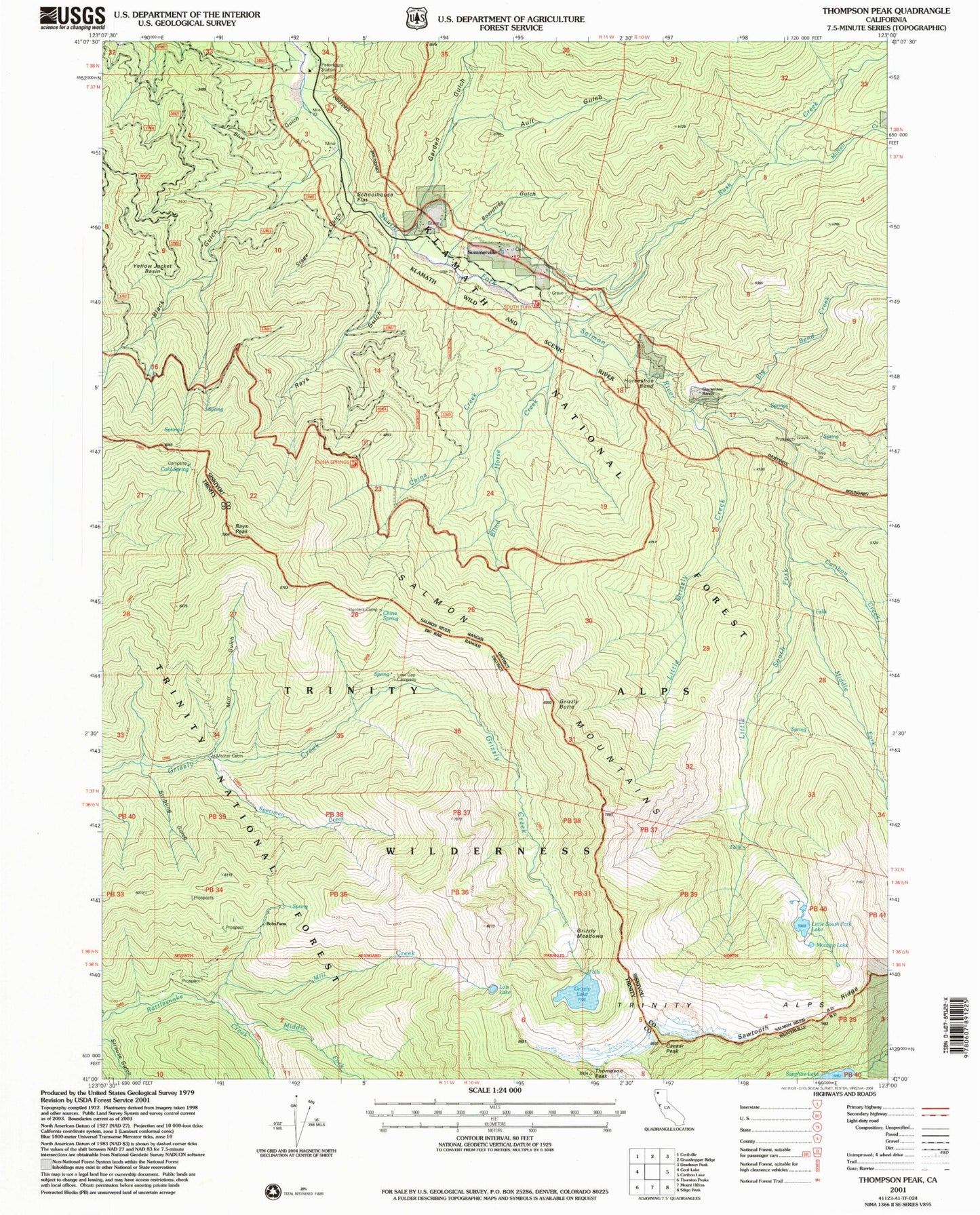
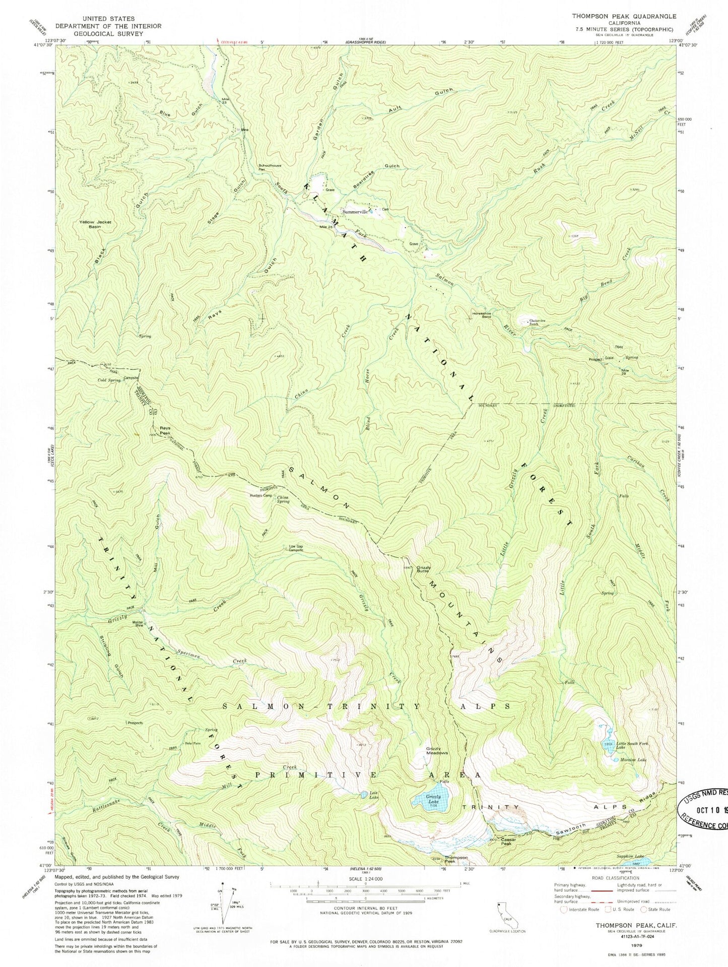
Classic USGS Thompson Peak California 7.5'x7.5' Topo Map
Couldn't load pickup availability
Historical USGS topographic quad map of Thompson Peak in the state of California. Typical map scale is 1:24,000, but may vary for certain years, if available. Print size: 24" x 27"
This quadrangle is in the following counties: Siskiyou, Trinity.
The map contains contour lines, roads, rivers, towns, and lakes. Printed on high-quality waterproof paper with UV fade-resistant inks, and shipped rolled.
Contains the following named places: Ault Gulch, Big Bend Creek, Black Gulch, Blind Horse Creek, Blue Gulch, Boardtree Gulch, Bobs Farm, Caesar Peak, Caribou Creek, China Creek, China Spring, Cold Spring, Garden Gulch, Glacierview Ranch, Grizzly Butte, Grizzly Lake, Grizzly Meadows, Horseshoe Bend, Hunters Camp, Little Grizzly Creek, Lor-o Ranch, Low Gap, McNeil Creek, Middle Fork of Little South Fork, Middle Fork Rattlesnake Creek, Mill Creek, Mill Gulch, Moliter Mine, Moraine Lake, Rays Gulch, Rush Creek, Schoolhouse Flat, Specimen Creek, Stage Gulch, Stribling Gulch, Coast Ranges, Little South Fork Salmon River, Little South Fork Lake, Lois Lake, Thompson Peak, Salmon Mountains, Yellow Jacket Basin, Rays Peak, Petersburg Station, Luther Lake, Hunters Camp, Low Gap Campsite, Moliter Cabin, Summerville, Trinity Alps, South Fork School (historical), Trinity Alps Wilderness