
MyTopo
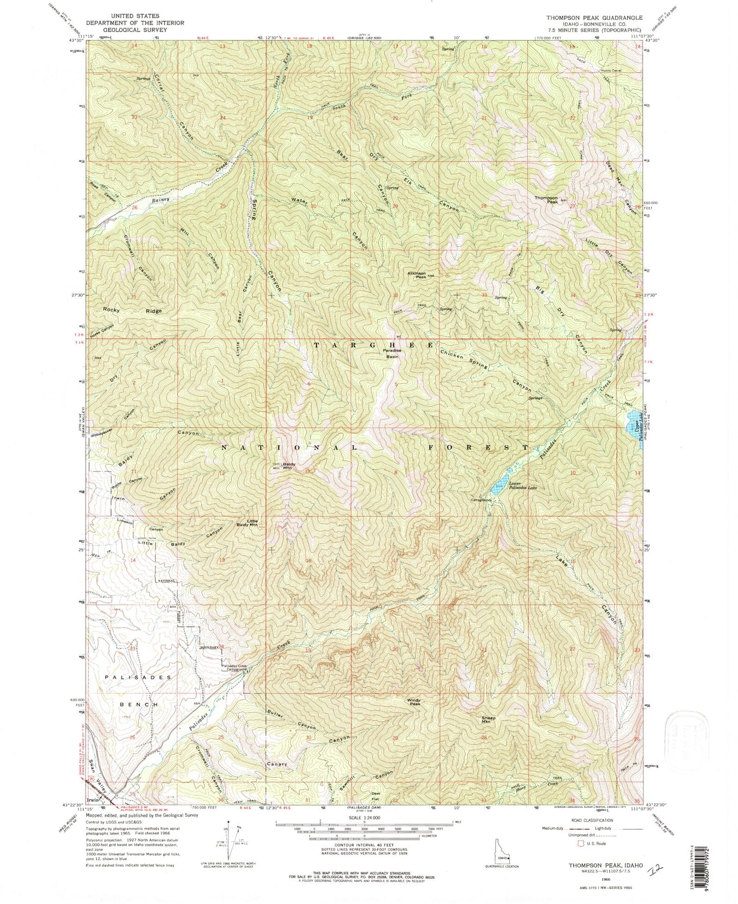
Classic USGS Thompson Peak Idaho 7.5'x7.5' Topo Map
Couldn't load pickup availability
Historical USGS topographic quad map of Thompson Peak in the state of Idaho. Typical map scale is 1:24,000, but may vary for certain years, if available. Print size: 24" x 27"
This quadrangle is in the following counties: Bonneville.
The map contains contour lines, roads, rivers, towns, and lakes. Printed on high-quality waterproof paper with UV fade-resistant inks, and shipped rolled.
Contains the following named places: Atkinson Peak, Baldy Mountain, Bear Canyon, Big Dry Canyon, Butler Canyon, Canary Canyon, Chicken Spring Canyon, Corral Canyon, Cromwell Canyon, Dry Elk Canyon, Lake Canyon, Little Baldy Mountain, Little Bear Canyon, Lower Palisades Lake, Mill Canyon, North Fork Rainey Creek, Palisades Bench, Palisades Creek Campground, Paradise Basin, Road Canyon, Rocky Canyon, Rocky Ridge, South Fork Rainey Creek, Spring Canyon, Thompson Peak, Water Canyon, Windy Peak, Sheep Mountain, Mill Creek, Palisades Lake Lodge, Canary Canyon Creek, Dry Creek


