
MyTopo
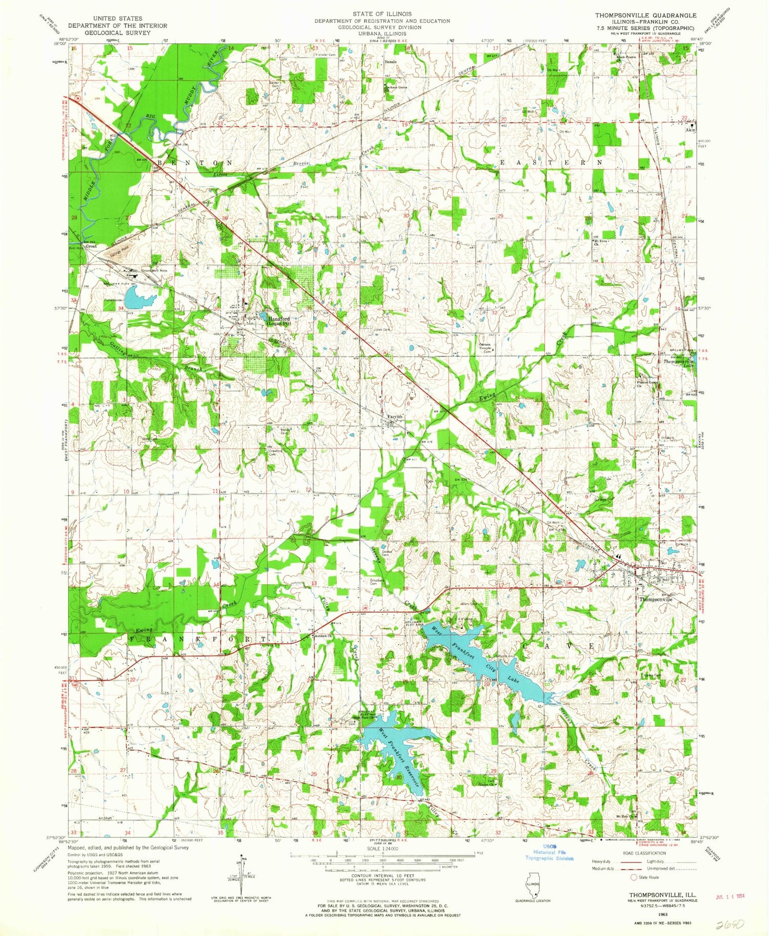
Classic USGS Thompsonville Illinois 7.5'x7.5' Topo Map
Couldn't load pickup availability
Historical USGS topographic quad map of Thompsonville in the state of Illinois. Map scale may vary for some years, but is generally around 1:24,000. Print size is approximately 24" x 27"
This quadrangle is in the following counties: Franklin.
The map contains contour lines, roads, rivers, towns, and lakes. Printed on high-quality waterproof paper with UV fade-resistant inks, and shipped rolled.
Contains the following named places: Akin Community Consolidated Elementary School, Antioch Church, Baxter Cemetery, Bessie, Bessie RLA Airport, Bethel Church, Bucktown School, Carters Temple, Cave Eastern Fire Protection District Station 1, Center School, Clem Cemetery, Crawford Cemetery, Downs Cemetery, Drummond Branch, East Crown Point School, East Fork Church, Eastern Post Office, Fitts Hill Post Office, Franklin Cemetery, Franklin School, Greenville, Groat, Illinois No Name Number 3 Dam, Isaacs Cemetery, Jackson Grove Baptist Church, Jones Cemetery, Knob Prairie Church, Little Bessie Creek, Logan, Logan Elementary School, Logan Post Office, Melvin Cemetery, Memorial Hospital Heliport, Mormon Church, Mount Etna Church, Mount Zion Church, Neal Cemetery, Neal School, New City Lake, New City Lake Dam, Old City Lake, Old City Lake Dam, Orient Number 5 Mine, Orton School, Parrish, Plaster Grove Church, Postoak School, Smothers Cemetery, Smothersville, Stevens Creek, Swofford Cemetery, Thompsonville, Thompsonville Grade School, Thompsonville High School, Thompsonville Post Office, Tilley Creek, Township of Benton, Township of Cave, Township of Eastern, Township of Frankfort, Union Church, Village of Hanaford, Village of Thompsonville, West Crown Point School, West Frankfort City Lake, West Frankfort Reservoir, ZIP Code: 62856


