
MyTopo
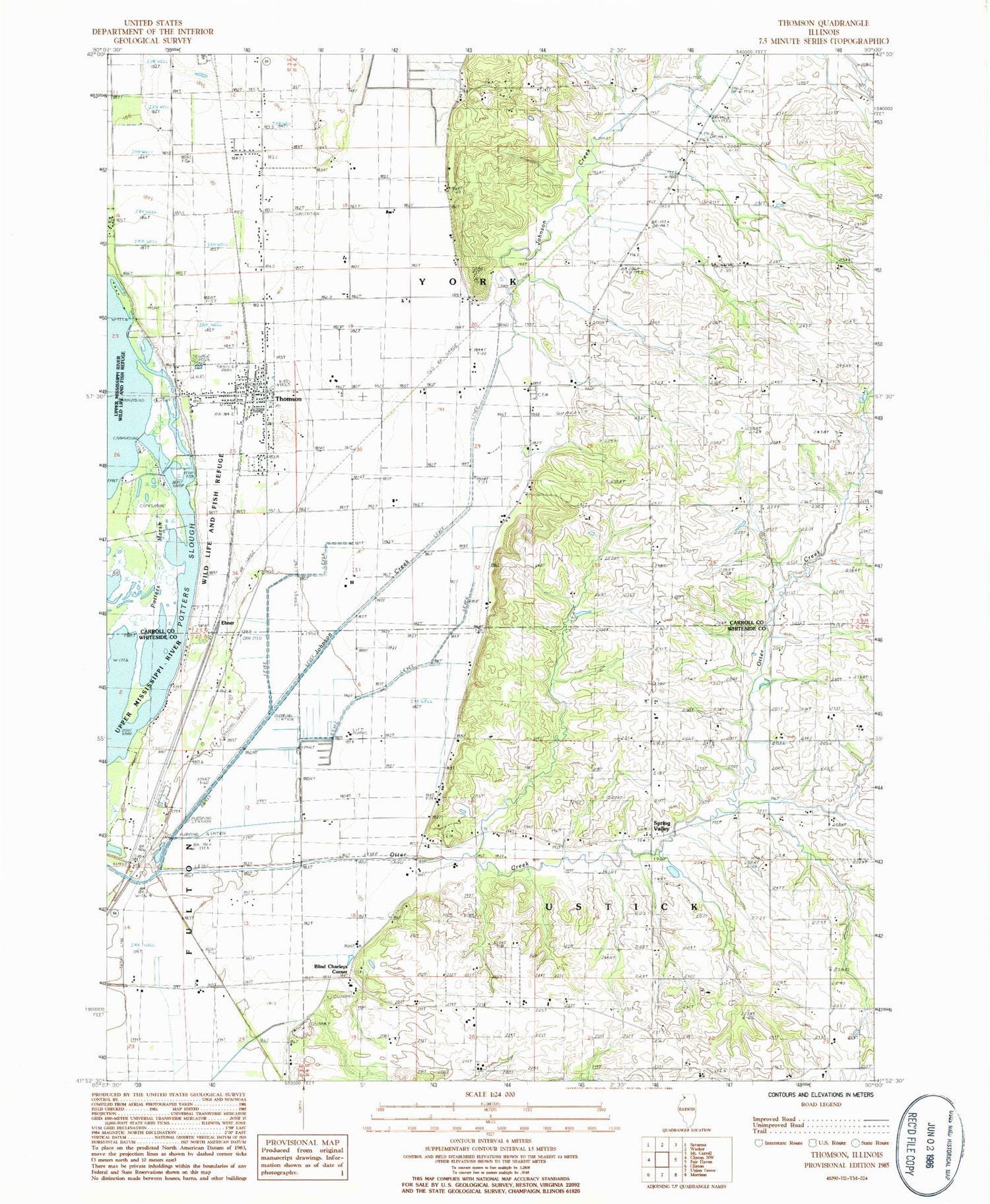
Classic USGS Thomson Illinois 7.5'x7.5' Topo Map
Couldn't load pickup availability
Historical USGS topographic quad map of Thomson in the state of Illinois. Map scale may vary for some years, but is generally around 1:24,000. Print size is approximately 24" x 27"
This quadrangle is in the following counties: Carroll, Whiteside.
The map contains contour lines, roads, rivers, towns, and lakes. Printed on high-quality waterproof paper with UV fade-resistant inks, and shipped rolled.
Contains the following named places: Acker - Fulton Quarry, Baker Cemetery, Blind Charleys Corner, Crouch School, Ebner, Hollinshead Cemetery, Lower York Cemetery, Old Goose Lake, Otter Bluff School, Otter Creek, Potter Slough, Rosenow Airport, Spring Valley, Spring Valley Farm, Spring Valley Methodist Cemetery, Spring Valley Presbyterian Cemetery, Spring Valley School, Tehan School, Thomson, Thomson - Fulton Sand Prairie Nature Preserve, Thomson Fire Protection District, Thomson High School, Thomson Post Office, Township of Ustick, Township of York, United States Penitentiary Thompson, Village of Thomson, York Church, ZIP Code: 61285


