MyTopo
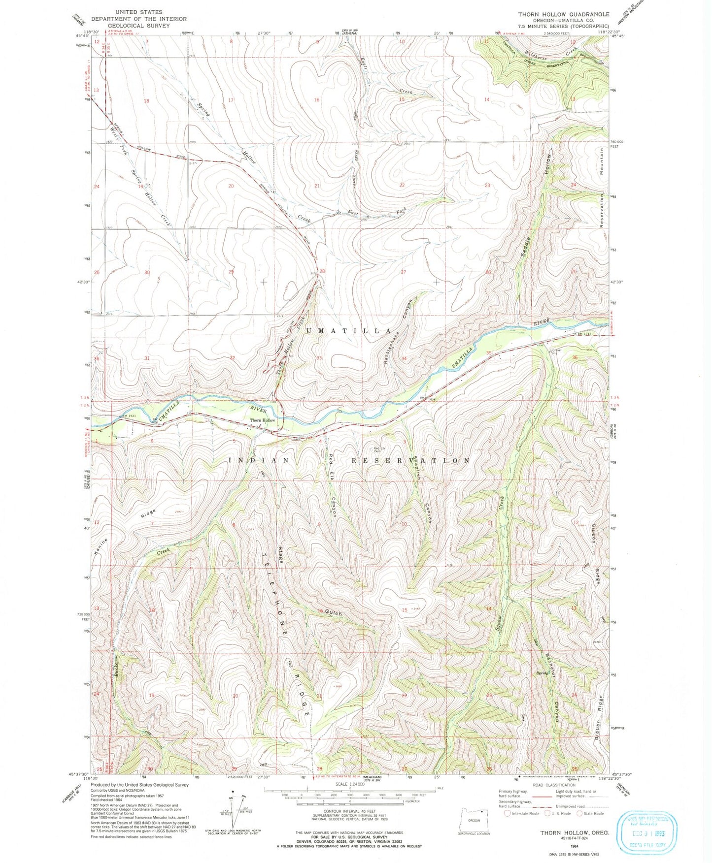
Classic USGS Thorn Hollow Oregon 7.5'x7.5' Topo Map
Couldn't load pickup availability
Historical USGS topographic quad map of Thorn Hollow in the state of Oregon. Map scale may vary for some years, but is generally around 1:24,000. Print size is approximately 24" x 27"
This quadrangle is in the following counties: Umatilla.
The map contains contour lines, roads, rivers, towns, and lakes. Printed on high-quality waterproof paper with UV fade-resistant inks, and shipped rolled.
Contains the following named places: Bachelor Canyon, Buckaroo Creek, East Fork Spring Hollow Creek, Isquulktpe Creek, Rattlesnake Canyon, Red Elk Canyon, Red Elk Cemetery, Saddle Hollow, Shaplish Canyon, Stage Gulch, Thorn Hollow, Thorn Hollow Creek, Thorn Hollow Grade, Thornhollow Post Office, Tumia, ZIP Code: 97810