MyTopo
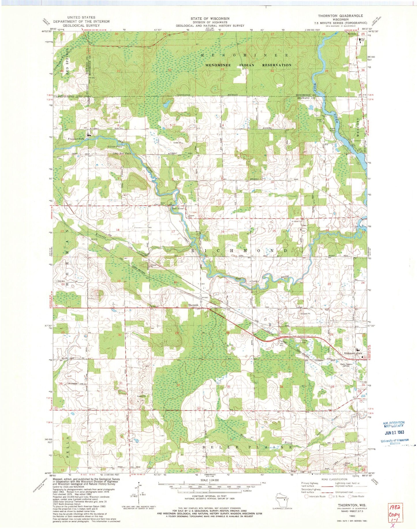
Classic USGS Thornton Wisconsin 7.5'x7.5' Topo Map
Couldn't load pickup availability
Historical USGS topographic quad map of Thornton in the state of Wisconsin. Map scale may vary for some years, but is generally around 1:24,000. Print size is approximately 24" x 27"
This quadrangle is in the following counties: Menominee, Shawano.
The map contains contour lines, roads, rivers, towns, and lakes. Printed on high-quality waterproof paper with UV fade-resistant inks, and shipped rolled.
Contains the following named places: 825 Reservoir, Alexian Brothers Novitiate, Boersdorf School, College of Menominee Nation - Keshena Campus, Dillenburg's Airport, Forest School, Freeman Falls, Gilmer Falls, Hanauer's Tree Farms, Keshena Primary School, Kroenke Creek, Krueger Dairy Farm, Little Bull Falls, Menominee Indian High School, Peters Hall School, Pine Grove School, Red River, Saint Jakobi Lutheran Church, Salem Methodist Church, Stony Hill School, Texas School, Thornton, Thornton Census Designated Place, Town of Richmond, Upper Shawano WP250 Dam, Weed 2WP1507 Dam, Weed Dam Pond 159, WOWN-FM (Shawano), WTCH-AM (Shawano), ZIP Code: 54166