
MyTopo
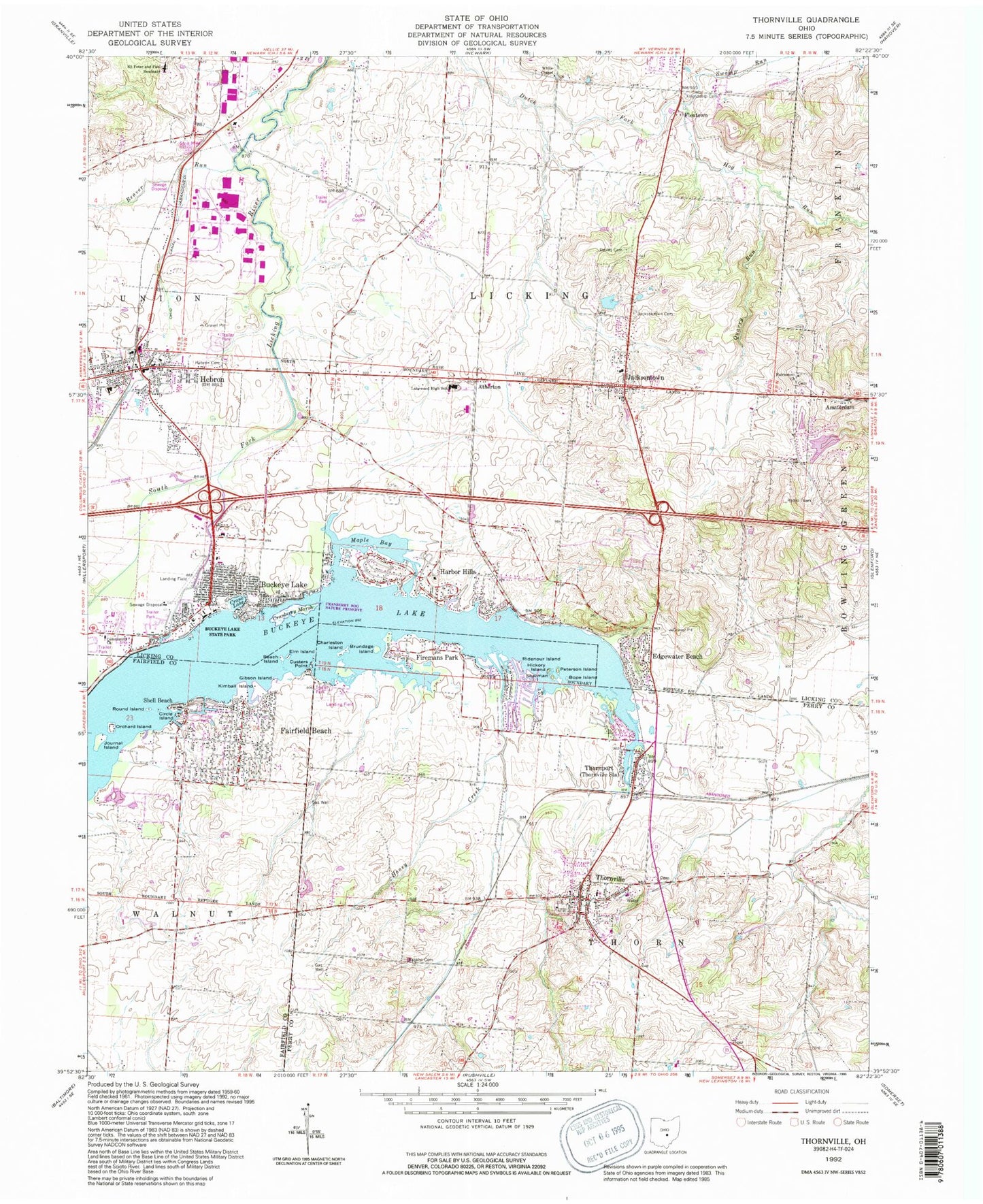
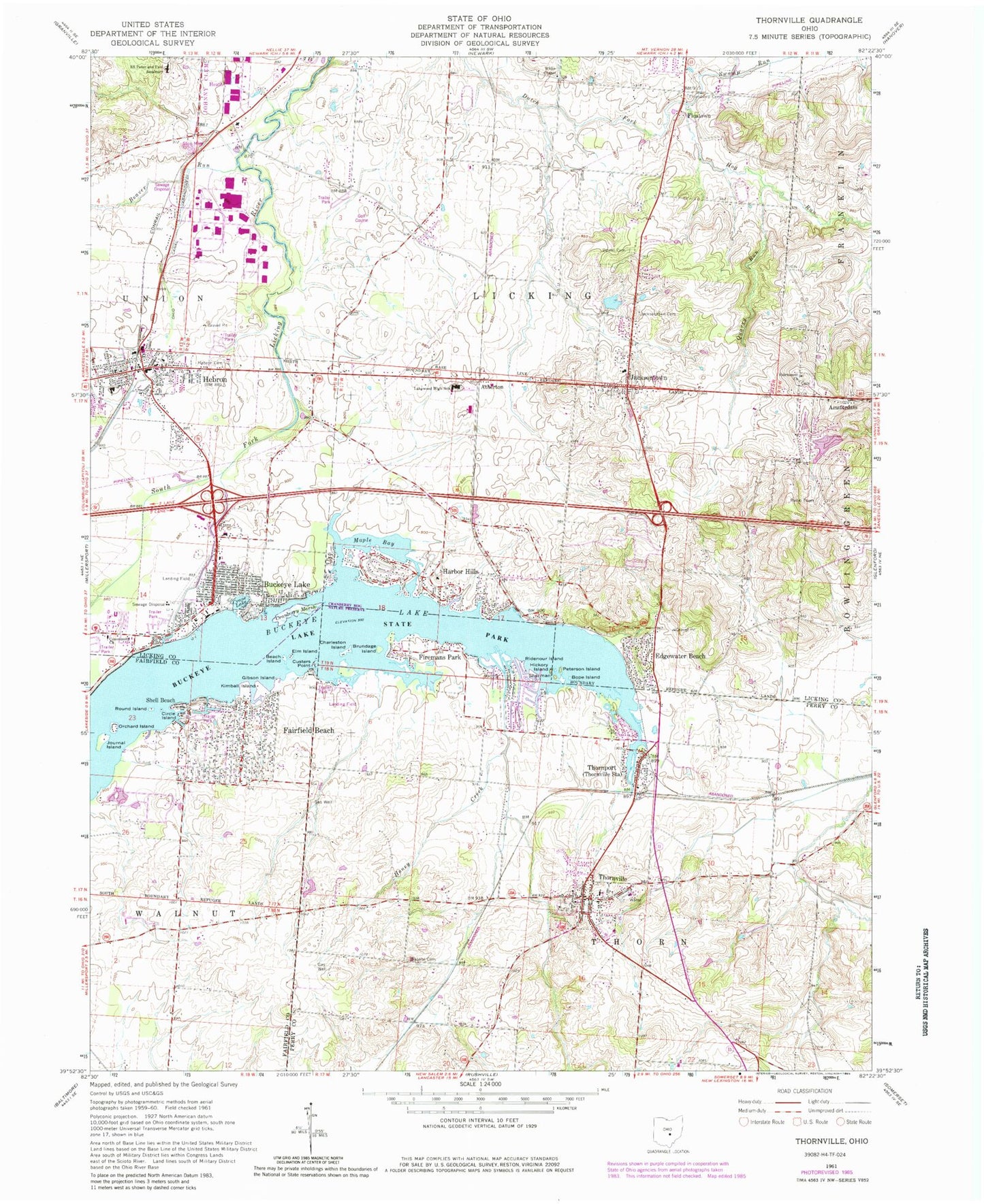
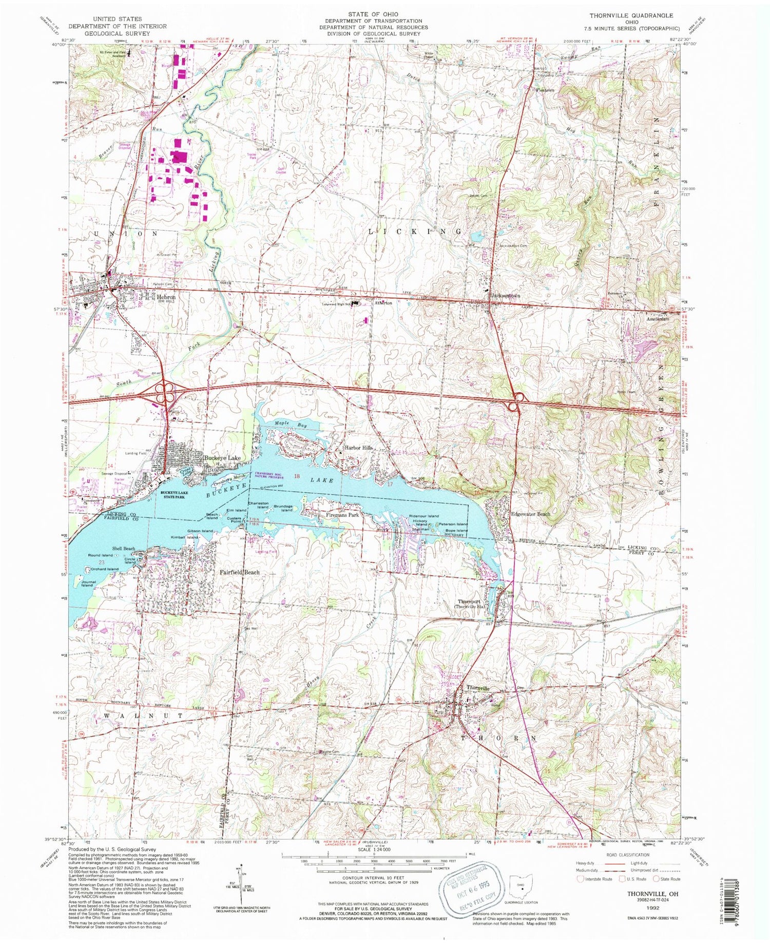
Classic USGS Thornville Ohio 7.5'x7.5' Topo Map
Couldn't load pickup availability
Historical USGS topographic quad map of Thornville in the state of Ohio. Typical map scale is 1:24,000, but may vary for certain years, if available. Print size: 24" x 27"
This quadrangle is in the following counties: Fairfield, Licking, Perry.
The map contains contour lines, roads, rivers, towns, and lakes. Printed on high-quality waterproof paper with UV fade-resistant inks, and shipped rolled.
Contains the following named places: Bope Island, Brundage Island, Buckeye State Lake Park, Circle Island, Crane Lake, Custers Point, Beard - Green Cemetery, Elm Island, Friendship Cemetery, Gibson Island, Harbor Hills, Hebron, Hebron Cemetery, Hickory Island, Hog Run, Honey Creek, Jacksontown Cemetery, Journal Island, Kimball Island, Lakewood High School, Orchard Island, Peterson Island, Quarry Run, Ridenour Island, Round Island, Saints Peter and Paul Seminary, Sherman Island, Swamp Run, Buckeye Lake, Edgewater Beach, Fairfield Beach, Firemans Park, Shell Beach, Thornville, County Line School (historical), Thornville Elementary School, Lakewood Junior High School, Roley School (historical), Lamps Mill (historical), Jacksontown Elementary School, Broomback School (historical), Woodland Place Farm (historical), Big Spring Farm (historical), Newark Industrial Park, Cranberry Bog State Nature Preserve, Hebron Elementary School, Thornport, Moscow (historical), Jacksontown United Methodist Church, Amsterdam, Atherton, Fleatown, Jacksontown, White Chapel, Dawes Arboretum, Maple Bay, Beach Island, Cranberry Marsh, Charleston Island, Fairmount Farm (historical), Observatory Hill, Beaver Run, Fairmount Church, Fairmount Cemetery, Hebron Baptist Church, Hebron Christian Church, Hebron United Methodist Church, Grace Lutheran Church, Thornville United Methodist Church, Dawes Arboretum Pond Dam, Dawes Arboretum Pond, Binns Lake Dam, Binns Lake, Buckeye Lake Dam, Buckeye Lake, Shelton Lake Dam, Shelton Lake, Roberts Field (historical), Clum Airport, WSFJ-TV (Newark), Township of Licking, Township of Thorn, Buckeye Lake Yacht Club, Community Church, Crane Island, Watkins Island, Harbor Hills, Harbor Hills Post Office (historical), Buckeye Lake Post Office (historical), Kemper Family Cemetery, Lutheran Reformed Cemetery, Methodist Episcopal Cemetery, Reform Baptist Cemetery, Hebron Post Office, Jacksontown Post Office, Thornport Post Office (historical), Thornville Post Office, Fairfield Beach Census Designated Place, Harbor Hills Census Designated Place, Village of Buckeye Lake, Village of Hebron, Village of Thornville, Licking Township Fire Company Station 1, Buckeye Lake Village Fire Department, Hebron Division of Fire and EMS, Thorn Township Fire and Emergency Management System, Millersport Fire Department Station 632, Thornport Census Designated Place, Thornville Police Department, Buckeye Lake Police Department, Licking Township Fire Company Station 3, Hebron Water Treatment Plant, Buckeye Lake Post Office, Jacksontown Census Designated Place