MyTopo
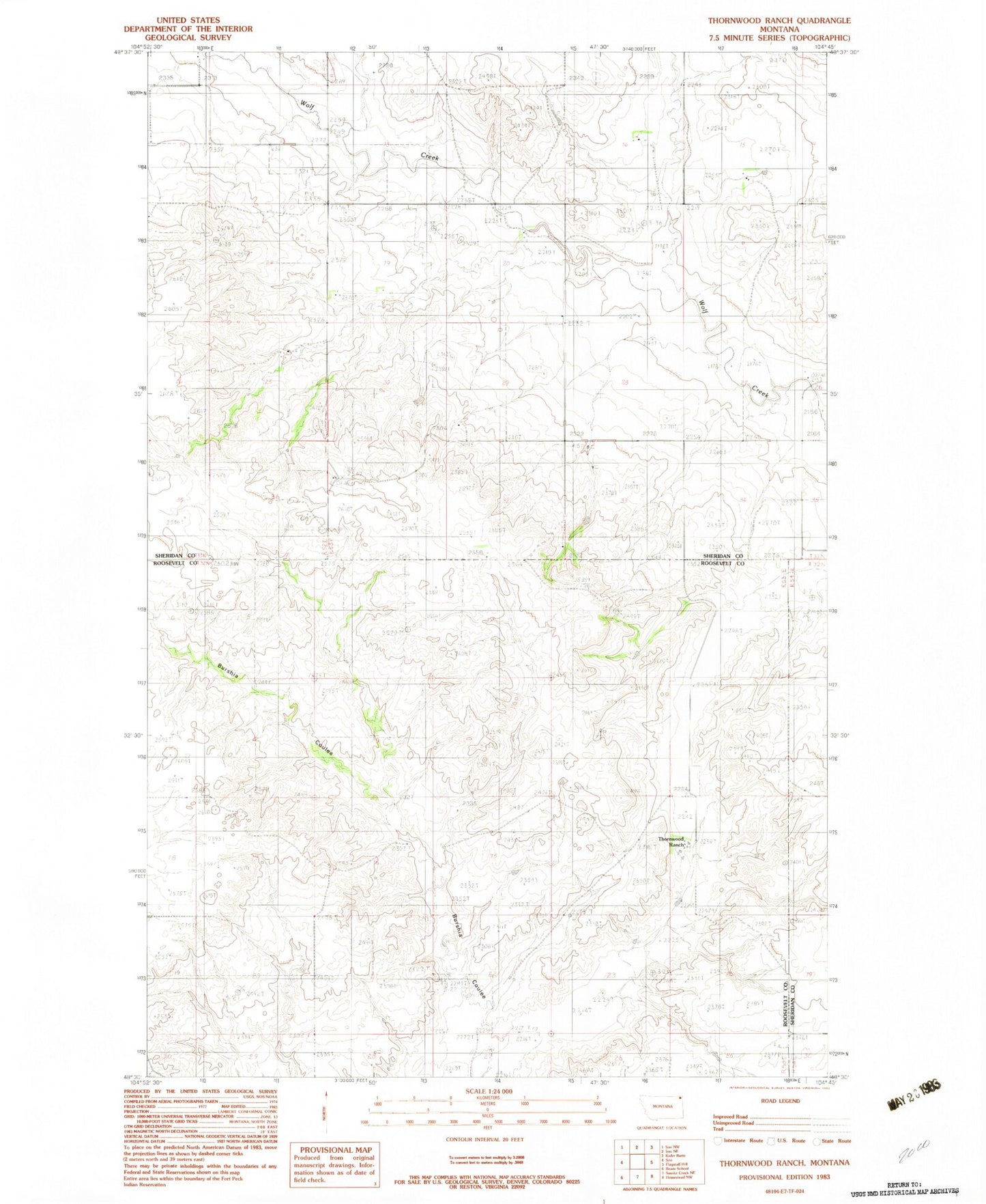
Classic USGS Thornwood Ranch Montana 7.5'x7.5' Topo Map
Regular price
$16.95
Regular price
Sale price
$16.95
Unit price
per
Couldn't load pickup availability
Historical USGS topographic quad map of Thornwood Ranch in the state of Montana. Map scale may vary for some years, but is generally around 1:24,000. Print size is approximately 24" x 27"
This quadrangle is in the following counties: Roosevelt, Sheridan.
The map contains contour lines, roads, rivers, towns, and lakes. Printed on high-quality waterproof paper with UV fade-resistant inks, and shipped rolled.
Contains the following named places: 32N53E02CBCB01 Well, 32N53E13BCCA01 Well, 32N54E17ABB_01 Well, 33N52E23BAAD01 Well, 33N52E23BADD01 Well, 33N53E19CCBB01 Well, 33N53E19CCBC01 Well, 33N53E20ACAB01 Well, 33N53E29CCBD01 Well, Malcolm Creek, Thornwood Ranch, Thornwood School