
MyTopo
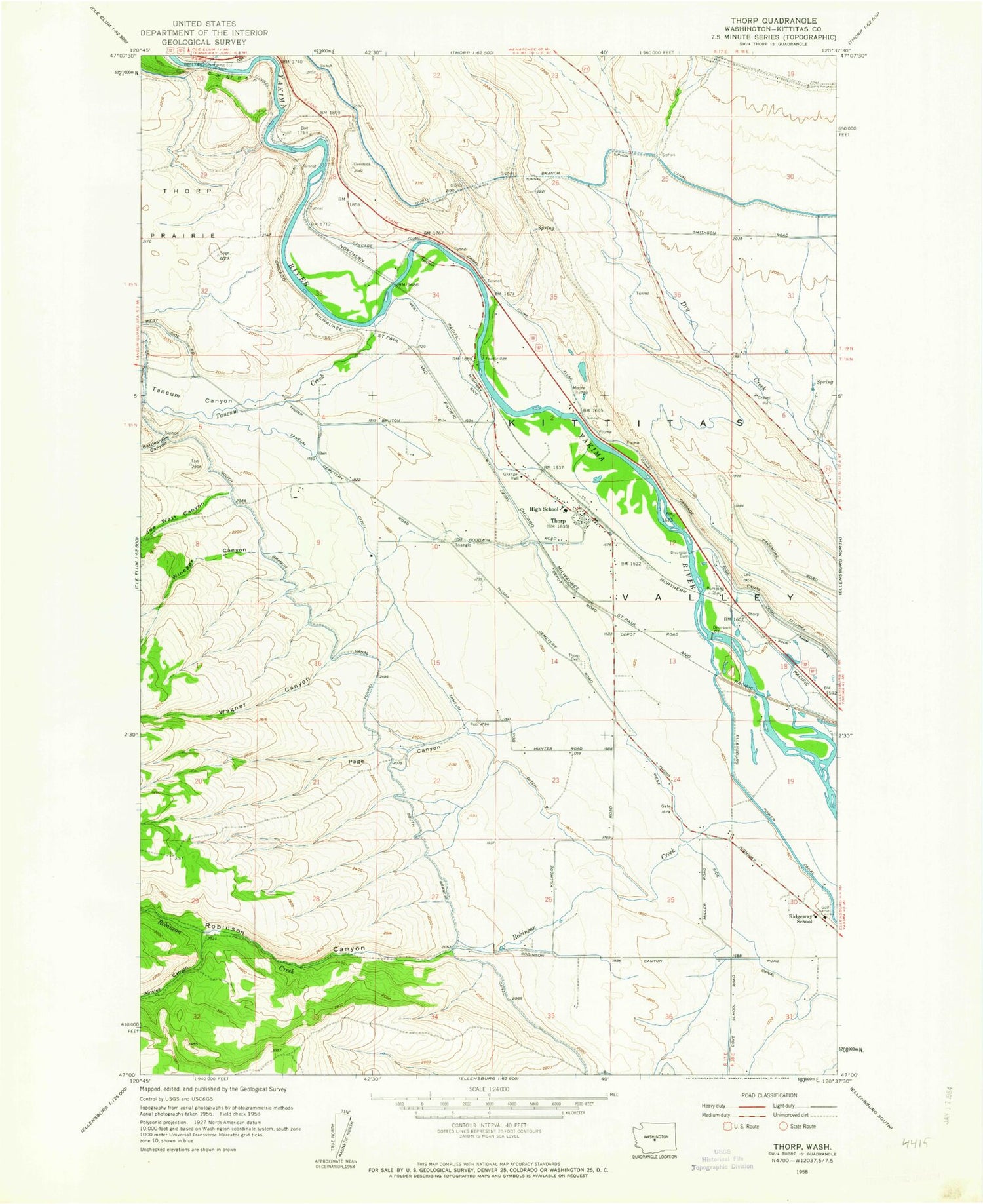
Classic USGS Thorp Washington 7.5'x7.5' Topo Map
Couldn't load pickup availability
Historical USGS topographic quad map of Thorp in the state of Washington. Map scale may vary for some years, but is generally around 1:24,000. Print size is approximately 24" x 27"
This quadrangle is in the following counties: Kittitas.
The map contains contour lines, roads, rivers, towns, and lakes. Printed on high-quality waterproof paper with UV fade-resistant inks, and shipped rolled.
Contains the following named places: Ainsley Canyon, Blowout Bench Airport, Dudley, Ellensburg Power Canal, High Valley Memorial Park Cemetery, Kittitas County, Kittitas County Fire District 1, North Winegar Canyon, Page Canyon, Rattlesnake Canyon, Ridgeway School, Robinson Canyon, Robinson Creek, South Branch Canal, South Winegar Canyon, Swauk Creek, Taneum Canyon, Taneum Creek, Taneum Ditch, Thorp, Thorp Cemetery, Thorp Census Designated Place, Thorp Elementary and Junior Senior High School, Thorp Post Office, Wagner Canyon, Watt Canyon, West Side Canal, Winegar Canyon, ZIP Code: 98946


