MyTopo
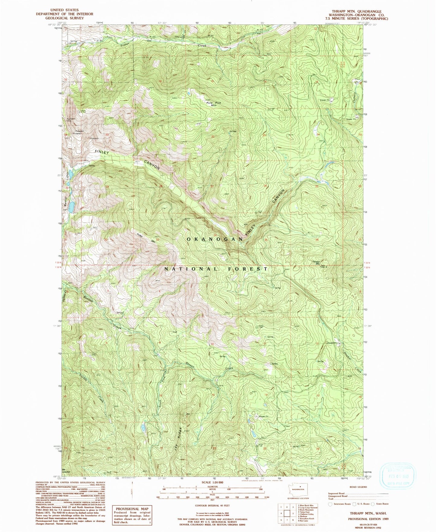
Classic USGS Thrapp Mountain Washington 7.5'x7.5' Topo Map
Couldn't load pickup availability
Historical USGS topographic quad map of Thrapp Mountain in the state of Washington. Map scale may vary for some years, but is generally around 1:24,000. Print size is approximately 24" x 27"
This quadrangle is in the following counties: Okanogan.
The map contains contour lines, roads, rivers, towns, and lakes. Printed on high-quality waterproof paper with UV fade-resistant inks, and shipped rolled.
Contains the following named places: Finley Mountain, Jack Creek, Jay Ridge, Pole Pick Mountain, Red Shirt Mine, South Fork Benson Creek, Thrapp Mountain, Wenner Lake Number Five, Wenner Lake Number Five Dam, Wenner Lake Number Four Dam, Wenner Lake Number Three Dam, Wenner Lake Number Two Dam, Wenner Lakes, Wenner Lakes Number Three, Wenner Lakes Number Two, Yockey Creek