MyTopo
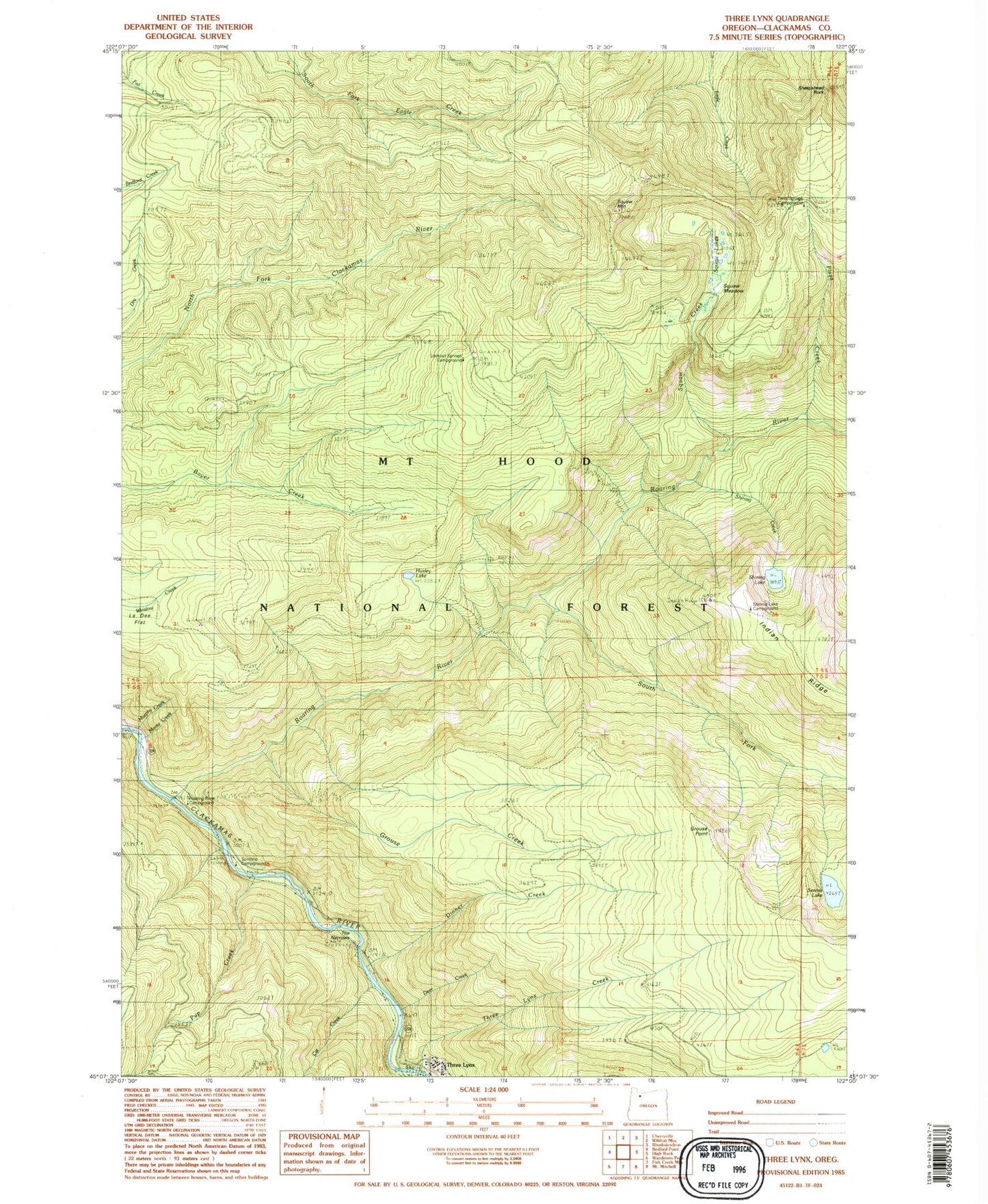
Classic USGS Three Lynx Oregon 7.5'x7.5' Topo Map
Couldn't load pickup availability
Historical USGS topographic quad map of Three Lynx in the state of Oregon. Typical map scale is 1:24,000, but may vary for certain years, if available. Print size: 24" x 27"
This quadrangle is in the following counties: Clackamas.
The map contains contour lines, roads, rivers, towns, and lakes. Printed on high-quality waterproof paper with UV fade-resistant inks, and shipped rolled.
Contains the following named places: Lookout Springs Campground (historical), Cat Creek, Grouse Creek, Shining Lake Campground, Shining Creek, Sheepshead Rock, Corral Springs Trail, Dinner Creek, Dry Ridge Trail, Fanton Plaza Trail, Grouse Point, Huxley Lake, Lookout Springs Guard Station (historical), Pup Creek, Roaring River, Roaring River Recreation Site, Serene Lake, Shining Lake, South Fork Roaring River, Tumala Creek, Tumala Lakes, Tumala Meadow, Tumala Mountain, The Narrows, Three Lynx, Three Lynx Creek, Twin Springs Forest Camp, Whitewater (historical), Monty Creek, Deer Creek, Plaza Creek, Sunstrip Recreation Site, Whitewater Forest Camp (historical), Three Lynx School (historical), Plaza Guard Station (historical), Winslow Spur Gravel Pit, North Fork Quarry, Roaring River Wilderness, Roaring Wild and Scenic River, South Fork Roaring Wild and Scenic River