MyTopo
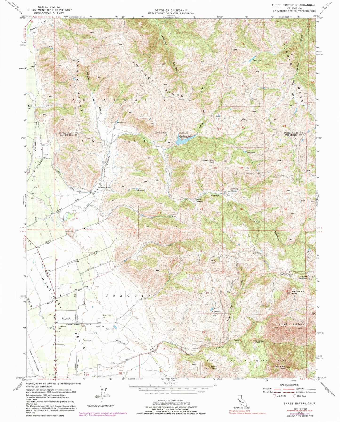
Classic USGS Three Sisters California 7.5'x7.5' Topo Map
Couldn't load pickup availability
Historical USGS topographic quad map of Three Sisters in the state of California. Map scale may vary for some years, but is generally around 1:24,000. Print size is approximately 24" x 27"
This quadrangle is in the following counties: San Benito, Santa Clara.
The map contains contour lines, roads, rivers, towns, and lakes. Printed on high-quality waterproof paper with UV fade-resistant inks, and shipped rolled.
Contains the following named places: Ausaymas Y San Felipe, Chimney Ridge, Coyote Peak, Dunne Ridge, Fairview School, Garcia Rancho, Hawkins 651 Dam, Hawkins Lake, Hawkins Ranch, Hollister Conduit, Little Peak Canyon, Lone Tree Creek, Messic Mountain, Rancho Las Cimas, San Joaquin, San Joaquin Peak, Santa Ana Mountain, Sparling Ranch, Spring Grove Elementary School, Sulfur Creek, Three Sisters, Wildcat Canyon, ZIP Code: 95023