MyTopo
Classic USGS Thumb Tank Peak New Mexico 7.5'x7.5' Topo Map
Couldn't load pickup availability
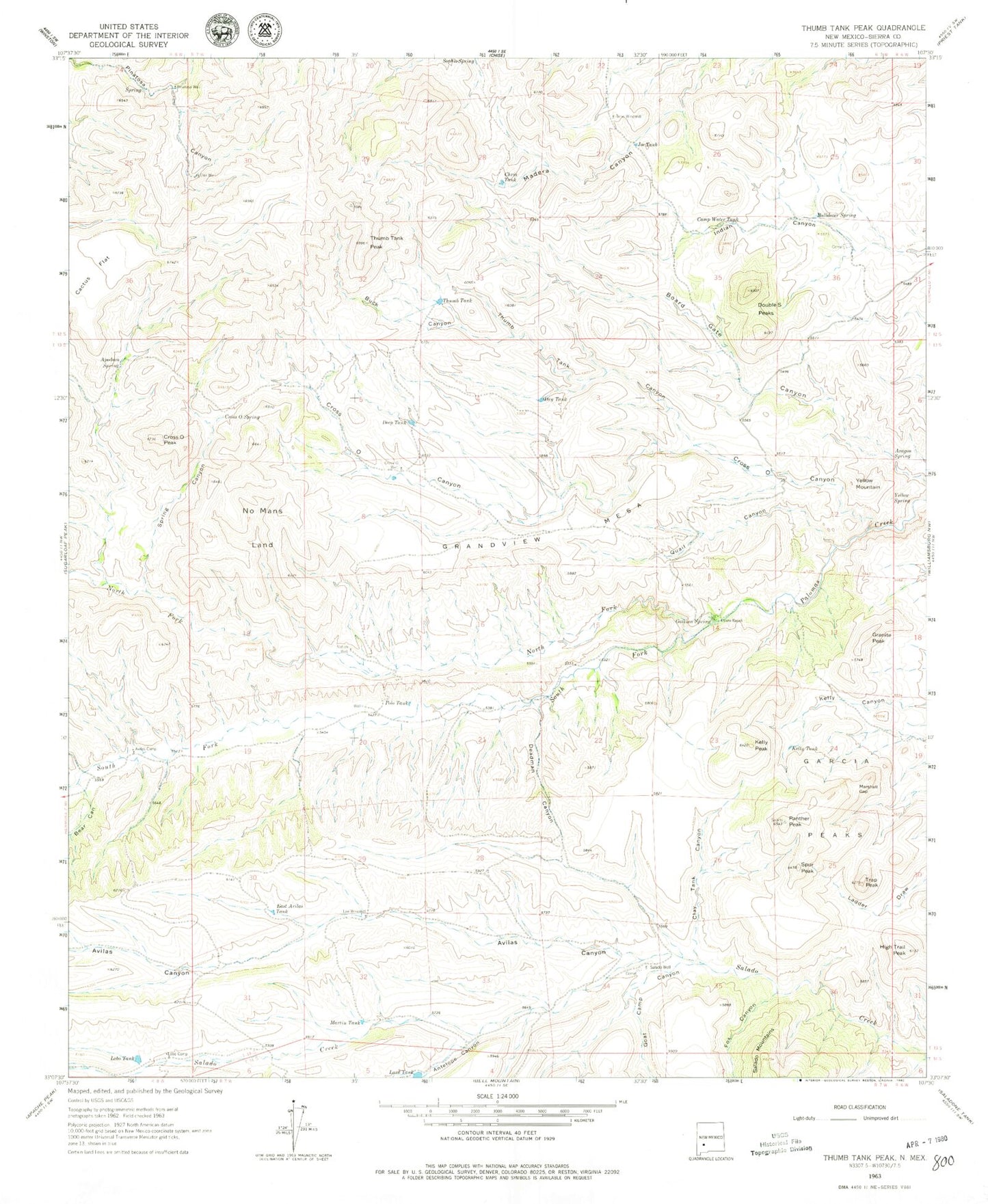
Historical USGS topographic quad map of Thumb Tank Peak in the state of New Mexico. Map scale may vary for some years, but is generally around 1:24,000. Print size is approximately 24" x 27"
This quadrangle is in the following counties: Sierra.
The map contains contour lines, roads, rivers, towns, and lakes. Printed on high-quality waterproof paper with UV fade-resistant inks, and shipped rolled.
Contains the following named places: Antelope Canyon, Apodaca Spring, Aragon Spring, Avilas Camp, Avilas Canyon, Bear Canyon, Buck Canyon, Bulldozer Spring, Cactus Flat, Camp Water Tank, Chris Tank, Clay Tank Canyon, Cross O Canyon, Cross O Peak, Cross O Spring, Cross O Well, Deadman Canyon, Deep Tank, Double S Peaks, Dry Tank, East Avilas Tank, Evans Ranch, Fox Canyon, Gallina Spring, Garcia Peaks, Goat Camp Canyon, Grandview Mesa, Granite Peak, High Trail Peak, Joe Tank, Kelly Peak, Kelly Tank, Lard Tank, Lee Windmill, Lobo Camp, Lobo Tank, Marshall Gap, Martin Tank, Nation Well, No Mans Land, North Fork Palomas Creek, Oak Well, Panther Peak, Pinatosa Well, Polo Tank, Quail Canyon, Reno Windmill, Salado Well, Sophio Spring, South Fork Palomas Creek, Spring Canyon, Spur Peak, Thumb Tank, Thumb Tank Canyon, Thumb Tank Peak, Trap Peak, Yellow Mountain, Yellow Spring