MyTopo
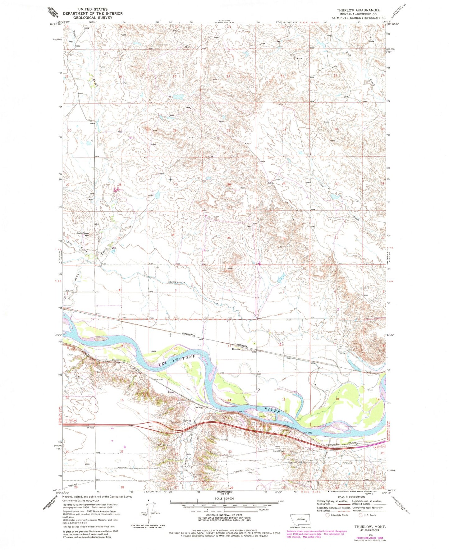
Classic USGS Thurlow Montana 7.5'x7.5' Topo Map
Couldn't load pickup availability
Historical USGS topographic quad map of Thurlow in the state of Montana. Map scale may vary for some years, but is generally around 1:24,000. Print size is approximately 24" x 27"
This quadrangle is in the following counties: Rosebud.
The map contains contour lines, roads, rivers, towns, and lakes. Printed on high-quality waterproof paper with UV fade-resistant inks, and shipped rolled.
Contains the following named places: 06N43E04C___01 Well, 06N43E05D___01 Well, 06N43E11A___01 Well, 06N43E11B___01 Well, 06N43E12A___01 Well, 06N44E19ADD_01 Well, 06N44E19DAA_01 Well, Buell Post Office, Cattle Brands Historical Marker, Coal Creek, Elkhorn Stage Station, Hathaway Rest Area, Hook Number 59 Dam, Jack Creek, Jack Creek Hill, Joppa, Morton Number 1 Dam, Rosebud Flat School, Rosebud Historical Marker, Sand Creek, Sand Creek Bridge, Sand Creek School, Shand Number 1 Dam, Sweeney Creek, Thurlow, Thurlow Post Office, Thurlow School