MyTopo
Classic USGS Tierra Redonda Mountain California 7.5'x7.5' Topo Map
Couldn't load pickup availability
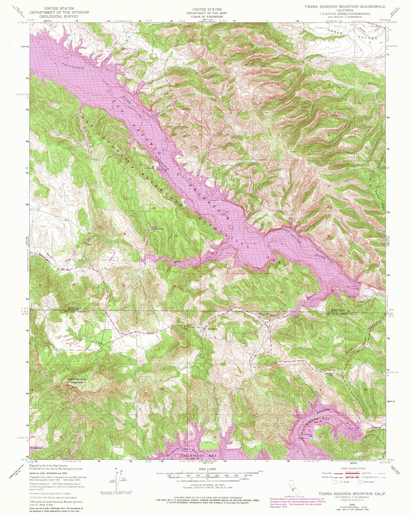
Historical USGS topographic quad map of Tierra Redonda Mountain in the state of California. Map scale may vary for some years, but is generally around 1:24,000. Print size is approximately 24" x 27"
This quadrangle is in the following counties: Monterey, San Luis Obispo.
The map contains contour lines, roads, rivers, towns, and lakes. Printed on high-quality waterproof paper with UV fade-resistant inks, and shipped rolled.
Contains the following named places: Bee Rock, Bee Rock Canyon, Bee Rock Hall, Bee Rock School, Branch Ranch, California Department of Forestry and Fire Protection Station 34 Oak Shores, Godfrey Ranch, Hames School, Harris Creek, Harris Valley, Lake San Antonio, Lynch Ranch, Nacimiento Dam, Nacimiento Lake Marina, Oak Shores Census Designated Place, Pleyto, San Antonio 1008-002 Dam, San Antonio Dam, Tierra Redonda Mountain, Williams Ranch, ZIP Code: 93426