MyTopo
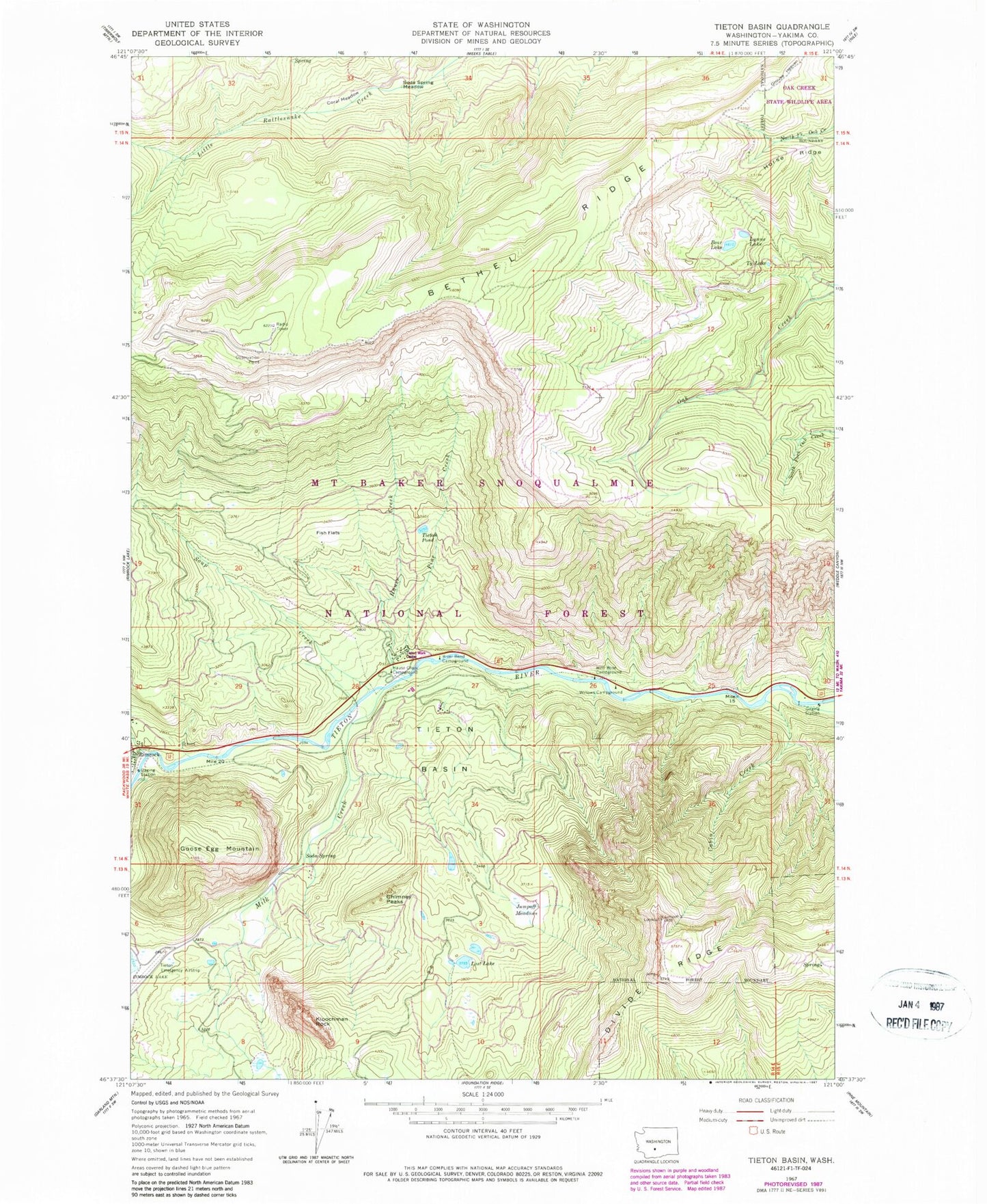
Classic USGS Tieton Basin Washington 7.5'x7.5' Topo Map
Couldn't load pickup availability
Historical USGS topographic quad map of Tieton Basin in the state of Washington. Typical map scale is 1:24,000, but may vary for certain years, if available. Print size: 24" x 27"
This quadrangle is in the following counties: Yakima.
The map contains contour lines, roads, rivers, towns, and lakes. Printed on high-quality waterproof paper with UV fade-resistant inks, and shipped rolled.
Contains the following named places: Bear Lake, Bethel Ridge, Cabin Creek, Chimney Peaks, Coral Meadow, Fish Flats, Goose Egg Mountain, Hause Creek, Hause Creek Campground, Horse Ridge, Jumpoff Meadows, Kloochman Rock, Lost Lake, Lynne Lake, Milk Creek, Pine Creek, River Bend Campground, Soda Spring, Soda Spring Meadow, Soup Creek, Tieton Basin, Tieton Pond, Tieton Ranger Station, Ty Lake, Wild Rose Campground, Wildcat Creek, Willows Campground, Tieton Work Center, Jump Off Lookout, Lost Lake Campground, Bear Lake Campground, Tieton State Airport, Bear Lake, Bethel Ridge, Cabin Creek, Chimney Peaks, Coral Meadow, Fish Flats, Goose Egg Mountain, Hause Creek, Hause Creek Campground, Horse Ridge, Jumpoff Meadows, Kloochman Rock, Lost Lake, Lynne Lake, Milk Creek, Pine Creek, River Bend Campground, Soda Spring, Soda Spring Meadow, Soup Creek, Tieton Basin, Tieton Pond, Tieton Ranger Station, Ty Lake, Wild Rose Campground, Wildcat Creek, Willows Campground, Tieton Work Center, Jump Off Lookout, Lost Lake Campground, Bear Lake Campground, Tieton State Airport