MyTopo
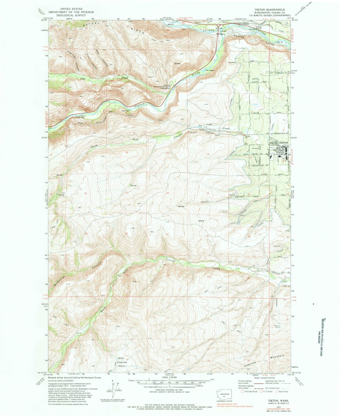
Classic USGS Tieton Washington 7.5'x7.5' Topo Map
Couldn't load pickup availability
Historical USGS topographic quad map of Tieton in the state of Washington. Map scale may vary for some years, but is generally around 1:24,000. Print size is approximately 24" x 27"
This quadrangle is in the following counties: Yakima.
The map contains contour lines, roads, rivers, towns, and lakes. Printed on high-quality waterproof paper with UV fade-resistant inks, and shipped rolled.
Contains the following named places: City of Tieton, Clint Canyon, Cowiche Basin, French Canyon, Lateral A, Lateral B, Lateral E, Lateral F, McDaniel Canyon, Meystre Canyon, NPK Canyon, Oak Creek, Oak Creek State Wildlife Area, Pine Tree Canyon, Tieton, Tieton Intermediate School, Tieton Post Office, Tieton River, Tieton Volunteer Fire Department, Tim Ponds, Waterworks Canyon, Yakima County Fire District 1 Highland Fire Department Tieton, ZIP Code: 98947