MyTopo
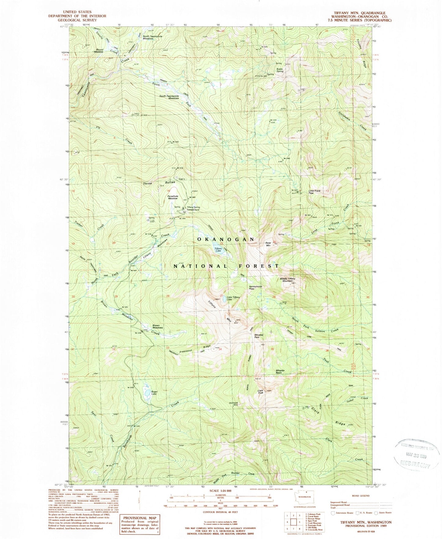
Classic USGS Tiffany Mountain Washington 7.5'x7.5' Topo Map
Couldn't load pickup availability
Historical USGS topographic quad map of Tiffany Mountain in the state of Washington. Map scale may vary for some years, but is generally around 1:24,000. Print size is approximately 24" x 27"
This quadrangle is in the following counties: Okanogan.
The map contains contour lines, roads, rivers, towns, and lakes. Printed on high-quality waterproof paper with UV fade-resistant inks, and shipped rolled.
Contains the following named places: Bernhardt Mine, Bernhardt Trail, Bottle Spring, Brown Meadows, Brown Meadows Creek, Clark Peak, Clark Ridge, Clark Ridge Trail, Freezeout Ridge, Freezeout Trail, Honeymoon Pass, Little Tiffany Lake, Lone Frank Pass, Middle Tiffany Mountain, North Summit Trail, North Twentymile Trail, Parachute Meadow, Rock Mountain, Roger Lake, Round Meadow, Smarty Creek, Smarty Creek Trail, South Fork Twentymile Creek, South Twentymile Meadows, Spur Creek, Three Buttes, Tiffany Lake, Tiffany Lake Trail, Tiffany Meadows, Tiffany Mountain, Tiffany Spring Campground, Timothy Ridge, Whistler Basin, Whistler Pass