MyTopo
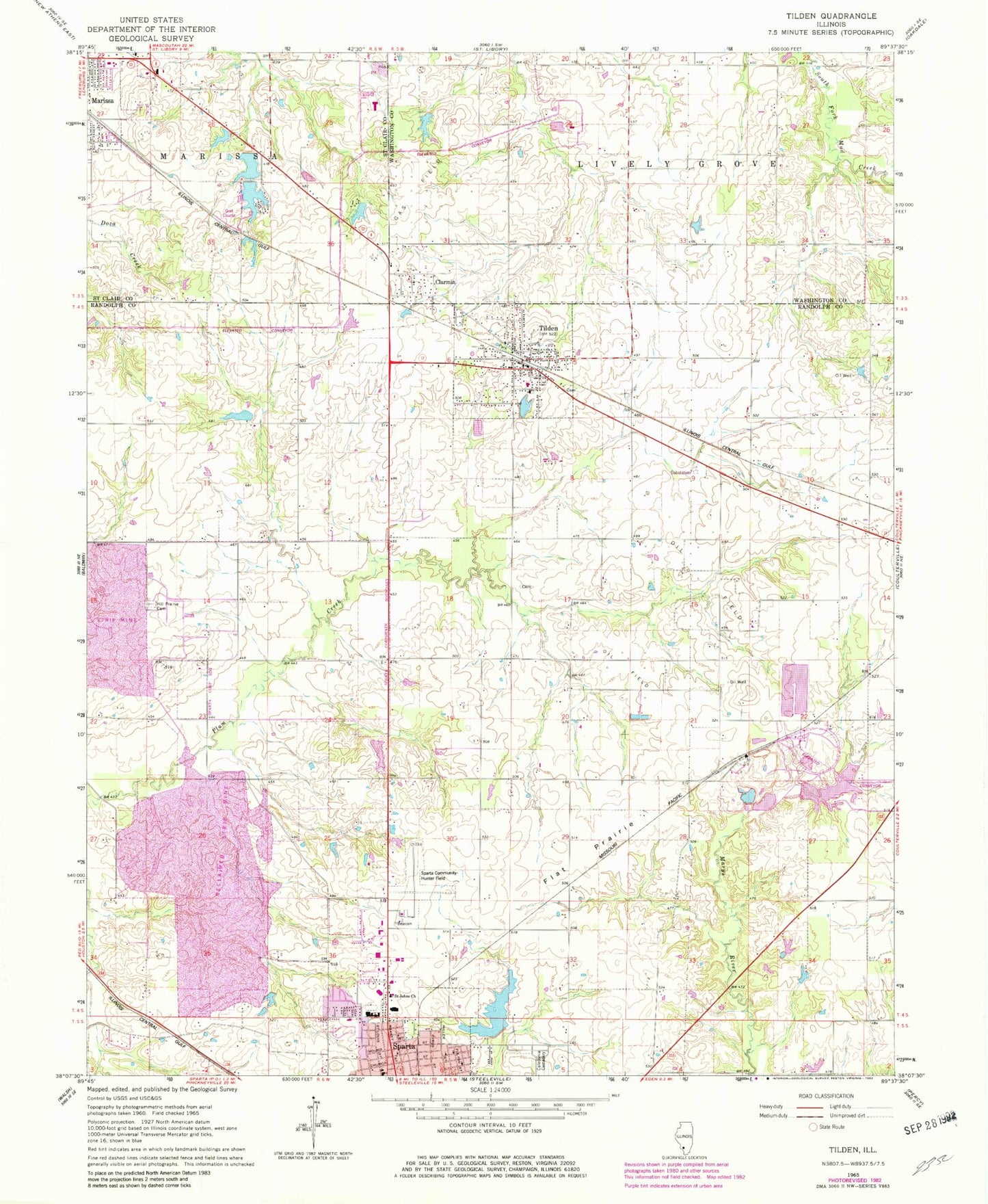
Classic USGS Tilden Illinois 7.5'x7.5' Topo Map
Couldn't load pickup availability
Historical USGS topographic quad map of Tilden in the state of Illinois. Map scale may vary for some years, but is generally around 1:24,000. Print size is approximately 24" x 27"
This quadrangle is in the following counties: Randolph, St. Clair, Washington.
The map contains contour lines, roads, rivers, towns, and lakes. Printed on high-quality waterproof paper with UV fade-resistant inks, and shipped rolled.
Contains the following named places: Bethel African Methodist Episcopal Church, Caledonia Cemetery, Church of God in Christ, City of Sparta, Clarmin, Clarmin School, Dickey School, First Freewill Baptist Church, First Reformed Presbyterian Church, Flat Prairie, Gospel Chapel Hall, Hayes School, Herschel Hunter Airport, Hill Prairie Cemetery, Illinois No Name Number 2023 Dam, Lindsey School, Marissa Recreation Association Lake, Marissa Recreation Association North Lake Dam, Marissa Recreation Association South Lake, Marissa Recreation Association South Lake Dam, MedStar Ambulance, Munford School, New City Reservoir, New City Reservoir Dam, Pleasant Hill School, Plum Creek School, Prest School, Randall School, Road To Life Church, Saint John Lutheran Church, Scotland School, Shaufler Pond, Shaufler Pond Dam, Sparta Community Airport-Hunter Field, Sparta High School, Sparta Primary Attendance Center, Sparta Reformed Presbyterian Church, Sparta-Lincoln Attendence Center, Tilden, Tilden Attendence Center, Tilden Church of the Nazarene, Tilden City Cemetery, Tilden Election Precinct, Tilden Elevator, Tilden Police Department, Tilden Post Office, Tilden Volunteer Fire Department, Tom Reid Park, Village of Tilden, Whiteoak, Whiteoak School, ZIP Code: 62292