MyTopo
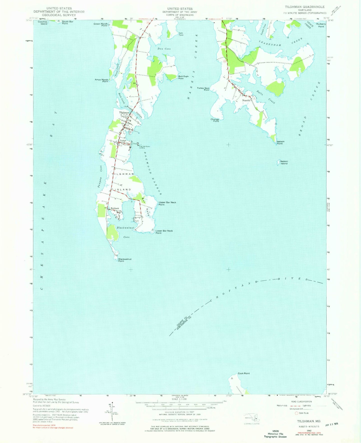
Classic USGS Tilghman Maryland 7.5'x7.5' Topo Map
Couldn't load pickup availability
Historical USGS topographic quad map of Tilghman in the state of Maryland. Map scale may vary for some years, but is generally around 1:24,000. Print size is approximately 24" x 27"
This quadrangle is in the following counties: Dorchester, Talbot.
The map contains contour lines, roads, rivers, towns, and lakes. Printed on high-quality waterproof paper with UV fade-resistant inks, and shipped rolled.
Contains the following named places: Amys Marsh Point, Avalon, Avalon Island, Back Creek, Bald Eagle Point, Balls Creek, Bar Neck, Big Point, Blackwalnut Cove, Blackwalnut Landing, Blackwalnut Point, Blades Point, Boat Point Cove, Boby Owl Cove, Broad Creek, Bromwell Cove, Caulk Point, Change Point, Cherry Tree Point, Choptank River, Cook Point, Cooper Point, Deep Harbor, Deep Harbour Farm Estates, District 5 Bay Hundred, Dogwood Harbor, Dun Cove, Elston Shores, Fairbank, Fairbanks Point, Fishing Point, Front Creek, Green Marsh Point, Harris Creek, Johns Cove, Judys Point, Knapps Narrows, Leadenham Creek, Locust Neck, Long Cove, Long Point, Lower Bar Neck Point, Meetinghouse Point, Middle Point, Muddy Cove, Neavitt, Neavitt Park, Neavitt Post Office, Neavitt United Methodist Church, Nelson Island Shoal, Nelson Point, Old Orchard Point, Pawpaw Cove, Piney Point, River Cove, Saint Johns Chapel Cemetery, Seth Point, South Bar Point, Steves Cove, Talbot County Library - Tilghman Branch, Talbot County Region V Wastewater Treatment Plant, Tilghman, Tilghman Elementary School, Tilghman Island, Tilghman Island Beach, Tilghman Island Cemetery, Tilghman Island Census Designated Place, Tilghman Island Landing, Tilghman Post Office, Tilghman United Methodist Church, Tilghman Volunteer Fire Company Station 70, Tilghman Whipp Airport, Turkey Neck Point, Upper Bar Neck Point, Wells Point, ZIP Codes: 21652, 21671


