MyTopo
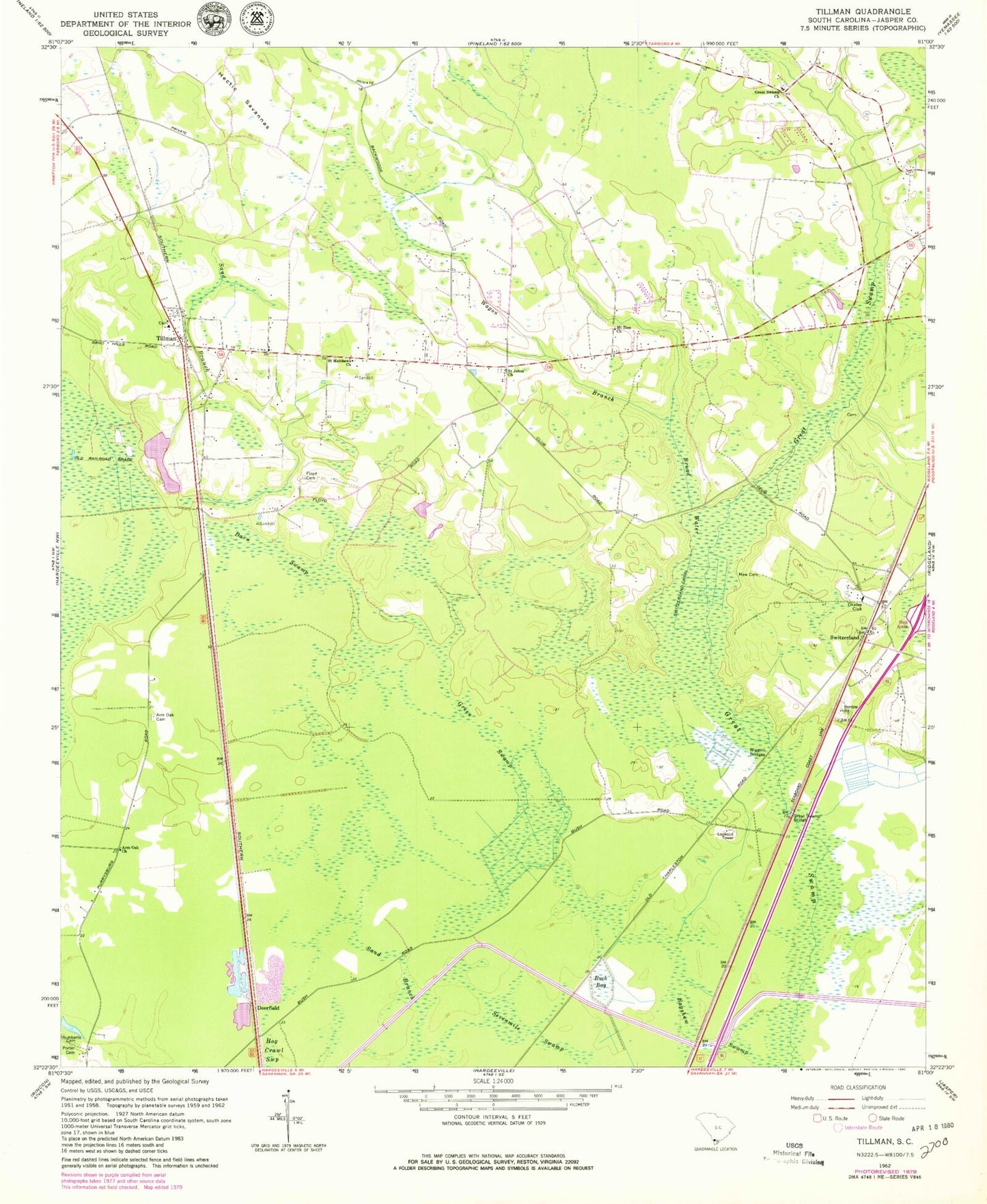
Classic USGS Tillman South Carolina 7.5'x7.5' Topo Map
Couldn't load pickup availability
Historical USGS topographic quad map of Tillman in the state of South Carolina. Map scale may vary for some years, but is generally around 1:24,000. Print size is approximately 24" x 27"
This quadrangle is in the following counties: Jasper.
The map contains contour lines, roads, rivers, towns, and lakes. Printed on high-quality waterproof paper with UV fade-resistant inks, and shipped rolled.
Contains the following named places: Arm Oak Cemetery, Arm Oak Church, Bagshaw Swamp, Broad Water, Buck Bay, Burton School, Darn Swamp, Deerfield, Ellis Community School, Floyd Cemetery, Great Swamp Bridge, Great Swamp Church, Green Swamp, Hectic Savannas, House of Prayer, Humberts Cemetery, Jasper County, Jasper County Fire Department Station 47, Mew Cemetery, Mount Zion Church, Okatee Club, Porter Cemetery, Rhoden Ward Cemetery, Saint Johns Church, Saint Matthews Church, Sand Branch, Sevenmile Swamp, South Carolina Noname 27009 D-2590 Dam, Switzerland, Switzerland Canal, Tillman, Tillman School, Wagon Branch, WCOG-AM (Ridgeland), Wiggins Bridge, Zion Ritter Church