MyTopo
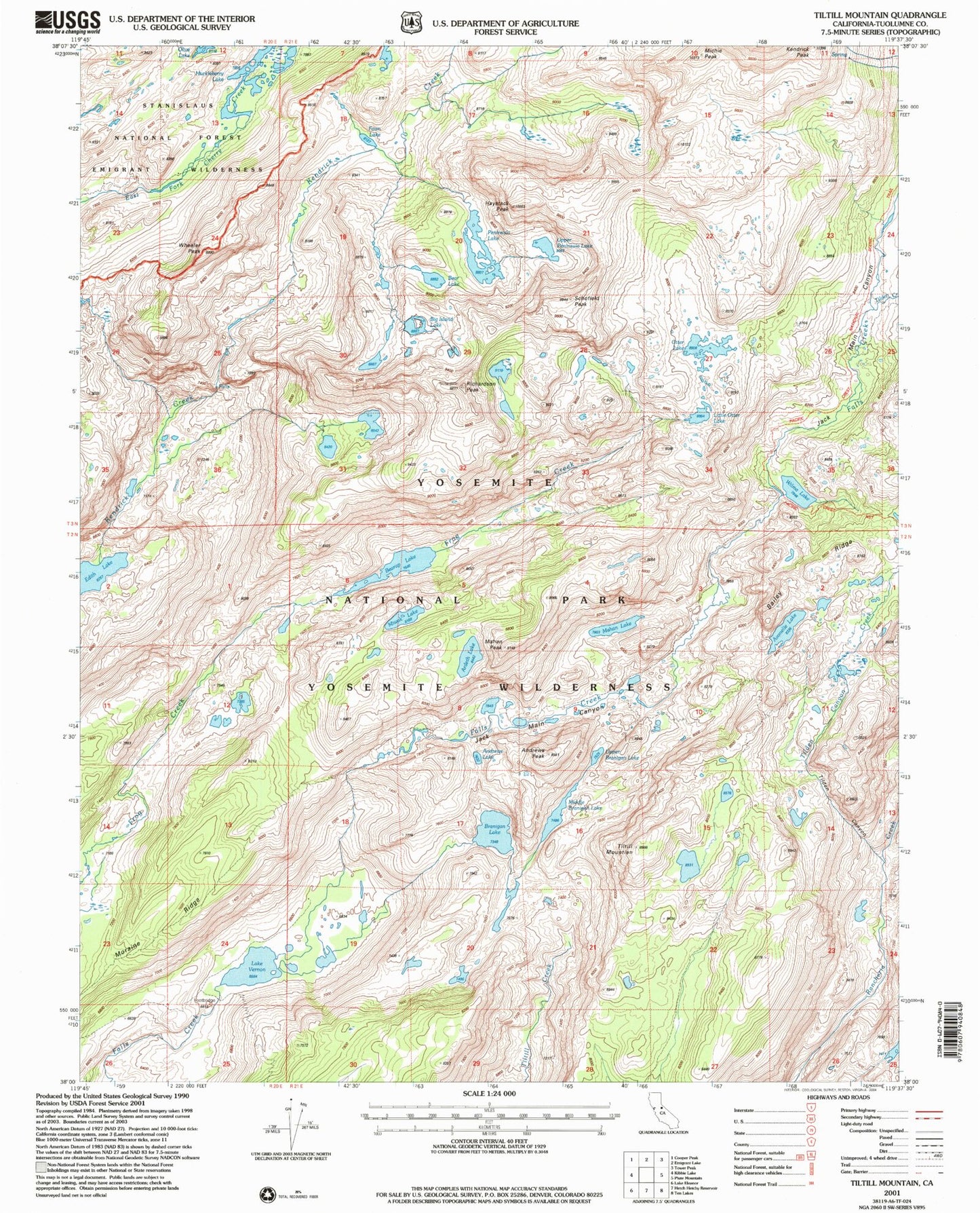
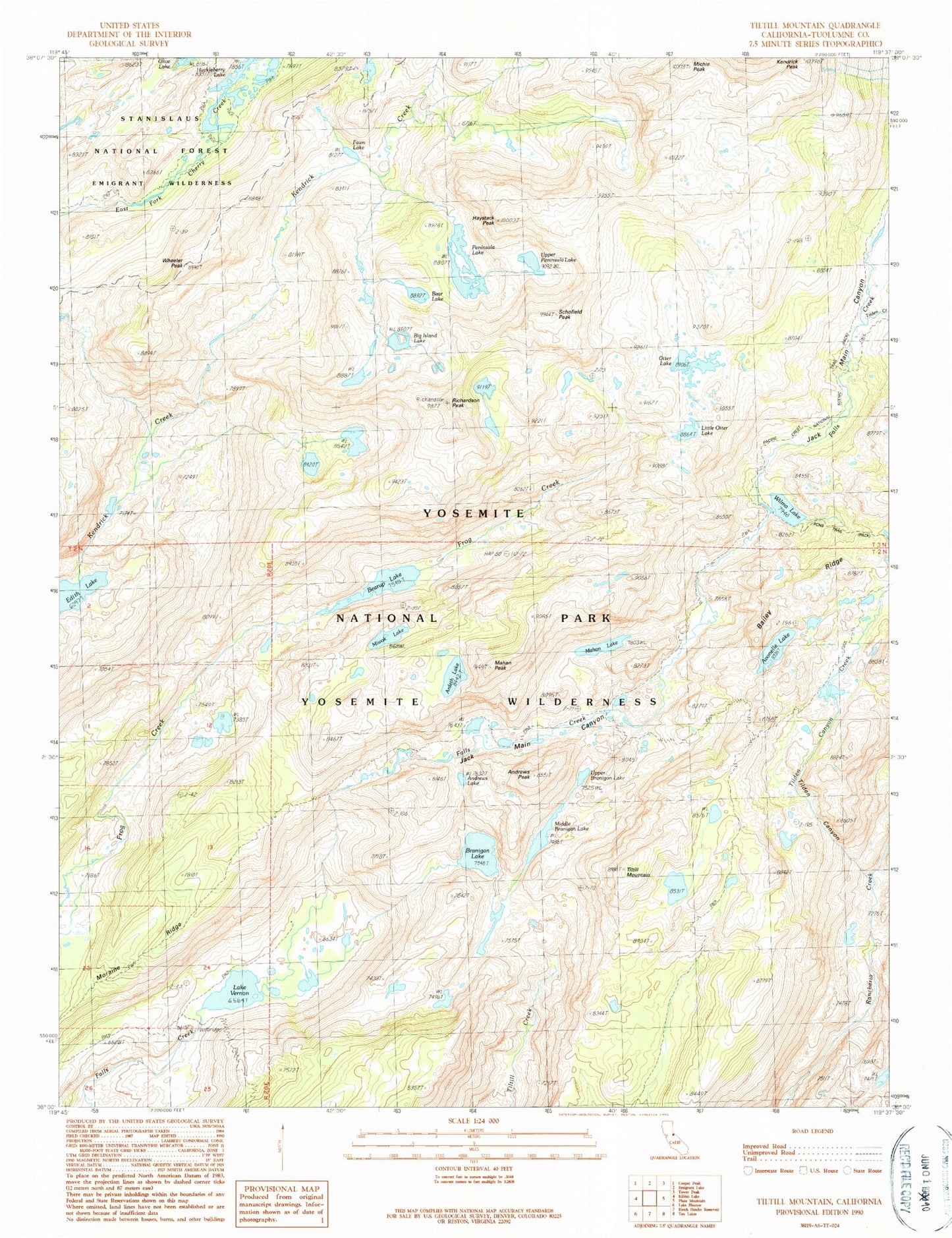
Classic USGS Tiltill Mountain California 7.5'x7.5' Topo Map
Couldn't load pickup availability
Historical USGS topographic quad map of Tiltill Mountain in the state of California. Typical map scale is 1:24,000, but may vary for certain years, if available. Print size: 24" x 27"
This quadrangle is in the following counties: Tuolumne.
The map contains contour lines, roads, rivers, towns, and lakes. Printed on high-quality waterproof paper with UV fade-resistant inks, and shipped rolled.
Contains the following named places: Andrews Lake, Ardeth Lake, Avonelle Lake, Branigan Lake, Haystack Peak, Kendrick Peak, Little Otter Lake, Mahan Lake, Michie Peak, Middle Branigan Lake, Miwok Lake, Otter Lake, Peninsula Lake, Upper Branigan Lake, Upper Peninsula Lake, Olive Lake, Bear Lake, Big Island Lake, Fawn Lake, Lake Vernon, Edith Lake, Schofield Peak, Andrews Peak, Bearup Lake, Jack Main Canyon, Moraine Ridge, Richardson Peak, Tilden Canyon, Tilden Canyon Creek, Tilden Creek, Tiltill Mountain, Wheeler Peak, Wilma Lake, Mahan Peak