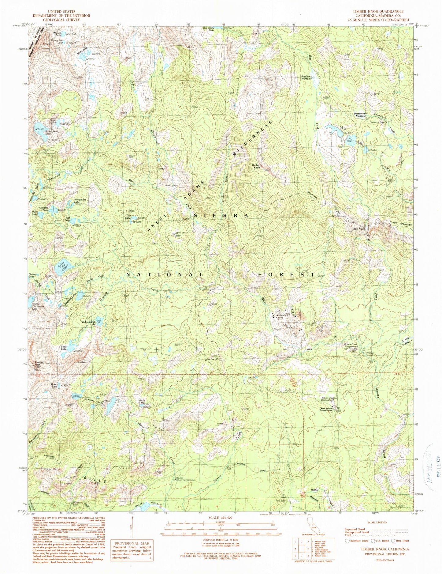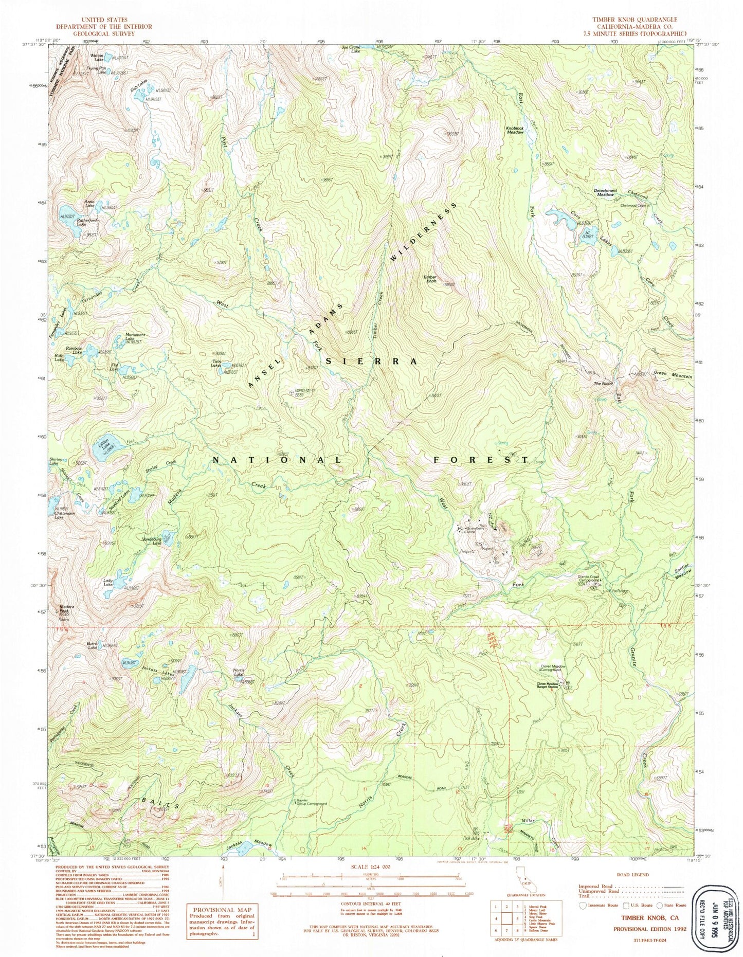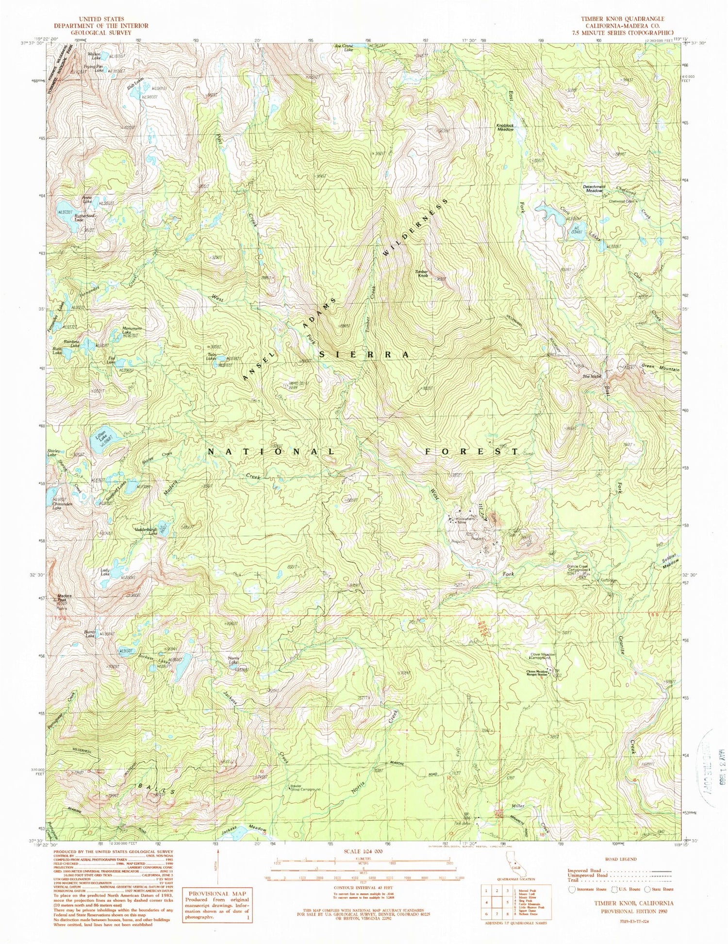
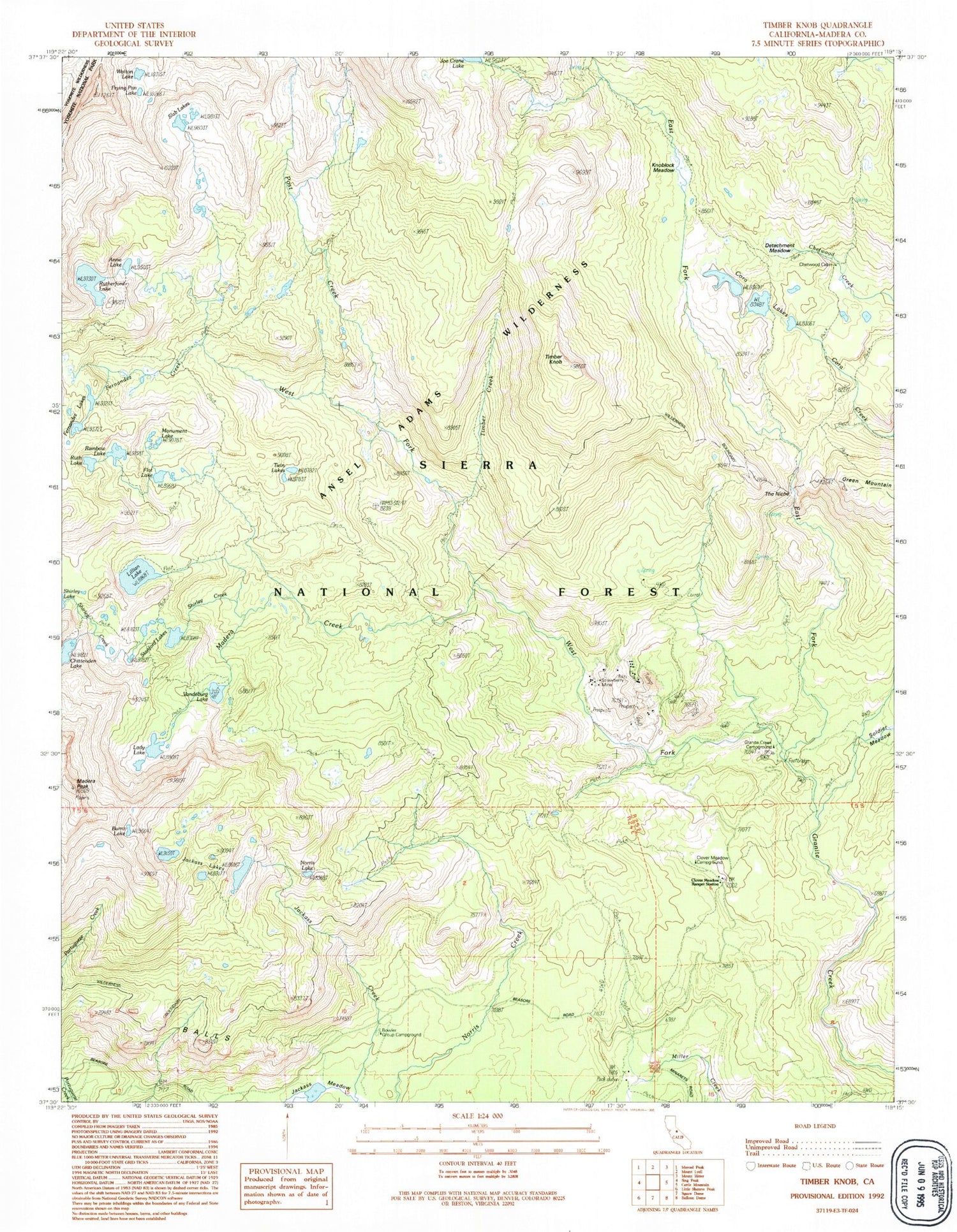
MyTopo
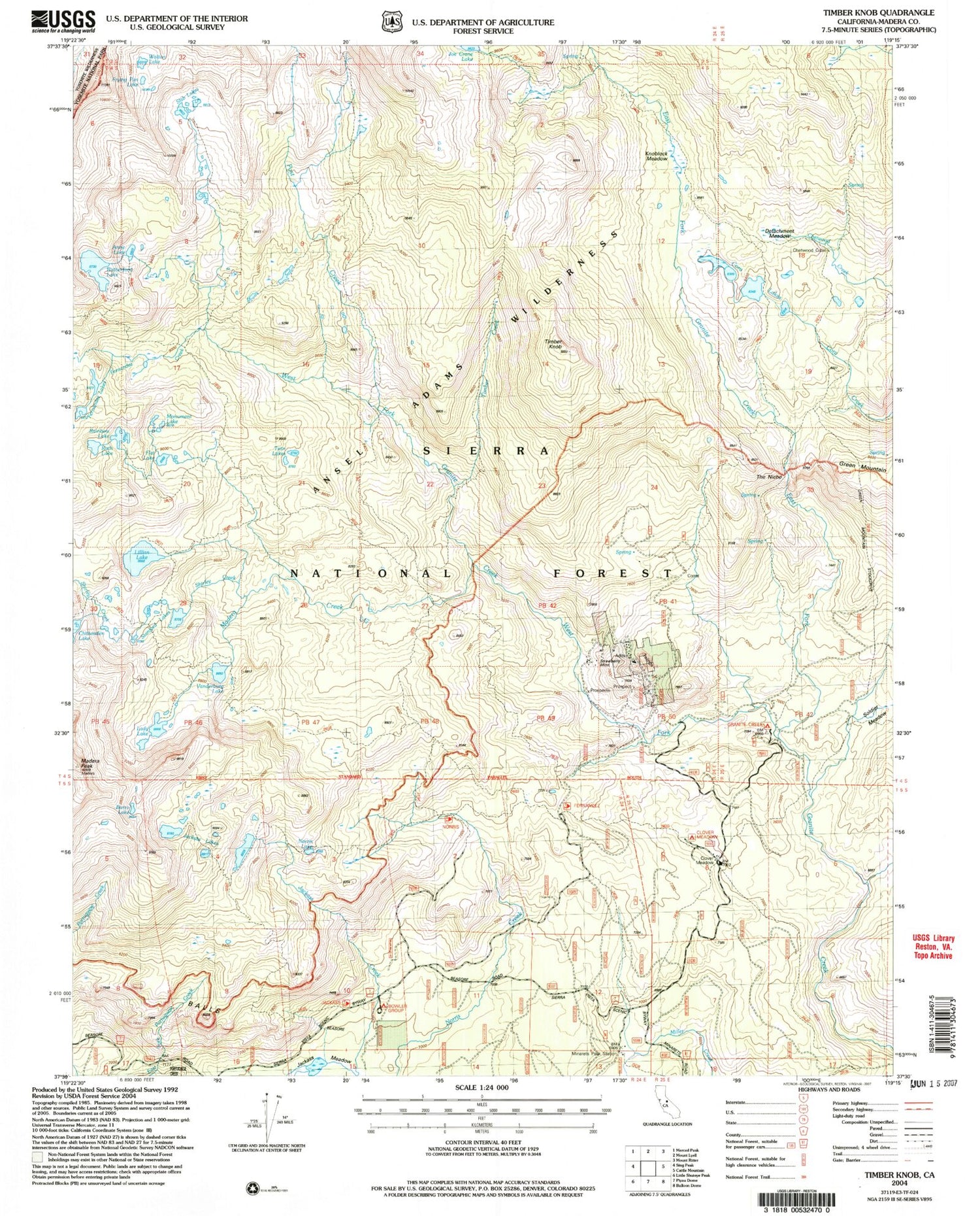
USGS Classic Timber Knob California 7.5'x7.5' Topo Map
Couldn't load pickup availability
Historical USGS topographic quad map of Timber Knob in the state of California. Scale: 1:24000. Print size: 24" x 27"
This quadrangle is in the following counties: Madera.
The map contains contour lines, roads, rivers, towns, lakes, and grids including latitude / longitude and UTM / MGRS. Printed on high-quality waterproof paper with UV fade-resistant inks.
Contains the following named places: Balls, Cora Lakes, Fernandez Lakes, Flat Lake, Jackass Lakes, Lillian Lake, Madera Lakes, Vanderburgh Lake, Knoblock Meadow, The Niche, Bowler Group Campground, Clover Meadow Campground, Anne Lake, Burro Lake, Chetwood Cabin, Clover Meadow Ranger Station, Detachment Meadow, East Fork Granite Creek, Fernandez Creek, Frying Pan Lake, Granite Creek Campground, Knoblock Cabin, Lady Lake, Madera Creek, Madera Peak, Miller Meadow, Miller Meadow Campground (historical), Monument Lake, Norris Lake, Post Creek, Rainbow Lake, Ruth Lake, Rutherford Lake, Shirley Creek, Slab Lakes, Soldier Meadow, Staniford Lakes, Timber Creek, Timber Knob, Twin Lakes, Walton Lake, West Fork Granite Creek, Strawberry Mines, Norris, Clover Meadow Ranger Station, Minarets Pack Station, Strawberry Mine, Rutherford Lake 1-036 Dam