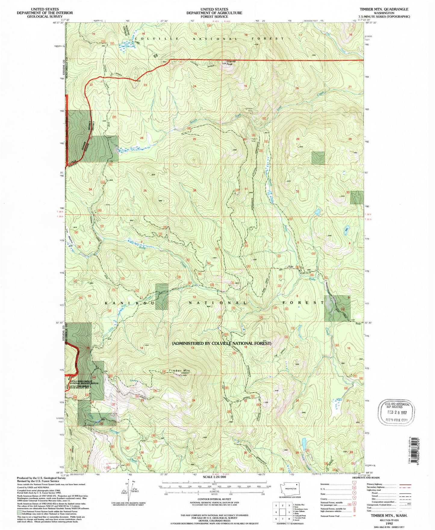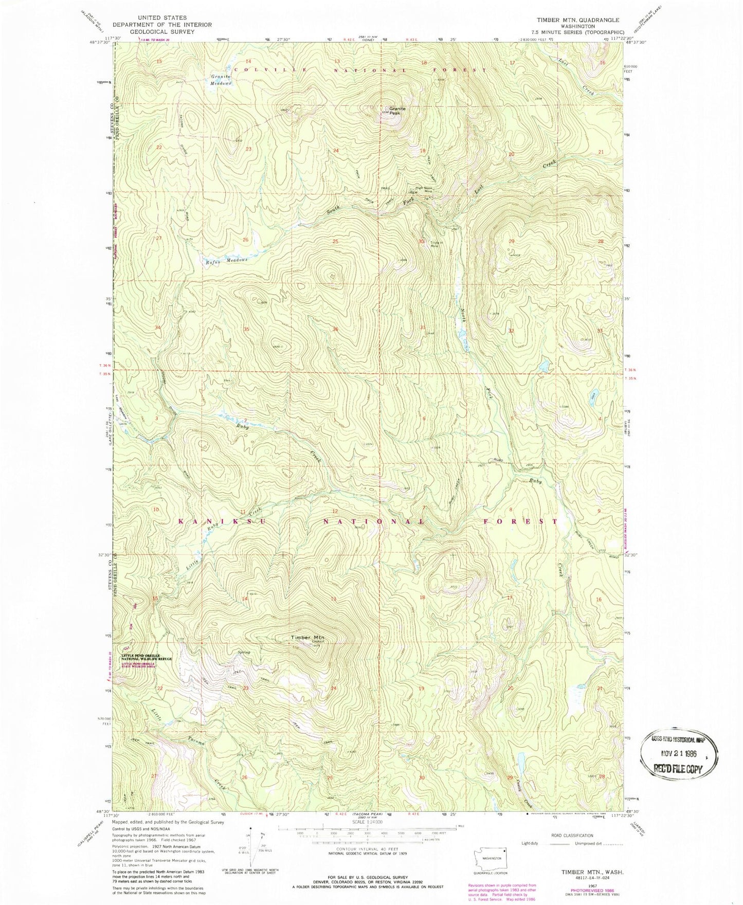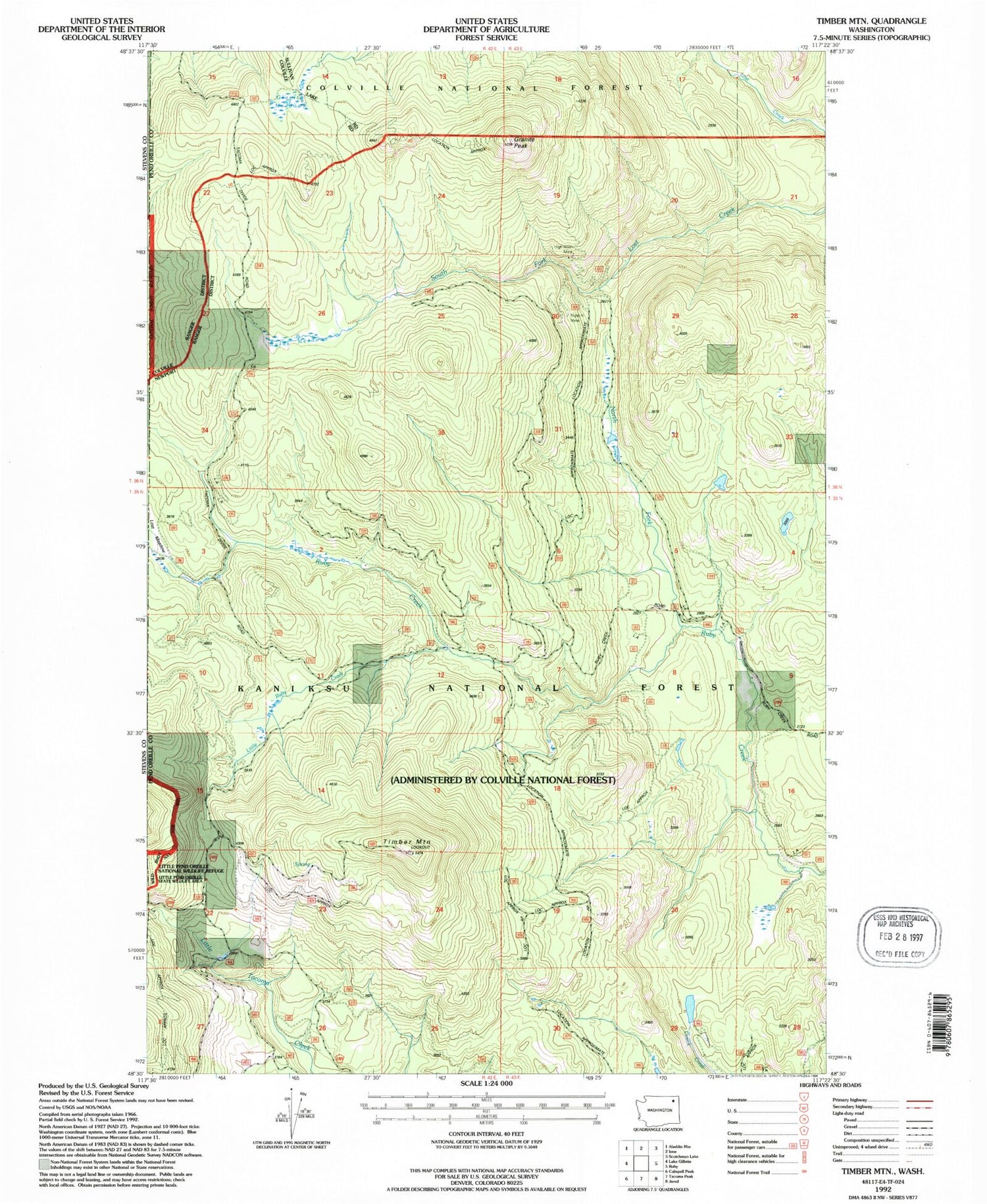

MyTopo
Classic USGS Timber Mountain Washington 7.5'x7.5' Topo Map
Regular price
$16.95
Regular price
Sale price
$16.95
Unit price
per
Couldn't load pickup availability
Historical USGS topographic quad map of Timber Mountain in the state of Washington. Map scale may vary for some years, but is generally around 1:24,000. Print size is approximately 24" x 27"
This quadrangle is in the following counties: Pend Oreille.
The map contains contour lines, roads, rivers, towns, and lakes. Printed on high-quality waterproof paper with UV fade-resistant inks, and shipped rolled.
Contains the following named places: Cusick Survival Training Site, Granite Meadows, Granite Peak, High Noon Mine, Little Ruby Creek, Lost Meadow, North Fork Ruby Creek, Rufus Meadows, Timber Mountain, Timber Mountain Lookout, Triple H Mine