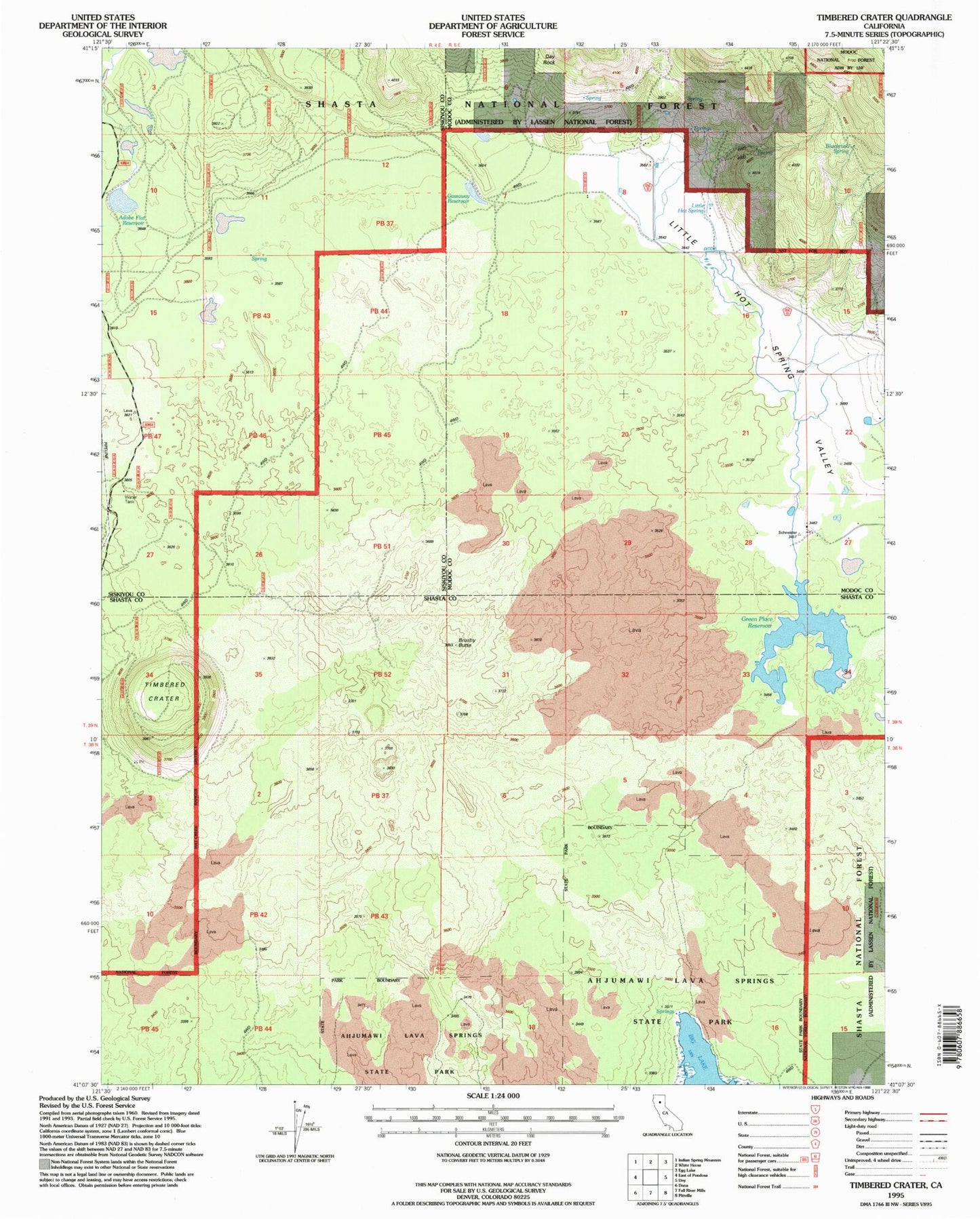
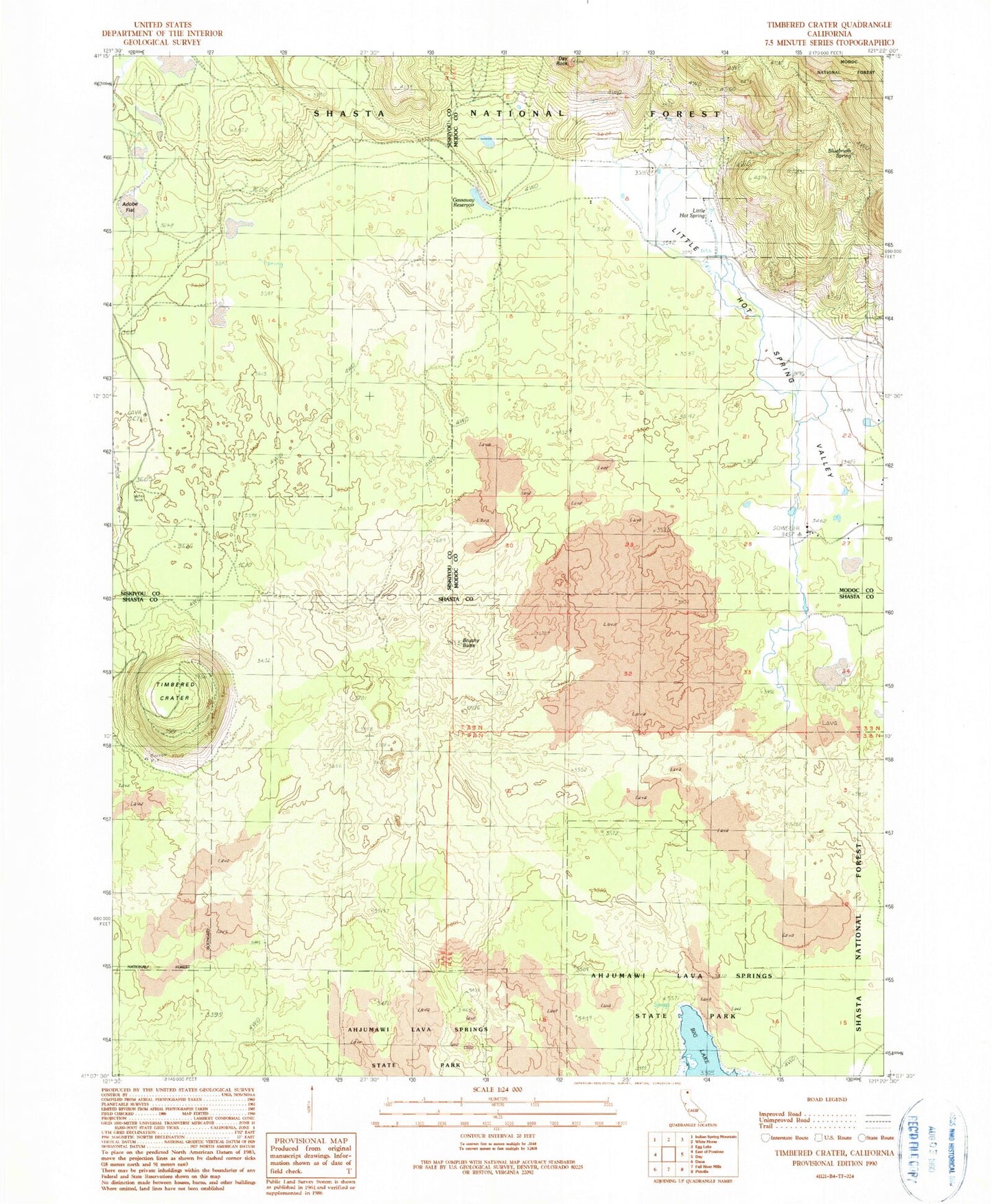
MyTopo
Classic USGS Timbered Crater California 7.5'x7.5' Topo Map
Regular price
$16.95
Regular price
Sale price
$16.95
Unit price
per
Couldn't load pickup availability
Historical USGS topographic quad map of Timbered Crater in the state of California. Typical map scale is 1:24,000, but may vary for certain years, if available. Print size: 24" x 27"
This quadrangle is in the following counties: Modoc, Shasta, Siskiyou.
The map contains contour lines, roads, rivers, towns, and lakes. Printed on high-quality waterproof paper with UV fade-resistant inks, and shipped rolled.
Contains the following named places: Adobe Flat, Bluebrush Spring, Brushy Butte, Day Rock, Gassaway Reservoir, Ahjumawi Lava Springs State Park, Timbered Crater, Little Hot Spring Valley, Green Place Reservoir (historical), Adobe Flat Reservoir, Little Hot Spring, Redwood Gun Club