MyTopo
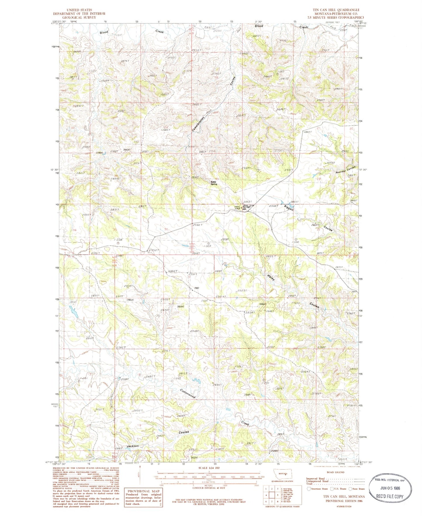
Classic USGS Tin Can Hill Montana 7.5'x7.5' Topo Map
Regular price
$16.95
Regular price
Sale price
$16.95
Unit price
per
Couldn't load pickup availability
Historical USGS topographic quad map of Tin Can Hill in the state of Montana. Map scale may vary for some years, but is generally around 1:24,000. Print size is approximately 24" x 27"
This quadrangle is in the following counties: Petroleum.
The map contains contour lines, roads, rivers, towns, and lakes. Printed on high-quality waterproof paper with UV fade-resistant inks, and shipped rolled.
Contains the following named places: 16N29E26BBDA01 Well, 17N28E11CA__01 Well, Camelbratten Coulee, Deep Coulee Dam, Dryland School, Jackson Coulee, Kettle Spring, Tin Can Hill