MyTopo
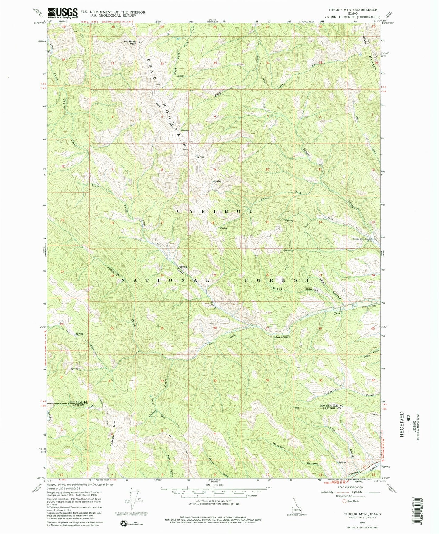
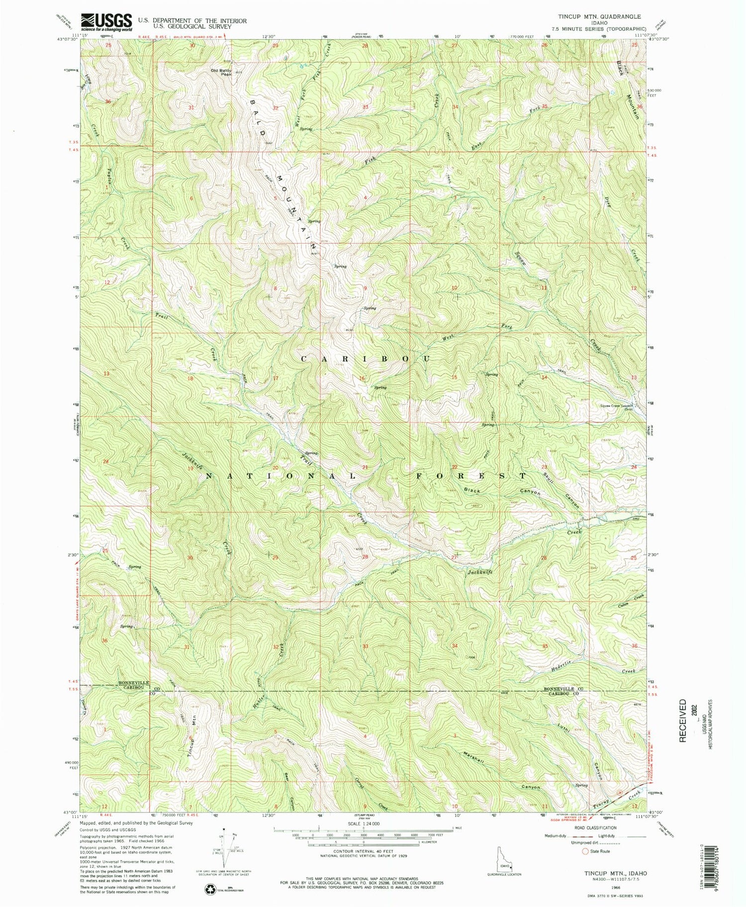
USGS Classic Tincup Mountain Idaho 7.5'x7.5' Topo Map
Regular price
$16.95
Regular price
Sale price
$16.95
Unit price
per
Couldn't load pickup availability
Historical USGS topographic quad map of Tincup Mountain in the state of Idaho. Scale: 1:24000. Print size: 24" x 27"
This quadrangle is in the following counties: Bonneville, Caribou.
The map contains contour lines, roads, rivers, towns, lakes, and grids including latitude / longitude and UTM / MGRS. Printed on high-quality waterproof paper with UV fade-resistant inks.
Contains the following named places: Bald Mountain, Bilk Creek, Black Canyon, Black Mountain, Hubler Creek, Luthi Canyon, Old Baldy Peak, Skull Canyon, Squaw Creek Sawmill, Taylor Creek, Trail Creek, West Fork Squaw Creek, Sadie Creek, Tincup Mountain, Black Creek, East Fork Fish Creek