MyTopo
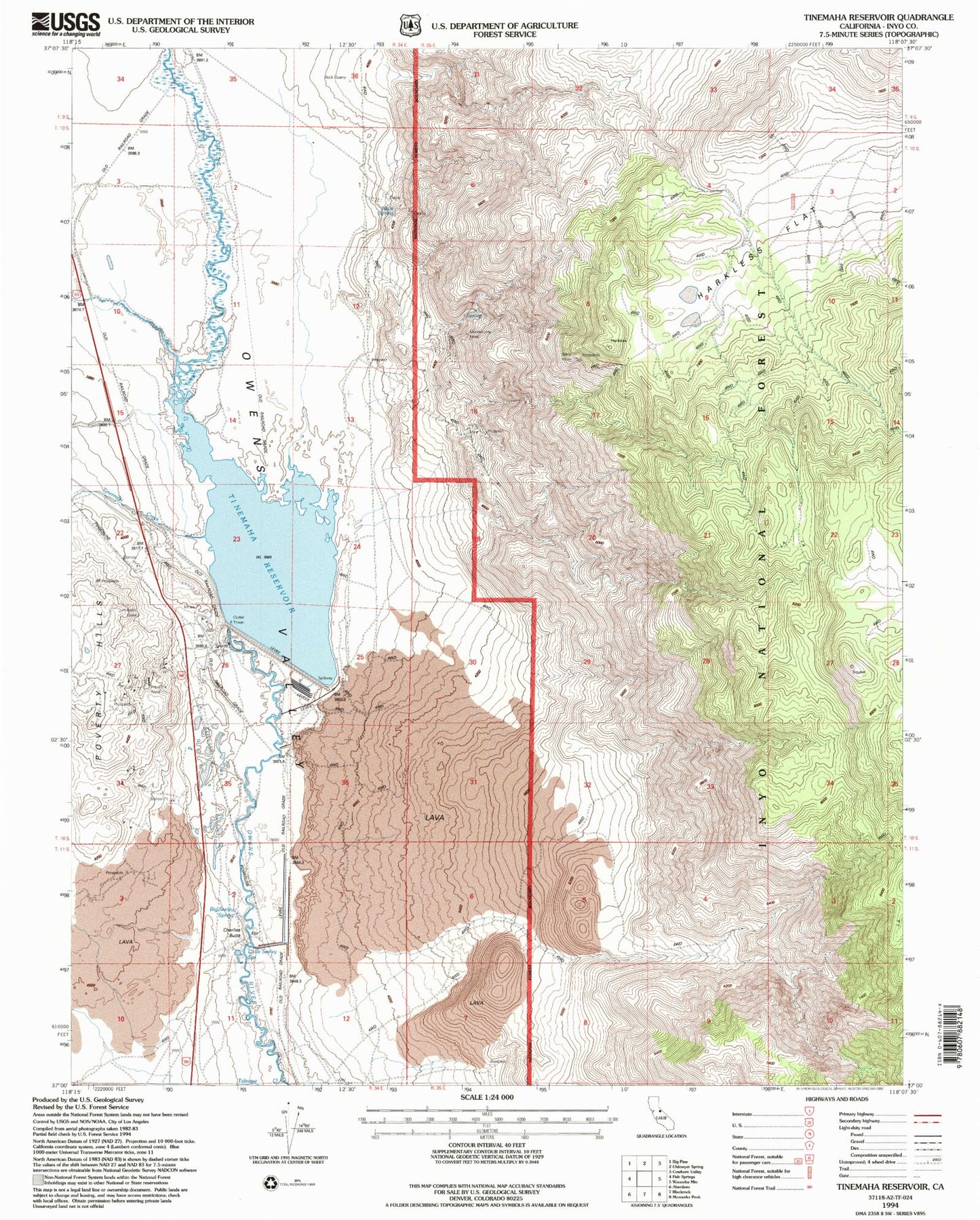
Classic USGS Tinemaha Reservoir California 7.5'x7.5' Topo Map
Couldn't load pickup availability
Historical USGS topographic quad map of Tinemaha Reservoir in the state of California. Map scale may vary for some years, but is generally around 1:24,000. Print size is approximately 24" x 27"
This quadrangle is in the following counties: Inyo.
The map contains contour lines, roads, rivers, towns, and lakes. Printed on high-quality waterproof paper with UV fade-resistant inks, and shipped rolled.
Contains the following named places: Alice Extension Prospect, Alice Prospect, Alice Quartz Mine, Big Pine Mine, Big Seeley Spring, Black Aster Prospect, Blake Mine, Blister Lode Prospect, Boaz Prospect, Bob White Prospect, Cabin Prospect, Charlies Butte, Contact Silver Number 8 Prospect, East Sylvester Prospect, Elna, Gold Bug Prospect, Gold Giant Number 4 Mine, Green Giant Marble Mine, Harkless Flat, J R Number 2 Prospect, Kaweah Prospect, Little Seeley Spring, Lucky Bee Prospect, Lucky Jim Prospect, Montezuma Mine, Montezuma South Prospect, Mule Spring, Mule Springs Number 1 Mine, New Era Mine, Plain View Prospect, Sangers Slough, Tinemaha 6-026 Dam, Tinemaha Creek, Tinemaha Reservoir, Valley View Prospect