MyTopo
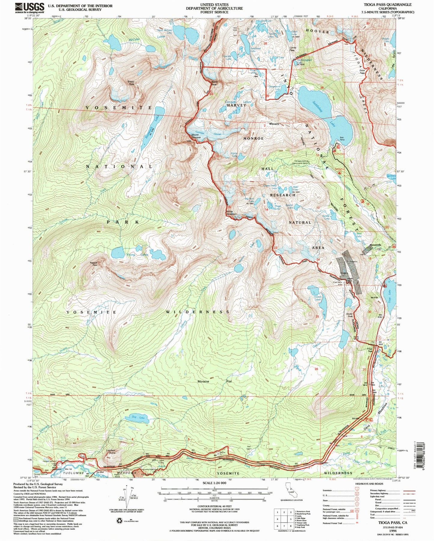
USGS Classic Tioga Pass California 7.5'x7.5' Topo Map
Couldn't load pickup availability
Historical USGS topographic quad map of Tioga Pass in the state of California. Scale: 1:24000. Print size: 24" x 27"
This quadrangle is in the following counties: Mono, Tuolumne.
The map contains contour lines, roads, rivers, towns, lakes, and grids including latitude / longitude and UTM / MGRS. Printed on high-quality waterproof paper with UV fade-resistant inks.
Contains the following named places: Alpine Lake, Big Horn Lake, Carnegie Institute Experimental Station, Cascade Lake, Conness Lakes, Dore Cliff, Dore Pass, Finger Lake, Gardisky Lake, Gaylor Peak, Granite Lakes, Green Treble Lake, Greenstone Lake, Hess Mine, Hummingbird Lake, Lundy Pass, Maul Lake, Odell Lake, Oneida Lake, Parsons Memorial Lodge, Roosevelt Lake, Saddlebag Lake, Sawmill Campground, Shamrock Lake, Skelton Lakes, Tioga Crest, Tioga Lake, Wasco Lake, Z Lake, Fantail Lake, Puppy Dome, Shell Lake, Bennettville (historical), Gaylor Lakes, Great Sierra Mine, Lyell Fork, McCabe Lakes, Saddlebag Campground, Spuller Lake, Steelhead Lake, Dana Fork, Dog Lake, Parker Pass Creek, Dana Meadows, Soda Springs, Young Lakes, Mount Conness, Lembert Dome, Moraine Flat, North Peak, Ragged Peak, Tioga Pass, Upper McCabe Lake, Conness Glacier, May Lundy Mine, Tioga Campground, Tuolumne Meadows Ranger Station, Harvey Monroe Hall Research Natural Area, Tuolumne Meadows Lodge, Twin Lakes, Sheep Peak, White Mountain, Saddlebag 104-039 Dam, Tioga Lake 104-040 Dam, Gaylor Lakes Trail, Upper Gaylor Lake, Saddlebag Lake Resort, Tioga Pass Entrance, Tioga Lake Overlook, Trailhead Group Campground, Bennetville Interpretive Site, Benneville Trailhead, Gardisky Lake Trailhead, Nunatak-Tioga Tarns Trailhead, Saddlebag Lake Trailhead