MyTopo
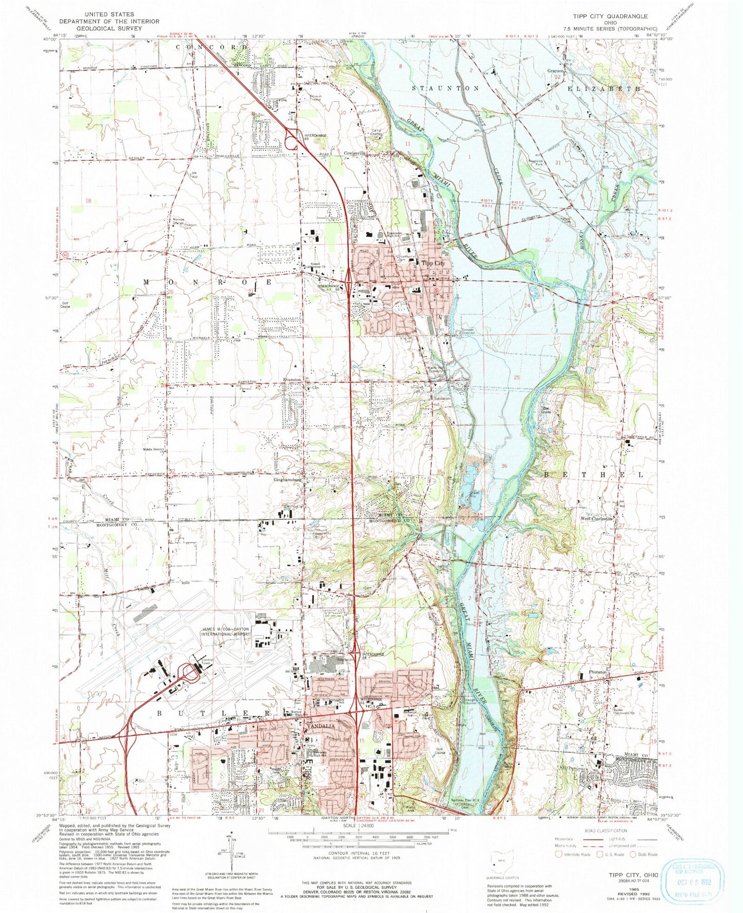
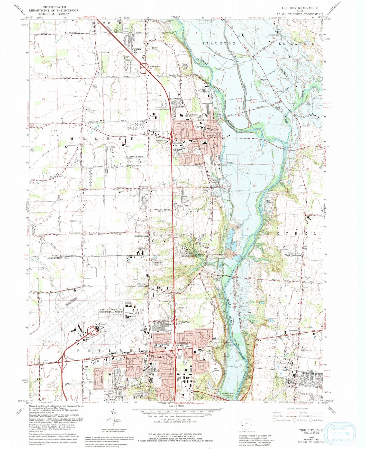
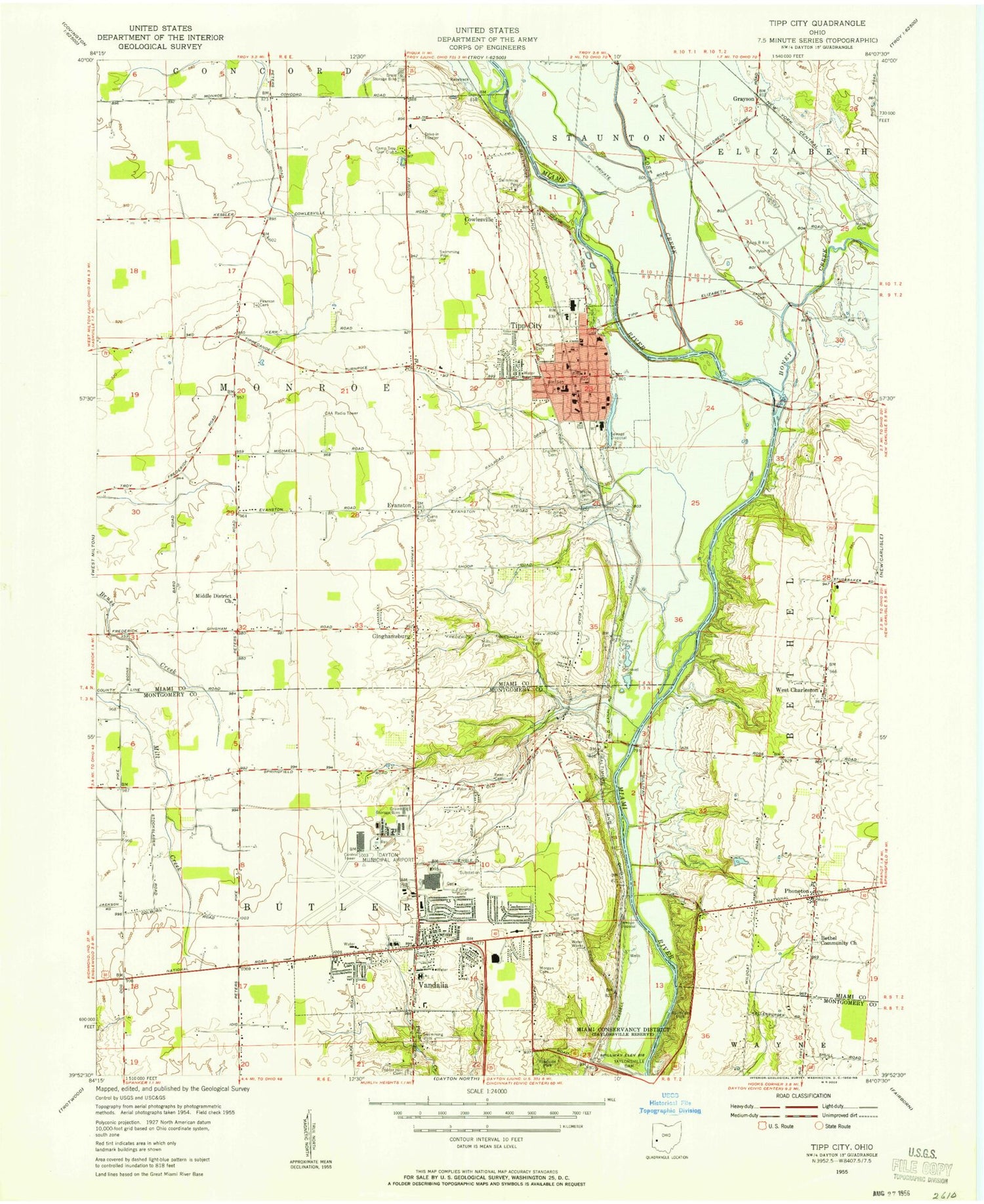
Classic USGS Tipp City Ohio 7.5'x7.5' Topo Map
Couldn't load pickup availability
Historical USGS topographic quad map of Tipp City in the state of Ohio. Typical map scale is 1:24,000, but may vary for certain years, if available. Print size: 24" x 27"
This quadrangle is in the following counties: Miami, Montgomery.
The map contains contour lines, roads, rivers, towns, and lakes. Printed on high-quality waterproof paper with UV fade-resistant inks, and shipped rolled.
Contains the following named places: Camp Chaffee, English Cemetery, Forest Hills Memorial Gardens, Honey Creek, Hyattsville Cemetery, Kepper Cemetery, Lost Creek, Maple Hill Cemetery, Pearson Cemetery, Poplar Hill Cemetery, Saint Christophers School, Saint Johns Cemetery, Tippecanoe High School, Cowlesville, Evanston, Vandalia, Cassell Hills Municipal Golf Course, Victory Park, Robinette Park, Vandalia Elementary School, Vandalia Branch Library, Butler High School, Helke Park, Helke Elementary School, Cliffside Golf Course, Tipp City Public Library, Morton Middle School, White Oak Shopping Center, Tipp City Plaza Shopping Center, Imperial Shopping Center, Tipp City, West Charleston, Scholz Industrial Park, Dayton Center Business Park, Grayson, Ginghamsburg, Gospel Lighthouse Church, Middle District Church of the Brethren, Phoneton, Freemans Prairie, Gerard Prairie, Dayton Army Air Field (historical), Four Seasons Mall Shopping Center, North Plaza Shopping Center, L T Ball Junior High School, Nevin Coppock Elementary School, Broadway Elementary School, Tipp Central Intermediate School, First Baptist Church, Saint John the Baptist Catholic Church, Zion Lutheran Church, Tipp City United Methodist Church, Ginghamsburg United Methodist Church, Bethel Cemetery, Poplar Grove School (historical), Charleston Falls Preserve, West Charleston Cemetery, Miami Primitive Baptist Church, West Charleston Church of the Brethren, West Charleston School (historical), Fulton Farms, Babbtown (historical), School Number 2 (historical), Old Tippecanoe Main Street Historic District, Bethel Community Church, Tadmor (historical), Tipp City Assembly of God Church, Hart Pond Dam, Hart Pond, Owen Pond Dam, Owen Pond, Demmitt Elementary School, James M Cox Dayton International Airport, Black Heliport, Township of Monroe, City of Vandalia, Hathaway Park, Monroe Township Building, Thomas B Kyle Senior Memorial Park, Tipp City Post Office, Tipp Government Center, Tweed Park, Woodlawn Park, Agape Pentecostal Assembly Church, Cassel Cemetery, Church of Christ, Compton Cemetery, First Baptist Church of Vandalia, Pinegrove Cemetery, Saint Johns Lutheran Church, Vandalia Baptist Temple, Vandalia Grace Brethren Church, Vandalia United Methodist Church, Ginghamsburg Post Office (historical), West Charleston Post Office (historical), Tipp City Post Office, Grayson Post Office (historical), Phoneton Post Office, Tadmor Post Office (historical), Vandalia Post Office, City of Tipp City, Honey Creek Preserve, Dayton International Airport Fire Department, Vandalia Division of Fire Station 3, Tipp City Fire Department, Vandalia Division of Fire Station 2, Tipp City Fire and Emergency Medical Services, Benchrock Farms, Airline Theatre (historical), Hickory Haven Farm, Senseman Farm, Southside Farms, Willow Wood Farms, Vandalia Police Department, Tipp City Police Department, Little Turtle Creek