MyTopo
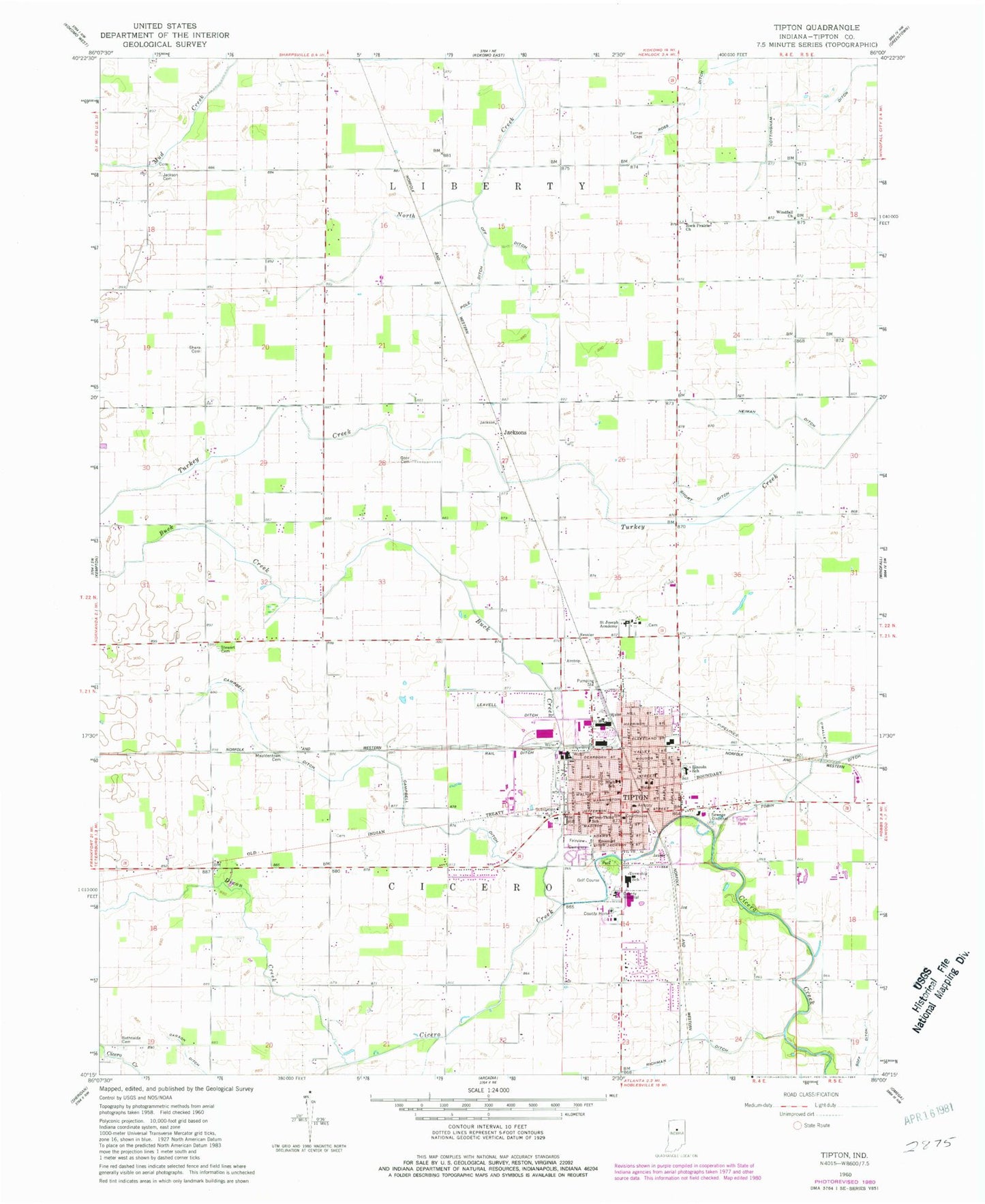
Classic USGS Tipton Indiana 7.5'x7.5' Topo Map
Couldn't load pickup availability
Historical USGS topographic quad map of Tipton in the state of Indiana. Map scale may vary for some years, but is generally around 1:24,000. Print size is approximately 24" x 27"
This quadrangle is in the following counties: Tipton.
The map contains contour lines, roads, rivers, towns, and lakes. Printed on high-quality waterproof paper with UV fade-resistant inks, and shipped rolled.
Contains the following named places: Baird-Wolford Airport, Bethsaida Cemetery, Buck Creek, Campbell Ditch, Carson Ditch, Cicero Township Volunteer Fire Department, City of Tipton, Dixon Creek, Emanuel Lutheran School, Fairview Cemetery, Goar Cemetery, Goff Ditch, IU Health Tipton Hospital, Jackson Cemetery, Jacksons, Jefferson Elementary School, Leavell Ditch, Lincoln Elementary School, Moldentown Cemetery, Mud Creek, Neiman Ditch, Off Ditch, O'Malley Ditch, Ploughe Farm, Pole Ditch, Rail Ditch, Richman Ditch, Ripberger Farms, Rock Prairie Church, Ross Ditch, Rural / Metro Ambulance - Tipton, Saint Joseph Academy, Schottmer Prime Pork Farm, Sharp Cemetery, Short Ditch, Stewart Cemetery, Tipton, Tipton County, Tipton County Sheriff's Office, Tipton Fire Department, Tipton Police Department, Tipton Post Office, Township of Cicero, Township of Liberty, Tragesser Airport, Turner Cemetery, Washington Elementary School, Washington Middle School, Windfall Church, ZIP Code: 46072