MyTopo
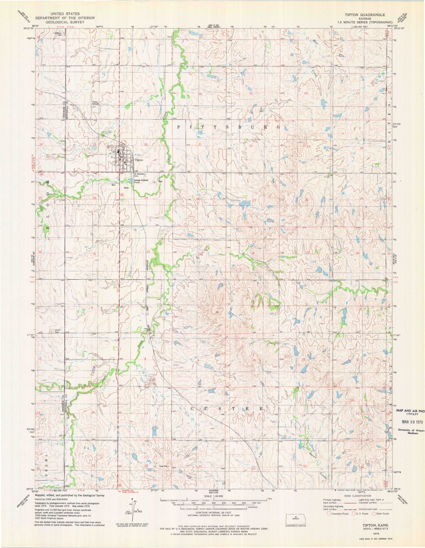
Classic USGS Tipton Kansas 7.5'x7.5' Topo Map
Couldn't load pickup availability
Historical USGS topographic quad map of Tipton in the state of Kansas. Map scale may vary for some years, but is generally around 1:24,000. Print size is approximately 24" x 27"
This quadrangle is in the following counties: Mitchell, Osborne.
The map contains contour lines, roads, rivers, towns, and lakes. Printed on high-quality waterproof paper with UV fade-resistant inks, and shipped rolled.
Contains the following named places: Agmark Grain Elevator Number 18, City of Tipton, Lutheran Cemetery, Ringneck Ranch Airport, Saint Boniface Cemetery, Tipton, Tipton Airfield, Tipton Catholic Junior - Senior High School, Tipton Christian School, Tipton Post Office, Tipton Rural Fire Department, Tipton Wastewater Plant, Township of Custer, Township of Pittsburg, Williams Butte