MyTopo
Classic USGS Tiptop Washington 7.5'x7.5' Topo Map
Regular price
$16.95
Regular price
Sale price
$16.95
Unit price
per
Couldn't load pickup availability
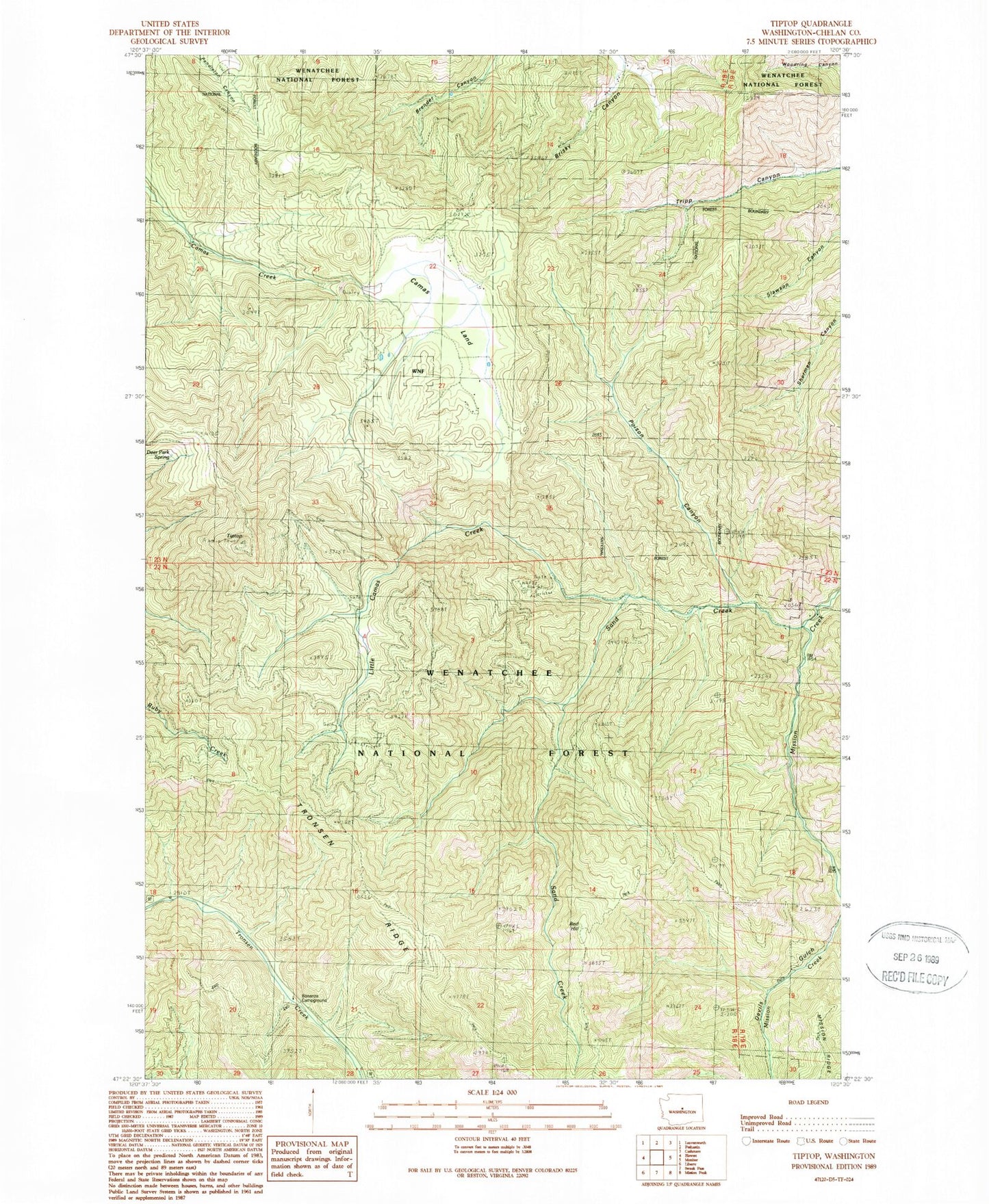
Historical USGS topographic quad map of Tiptop in the state of Washington. Map scale may vary for some years, but is generally around 1:24,000. Print size is approximately 24" x 27"
This quadrangle is in the following counties: Chelan.
The map contains contour lines, roads, rivers, towns, and lakes. Printed on high-quality waterproof paper with UV fade-resistant inks, and shipped rolled.
Contains the following named places: Bonanza Campground, Camas Land, Cashmere Division, Deer Park Spring, Devils Gulch, East Fork Mission Creek, Little Camas Creek, Poison Canyon, Red Hill, Red Hill Trail, Ruby Creek Trail, Sand Creek, State of Washington, Tiptop, Tiptop Mount Lillian Trail, West Sand Creek Trail