MyTopo
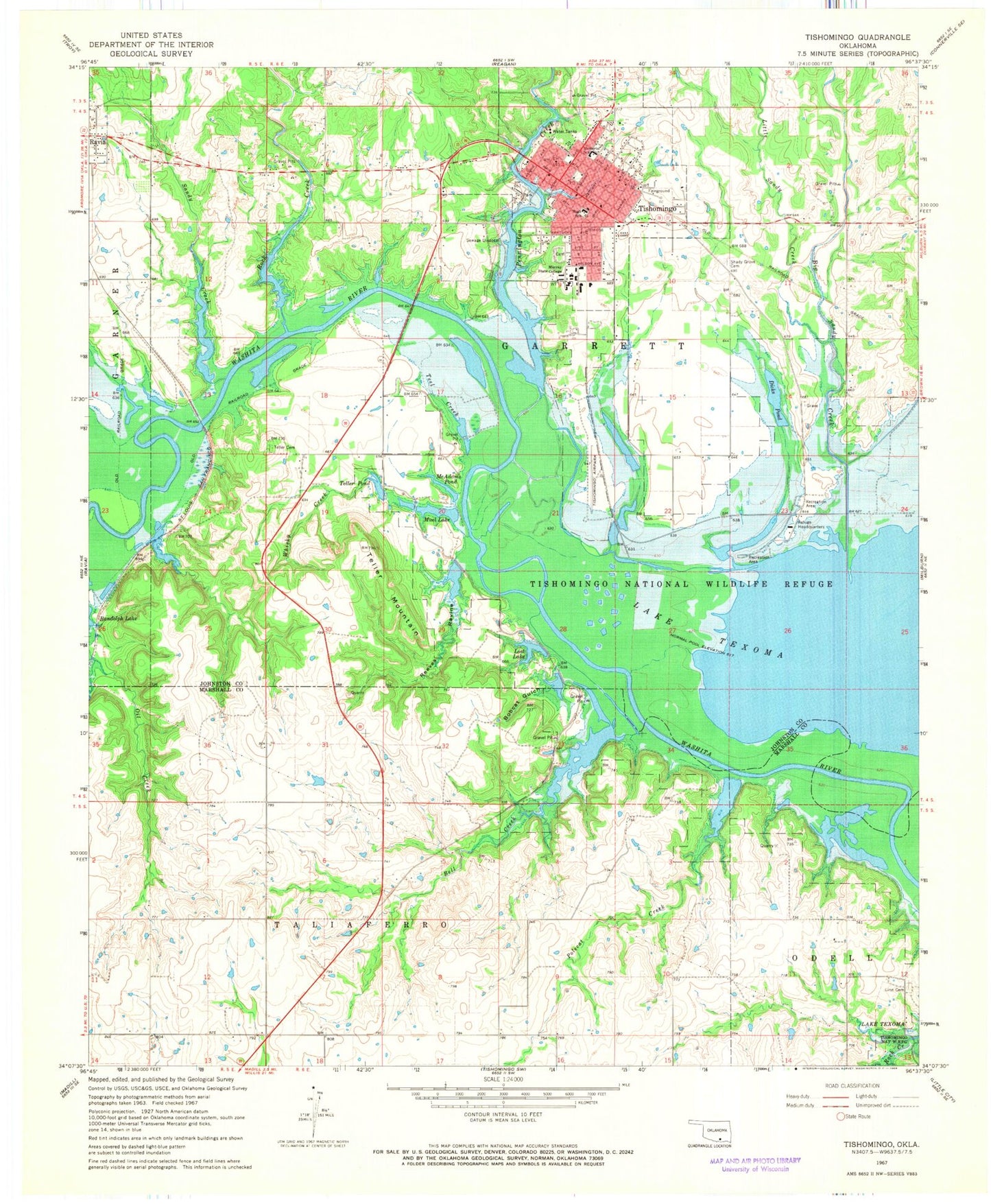
Classic USGS Tishomingo Oklahoma 7.5'x7.5' Topo Map
Couldn't load pickup availability
Historical USGS topographic quad map of Tishomingo in the state of Oklahoma. Map scale may vary for some years, but is generally around 1:24,000. Print size is approximately 24" x 27"
This quadrangle is in the following counties: Johnston, Marshall.
The map contains contour lines, roads, rivers, towns, and lakes. Printed on high-quality waterproof paper with UV fade-resistant inks, and shipped rolled.
Contains the following named places: Bell Creek, Big Sandy Creek, Bobcat Gulch, Bobcat Lake, Bobcat Lake Dam, City of Tishomingo, Cottonwood Lake, Cottonwood Lake Dam, Dicks Pond, Dicks Pond Dam, Johnston County Ambulance Service, KTSH-FM (Tishomingo), Linn Cemetery, Little Sandy Creek, Lost Lake, Lost Lake Dam, McAdams Pond, McAdams Pond Dam, McDaniel Aviation, Mercy Hospital Tishomingo, Muel Lake, Muel Lake Dam, Murray State College, Murray State College Police Department, Pennington Creek, Polecat Creek, Randolph, Reeves Ravine, Reeves Ravine Dam, Reeves Ravine Reservoir, Rock Creek, Sand Creek, Shady Grove Cemetery, Spring Creek Pond, Spring Creek Pond Dam, Teal Pond Dam, Teel Creek, Teller Cemetery, Teller Mountain, Teller Pond, Teller Pond Dam, Tishomingo, Tishomingo Airpark, Tishomingo Cemetery, Tishomingo Elementary School, Tishomingo Fire Department, Tishomingo High School, Tishomingo Middle School, Tishomingo National Wildlife Refuge, Tishomingo Police Dept, Tishomingo Post Office, Tishomingo Public Hunting Area, Whiskey Creek Dam, Whiskey Creek Reservoir, Whisky Creek


