
MyTopo
Classic USGS Tobacco Row Mountain Virginia 7.5'x7.5' Topo Map
Couldn't load pickup availability
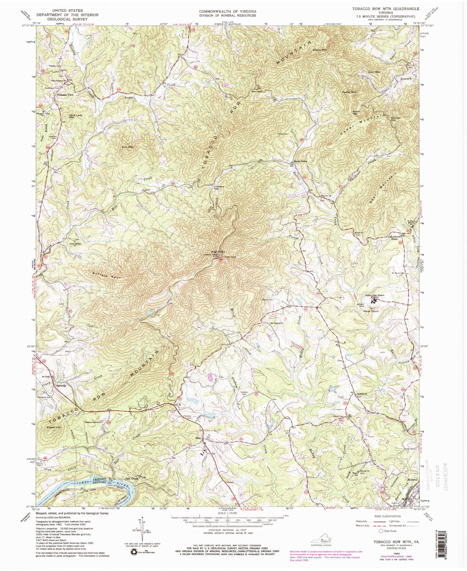
Historical USGS topographic quad map of Tobacco Row Mountain in the state of Virginia. Typical map scale is 1:24,000, but may vary for certain years, if available. Print size: 24" x 27"
This quadrangle is in the following counties: Amherst, Bedford.
The map contains contour lines, roads, rivers, towns, and lakes. Printed on high-quality waterproof paper with UV fade-resistant inks, and shipped rolled.
Contains the following named places: Bear Mountain, Bethany Church, Burford Cemetery, Camden Gap, Cedar Mountain, Chestnut Grove Baptist Church, Childress Creek, Crawford Gap, Crawfords Store, Davies Branch, Falling Rock Creek, Father Judge Mission Seminary, Fletcher Cemetery, Forest Creek, Gatewood Cemetery, Gun Mountain, Harris Cemetery, Hicks Cemetery, Hicks Morris Peters Cemetery, Hicks Store, High Peak, Hudson Cemetery, Hudson Cemetery, Little Bethel Church, Love Lady Mountain, Mill Creek, Miller Creek, Mount Carmel Church, Mount Tabor Church, New Prospect Baptist Church, Pedlar Gap, Pleasant View Elementary School, Potato Hill, Pryor Creek, Saint Pauls Cemetery, Saint Pauls Mission School, Sally Creek, Salt Creek, Shady Mountain, Shiloh Church, Smyrna Church, Sunrise Church, Timothy Baptist Church, Watts Cemetery, Watts School, Weir Gap, Amherst County, Crab Creek, Tobacco Row Mountain, General Alberts Dam, General Alberts Other Dam, Agricola, Buffalo Spur, Elon, Gum Mountain, Monroe, Pedlar Mountain, Pleasant View, Salt Creek, Chestnut Grove School (historical), Elon Baptist Church, Elon Elementary School, Elon Presbyterian Church, Indian Mission, Pleasant Chapel (historical), Rocky Seat School (historical), Saint Pauls Episcopal Mission, Monelison Volunteer Fire Department Station 3


