MyTopo
Classic USGS Tobias Peak California 7.5'x7.5' Topo Map
Couldn't load pickup availability
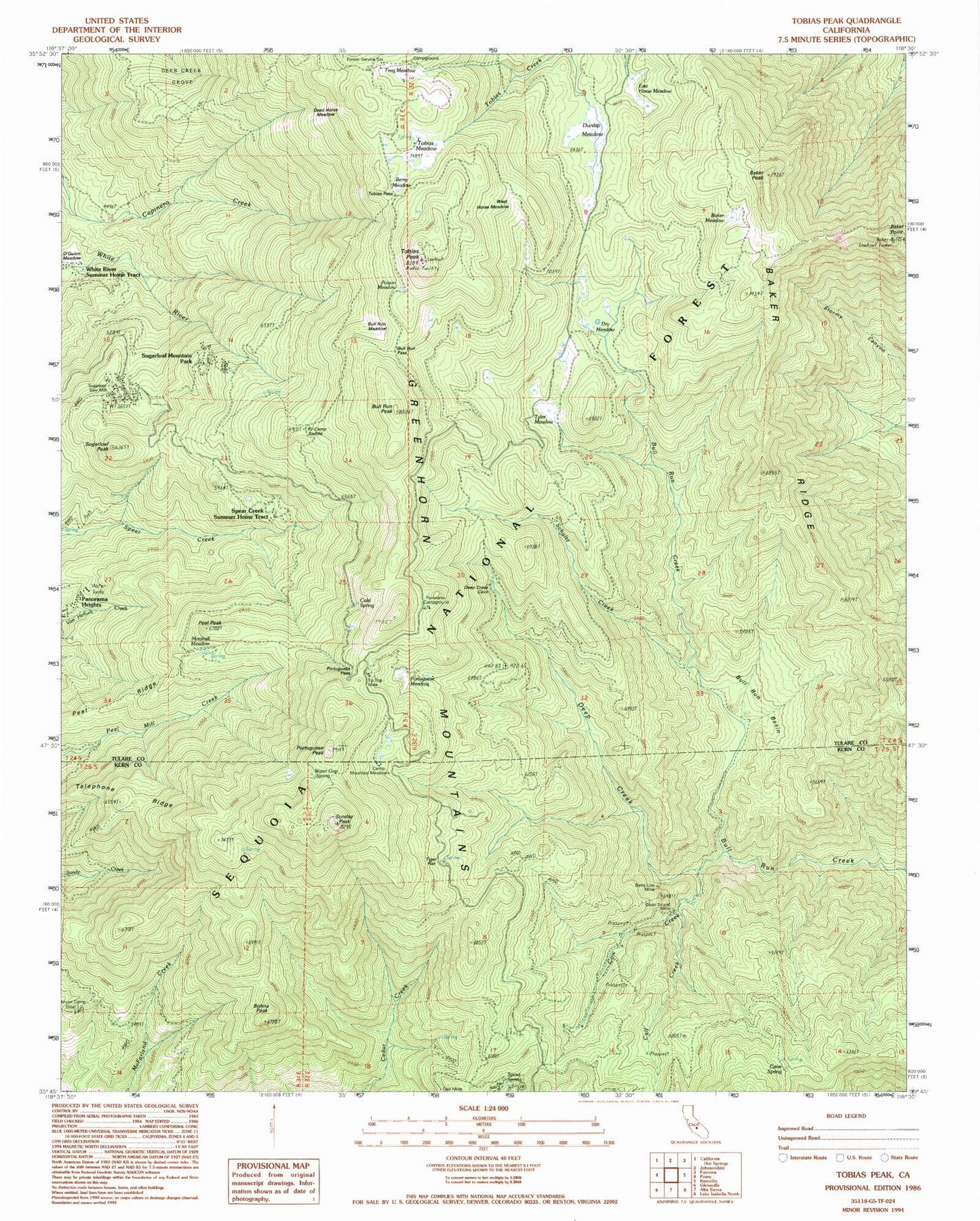
Historical USGS topographic quad map of Tobias Peak in the state of California. Typical map scale is 1:24,000, but may vary for certain years, if available. Print size: 24" x 27"
This quadrangle is in the following counties: Kern, Tulare.
The map contains contour lines, roads, rivers, towns, and lakes. Printed on high-quality waterproof paper with UV fade-resistant inks, and shipped rolled.
Contains the following named places: Baker Meadow, Baker Peak, Baker Point, Baker Ridge, Betty Lou Mine, Black Sambo Mine, Bull Run Basin, Bull Run Cattle Drive, Bull Run Meadow, Bull Run Pass, Bull Run Peak, Calf Creek, Cane Spring, Cold Spring, Cow Creek, Dead Horse Meadow, Deep Creek, Deer Creek Grove, Dry Meadow, Dunlap Meadow, Fir Camp Saddle, Frog Meadow, Frog Meadow Guard Station, Gooseberry Campground, Horse Meadow, Marshall Meadow, Munn Camp, O'Quinn Meadow, Owl Mine, Panorama Campground, Peel Peak, Peel Ridge, Poison Meadow, Portuguese Meadow, Portuguese Pass, Portuguese Peak, Schultz Creek, Silver Strand Mine, Spout Spring, Sugarloaf Peak, Sunday Peak, Tiger Flat Campground, Tip Top Mine, Tobias Meadow, Tobias Peak, Tobias Trail, Tyler Meadow, Virginia Trail, Water Gap Spring, Greenhorn Mountains, Telephone Ridge, Sugarloaf Campground, Bony Witt, Frog Meadows Campground, Tobias Lookout, Frog Meadows Guard Station, Bohna Peak, Guernsey Mill, Spear Creek Summer Home Tract, Sugarloaf Mountain Park, Camp Mountain Meadows, Tiger Flat, Berry Meadow, East Horse Meadow, Sugarloaf Saw Mill, West Horse Meadow, Sugarloaf Mountain Park Census Designated Place (historical), Sugarloaf Saw Mill Census Designated Place