MyTopo
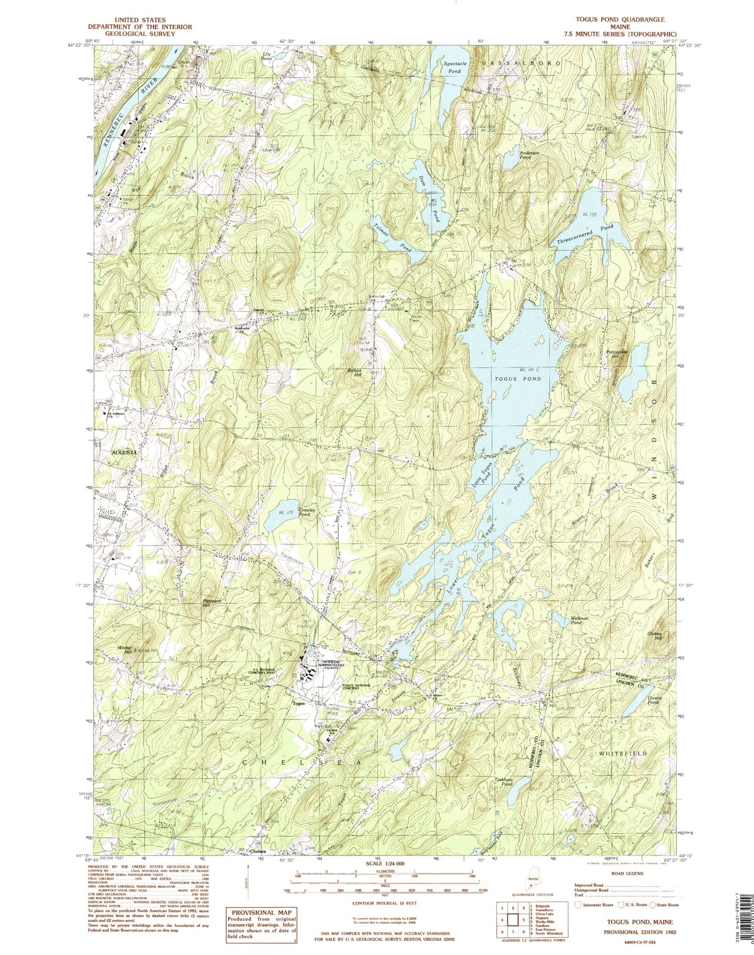
Classic USGS Togus Pond Maine 7.5'x7.5' Topo Map
Couldn't load pickup availability
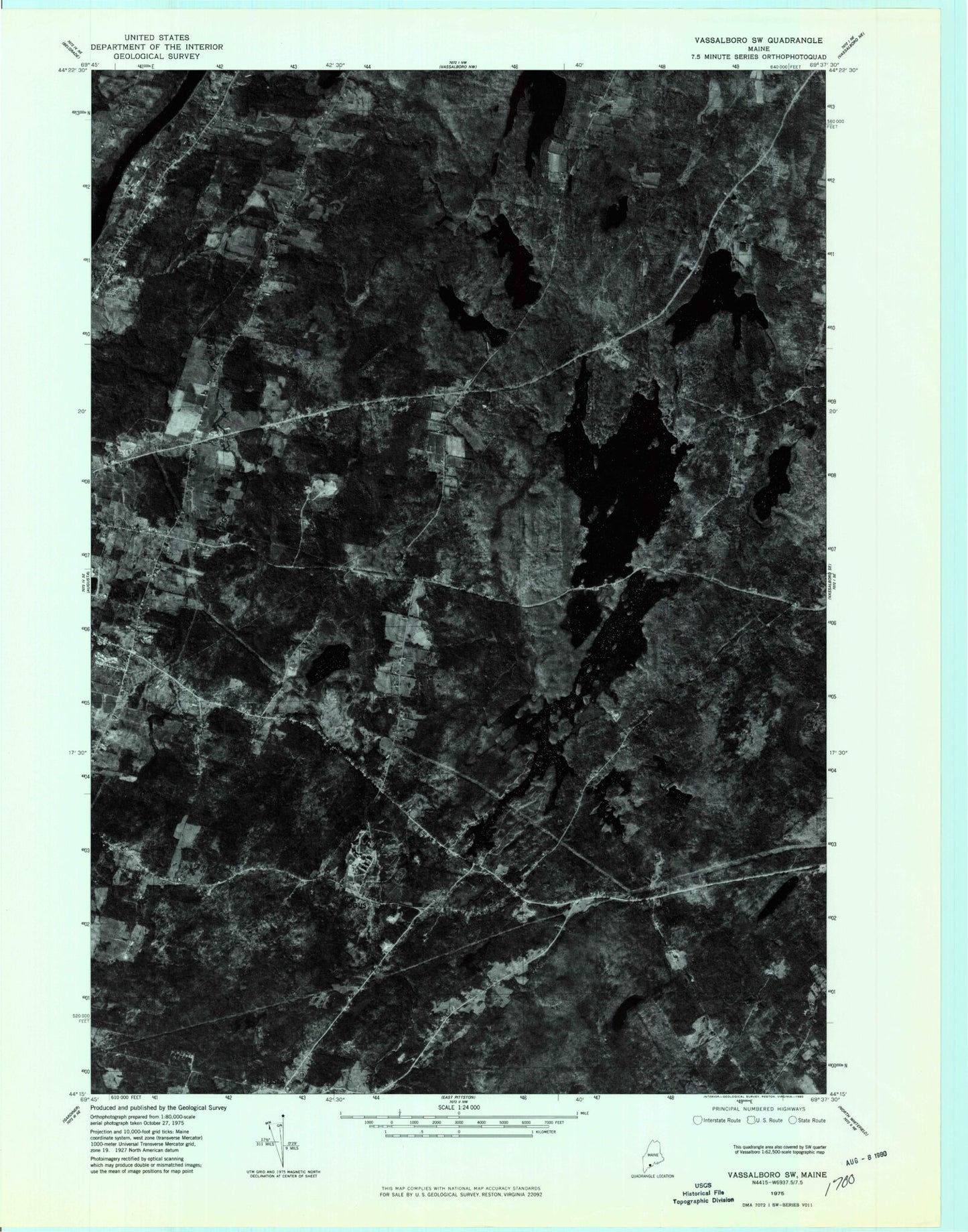
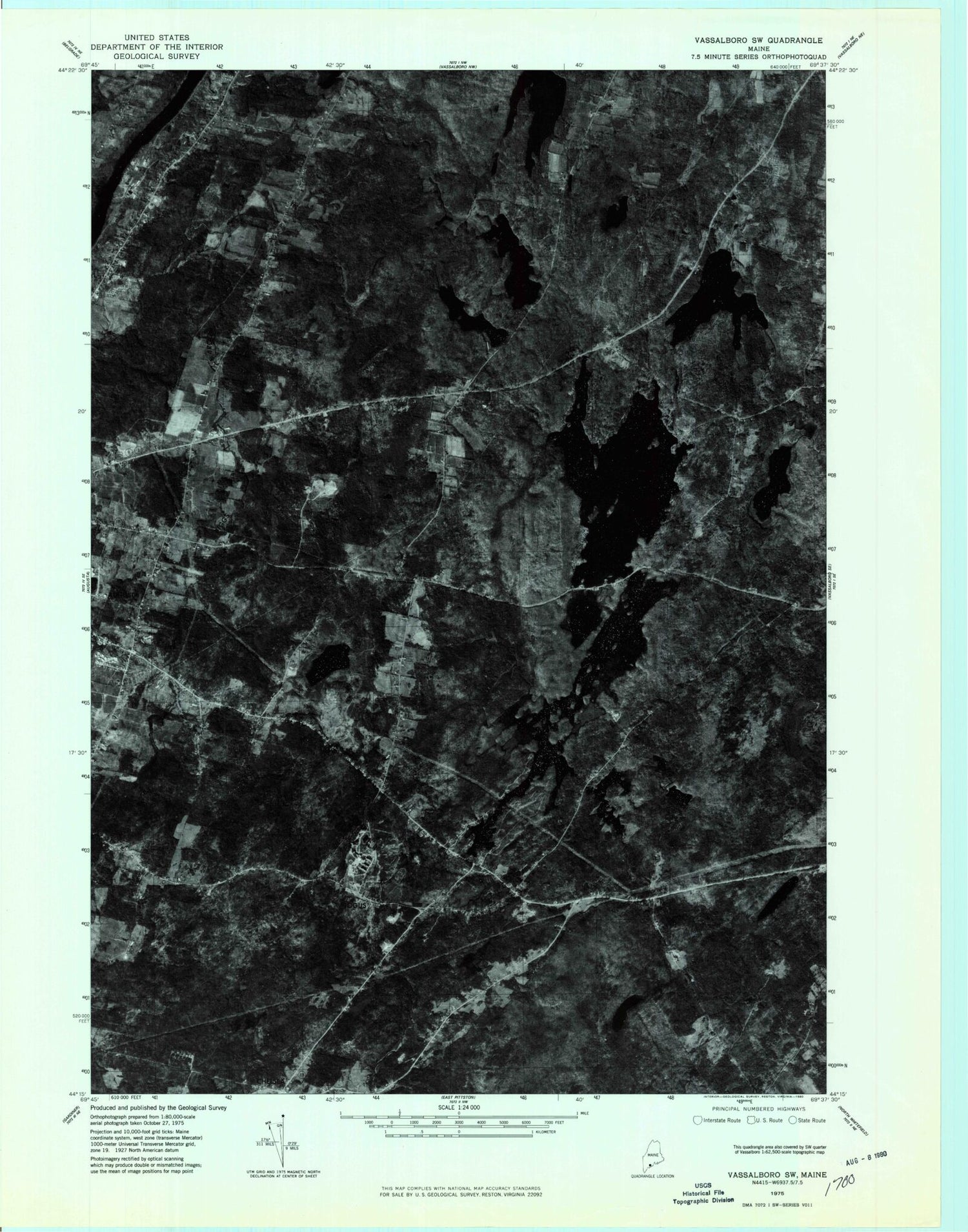
Historical USGS topographic quad map of Togus Pond in the state of Maine. Typical map scale is 1:24,000, but may vary for certain years, if available. Print size: 24" x 27"
This quadrangle is in the following counties: Kennebec, Lincoln.
The map contains contour lines, roads, rivers, towns, and lakes. Printed on high-quality waterproof paper with UV fade-resistant inks, and shipped rolled.
Contains the following named places: Anderson Pond, Baker Bogs, Bolton Hill, Bolton Hill Cemetery, Brann Brook, Chelsea, Dam Pond, Givens Hill, Givens Pond, Greeley Pond, Lily Pond, Little Togus Pond, Lower Togus Pond, Pleasant Hill, Porcupine Hill, Spectacle Pond, Stickney Brook, Threecornered Pond, Tinkham Pond, Togus Pond, Tolman Pond, Wellman Pond, Winter Hill, Togus, Capital Area Technical Center, Farrington Elementary School, Cony Middle and High School, Stony Brook, WMME-FM (Augusta), City of Augusta, Town of Chelsea, Lower Togus Pond Dam, Togus Pond, Togus National Cemetery, Togus Veterans Affairs Medical Center, Delta Ambulance Augusta, Allen Cemetery, Chase - Riverside Cemetery, Douglas Cemetery, Mud Mill Cemetery, Trask Cemetery, Chelsea Elementary School, Togus National Cemetery East