MyTopo
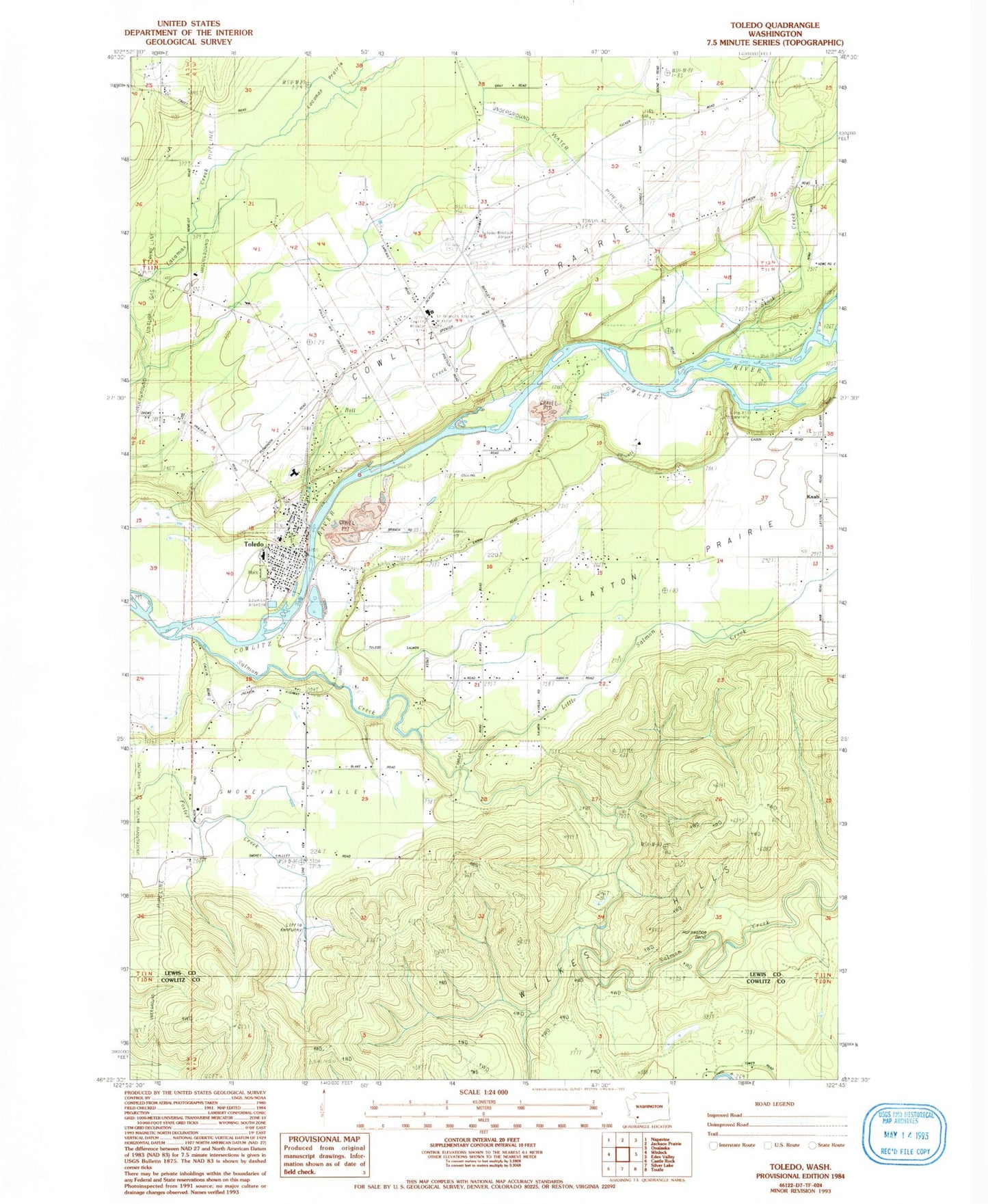
Classic USGS Toledo Washington 7.5'x7.5' Topo Map
Couldn't load pickup availability
Historical USGS topographic quad map of Toledo in the state of Washington. Map scale may vary for some years, but is generally around 1:24,000. Print size is approximately 24" x 27"
This quadrangle is in the following counties: Cowlitz, Lewis.
The map contains contour lines, roads, rivers, towns, and lakes. Printed on high-quality waterproof paper with UV fade-resistant inks, and shipped rolled.
Contains the following named places: Bill Creek, City of Toledo, Conradi Lake, Conradi Lake Dam, Cougar Creek, Cowlitz, Cowlitz Mission, Cowlitz Prairie, Cowlitz Prairie Grange, Ed Carlson Memorial Field - South Lewis County Airport, Horseshoe Bend, Lacamas Prairie, Layton Prairie, Layton Prairie School, Lewis County Fire District 2, Lewis County Fire District 2 Station 2, Little Kentucky, Little Salmon Creek, Lone Hill Cemetery, Lower Cowlitz School, Mill Creek, Pin Creek, Roberts Cemetery, Saint Francis Cemetery, Saint Francis Xavier Mission, Saint Marys Academy, Salmon Creek, Skook Creek, Toledo, Toledo Cemetery, Toledo Elementary School, Toledo High School, Toledo Middle School, Toledo Police Department, Toledo Post Office, Tower, Upper Cowlitz School, Wayside School, Wilkes Hills