MyTopo
Classic USGS Tolo Mountain Oregon 7.5'x7.5' Topo Map
Couldn't load pickup availability
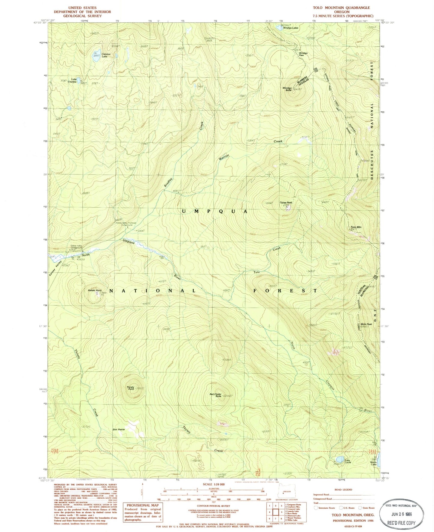
Historical USGS topographic quad map of Tolo Mountain in the state of Oregon. Typical map scale is 1:24,000, but may vary for certain years, if available. Print size: 24" x 27"
This quadrangle is in the following counties: Douglas, Klamath.
The map contains contour lines, roads, rivers, towns, and lakes. Printed on high-quality waterproof paper with UV fade-resistant inks, and shipped rolled.
Contains the following named places: Bradley Creek, Calamut Lake, Calamut Way, Lake Charline, Kelsay Point, Kelsay VAlley Recreation Site, Kelsay Way, Lake Lucile, Maidu Lake, Maidu Lake Way, Mule Peak, Red Cinder Butte, Slim Prairie, Tenas Peak, Thirsty Point, Tolo Creek, Tolo Mountain, Warrior Creek, Windigo Butte, Windigo Lakes, Windigo Pass, Linda Lake, Kelsay Valley Trailhead, Kelsay Valley Horse Camp, Lake Lucile Campground (historical), Tenas Peak Lookout Station, Windigo Pass Recreation Site, Lake Patricia