MyTopo
Classic USGS Tom Lake Minnesota 7.5'x7.5' Topo Map
Regular price
$16.95
Regular price
Sale price
$16.95
Unit price
per
Couldn't load pickup availability
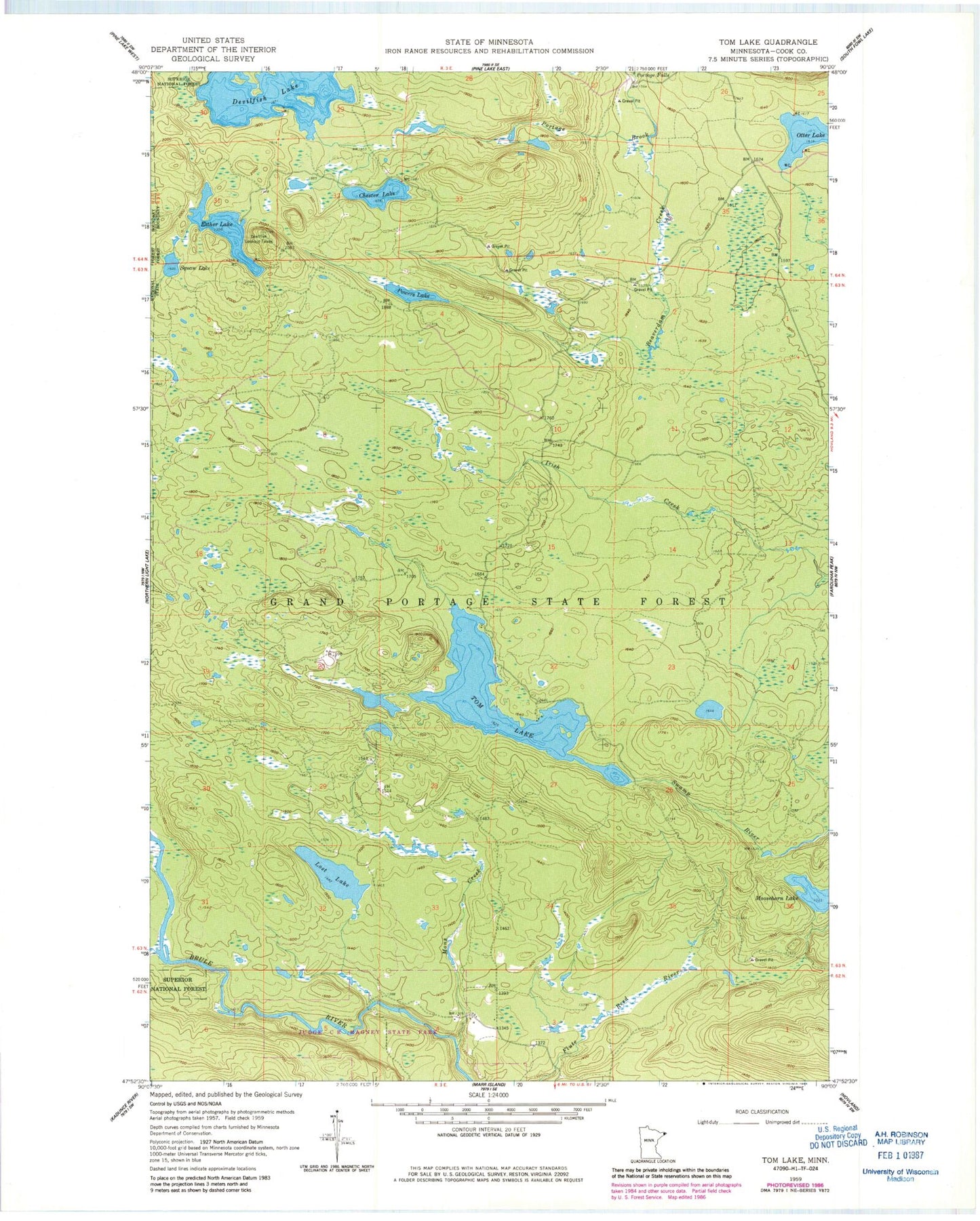
Historical USGS topographic quad map of Tom Lake in the state of Minnesota. Map scale may vary for some years, but is generally around 1:24,000. Print size is approximately 24" x 27"
This quadrangle is in the following counties: Cook.
The map contains contour lines, roads, rivers, towns, and lakes. Printed on high-quality waterproof paper with UV fade-resistant inks, and shipped rolled.
Contains the following named places: Beaverdam Creek, Chester Lake, Devilfish Lake, Devilfish Lookout Tower, Esther Lake, Farquhar Knob, Lost Lake, Mons Creek, Moosehorn Lake, Olga Lake, Otter Lake, Portage Falls, Powers Lake, Tom Lake, WBFX-FM (Grand Marais)