MyTopo
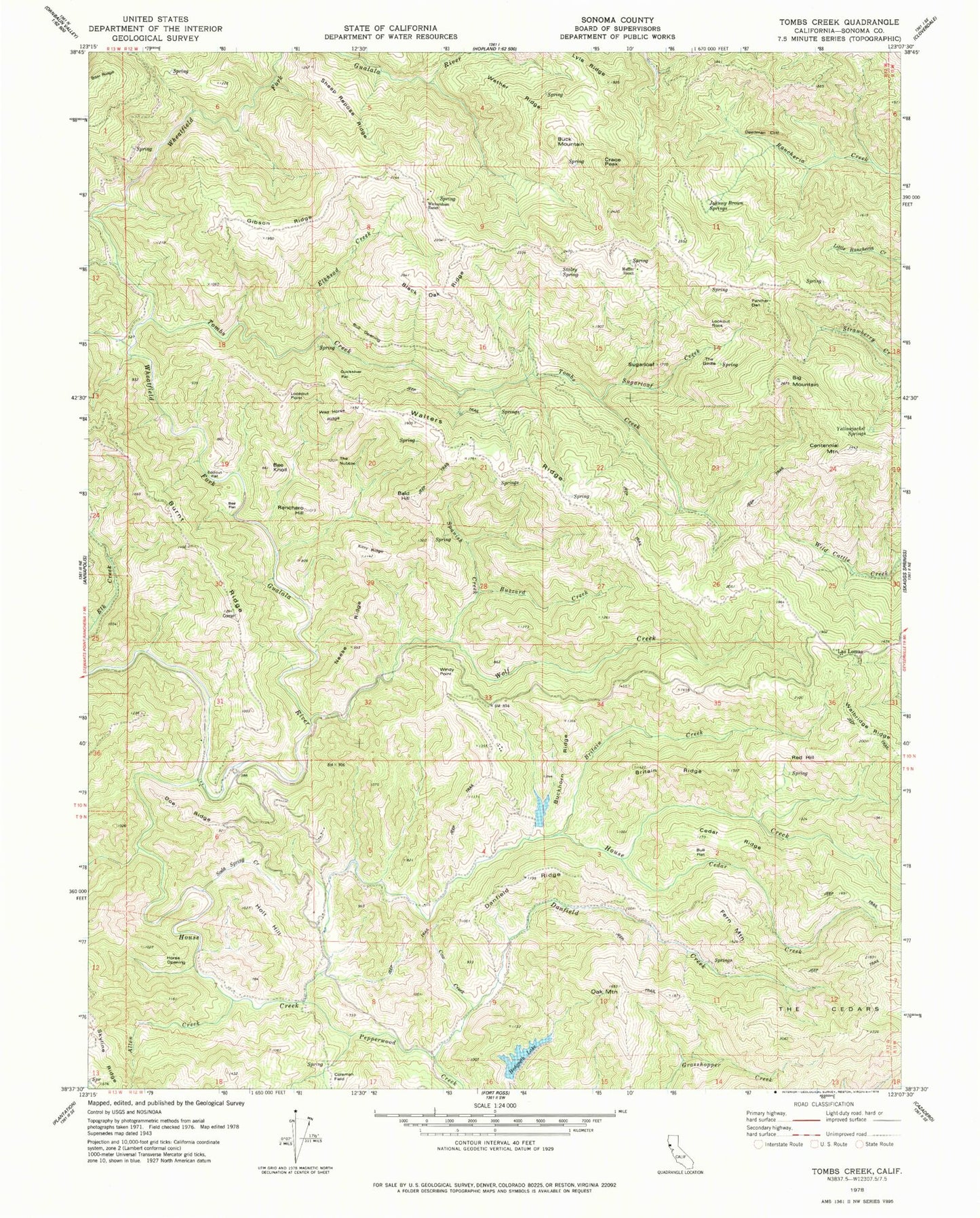
Classic USGS Tombs Creek California 7.5'x7.5' Topo Map
Couldn't load pickup availability
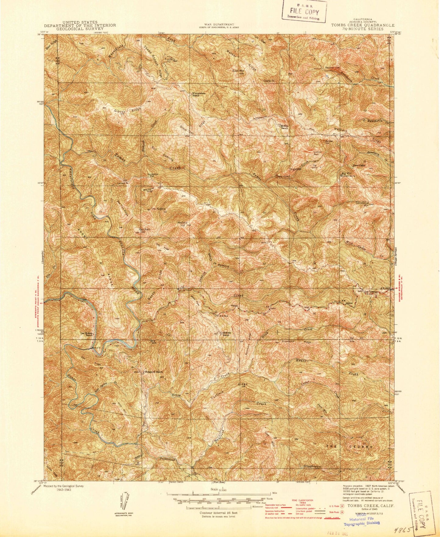
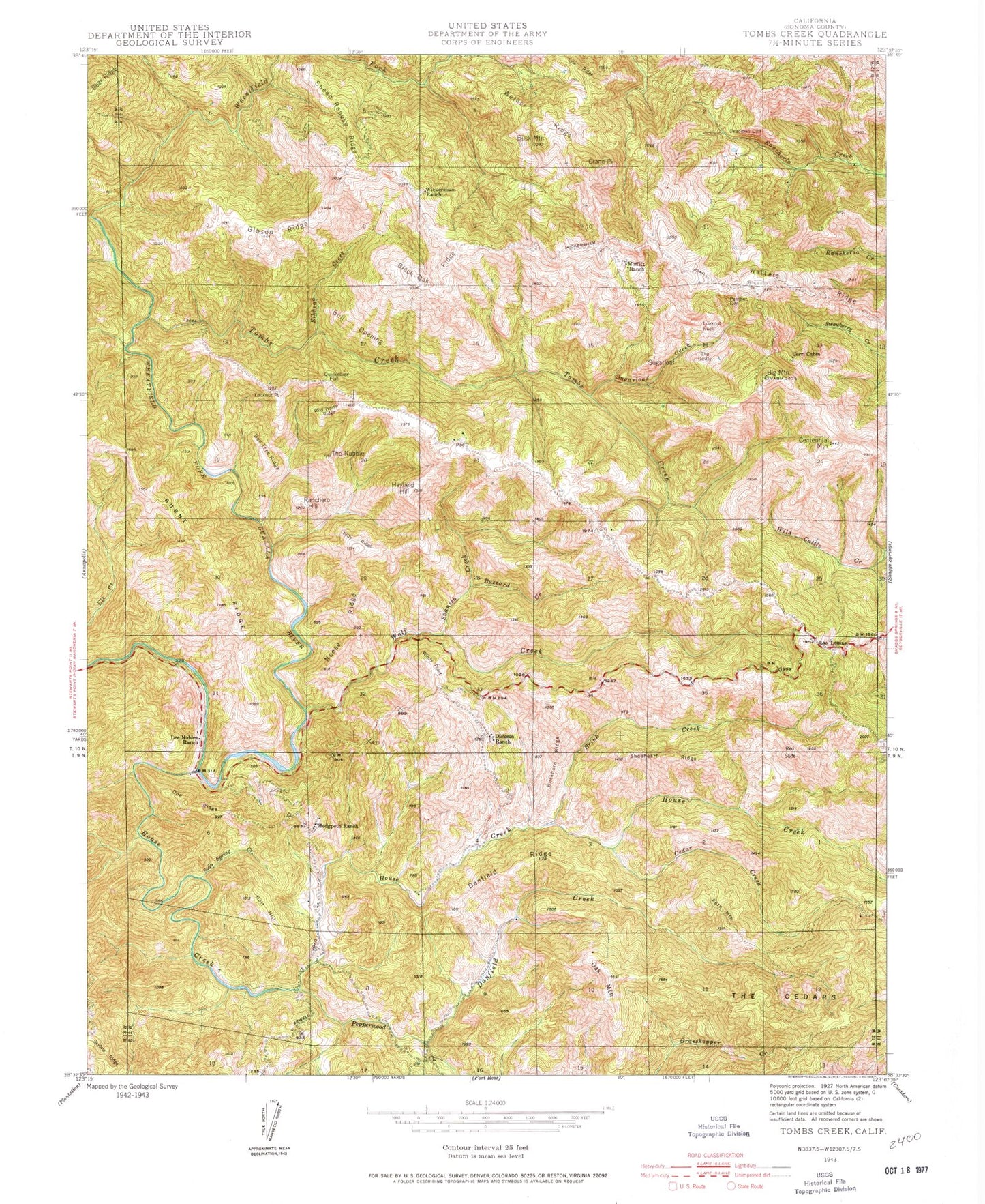
Historical USGS topographic quad map of Tombs Creek in the state of California. Typical map scale is 1:24,000, but may vary for certain years, if available. Print size: 24" x 27"
This quadrangle is in the following counties: Sonoma.
The map contains contour lines, roads, rivers, towns, and lakes. Printed on high-quality waterproof paper with UV fade-resistant inks, and shipped rolled.
Contains the following named places: Allen Creek, Bee Flat, Bee Knoll, Big Mountain, Black Oak Ridge, Britain Creek, Britain Ridge, Buckhorn Ridge, Bull Flat, Bull Opening, Burnt Ridge, Buzzard Creek, Cedar Creek, Cedar Ridge, Centennial Mountain, Coleman Field, Cow Creek, Danfield Creek, Danfield Ridge, Deadman Cliff, Doe Ridge, Eddicut Flat, Elkhead Creek, Fern Mountain, Gibson Ridge, Hedgpeth Lake, Holt Hill, Horse Opening, House Creek, Johnny Brown Springs, Kitty Ridge, Lyle Ridge, Moffitt Ranch, Neese Ridge, Oak Mountain, Panther Den, Pepperwood Creek, Quicksilver Flat, Ranchero Hill, Sheep Repose Ridge, Skyline Ridge, Soda Spring Creek, Spanish Creek, Staley Spring, Sugarloaf, Sugarloaf Creek, The Girdle, The Nubble, Tombs Creek, Walters Ridge, Wether Ridge, Wickersham Ranch, Wild Horse Ridge, Wolf Creek, Yellowjacket Springs, Cerri Cabin, Dickson Ranch, Hedgpeth Ranch, Lee Nobles Ranch, Bald Hill, Buck Mountain, Crane Peak, Las Lomas, Lookout Point, Lookout Rock, Red Hill, Windy Point, Hillside Ranch 4420 Dam, Allen Creek, Bee Flat, Bee Knoll, Big Mountain, Black Oak Ridge, Britain Creek, Britain Ridge, Buckhorn Ridge, Bull Flat, Bull Opening, Burnt Ridge, Buzzard Creek, Cedar Creek, Cedar Ridge, Centennial Mountain, Coleman Field, Cow Creek, Danfield Creek, Danfield Ridge, Deadman Cliff, Doe Ridge, Eddicut Flat, Elkhead Creek, Fern Mountain, Gibson Ridge, Hedgpeth Lake, Holt Hill, Horse Opening, House Creek, Johnny Brown Springs, Kitty Ridge, Lyle Ridge, Moffitt Ranch, Neese Ridge, Oak Mountain, Panther Den, Pepperwood Creek, Quicksilver Flat, Ranchero Hill, Sheep Repose Ridge, Skyline Ridge, Soda Spring Creek, Spanish Creek, Staley Spring, Sugarloaf, Sugarloaf Creek, The Girdle, The Nubble, Tombs Creek, Walters Ridge, Wether Ridge, Wickersham Ranch, Wild Horse Ridge, Wolf Creek, Yellowjacket Springs, Cerri Cabin, Dickson Ranch, Hedgpeth Ranch, Lee Nobles Ranch, Bald Hill, Buck Mountain, Crane Peak, Las Lomas, Lookout Point, Lookout Rock, Red Hill, Windy Point, Hillside Ranch 4420 Dam