MyTopo
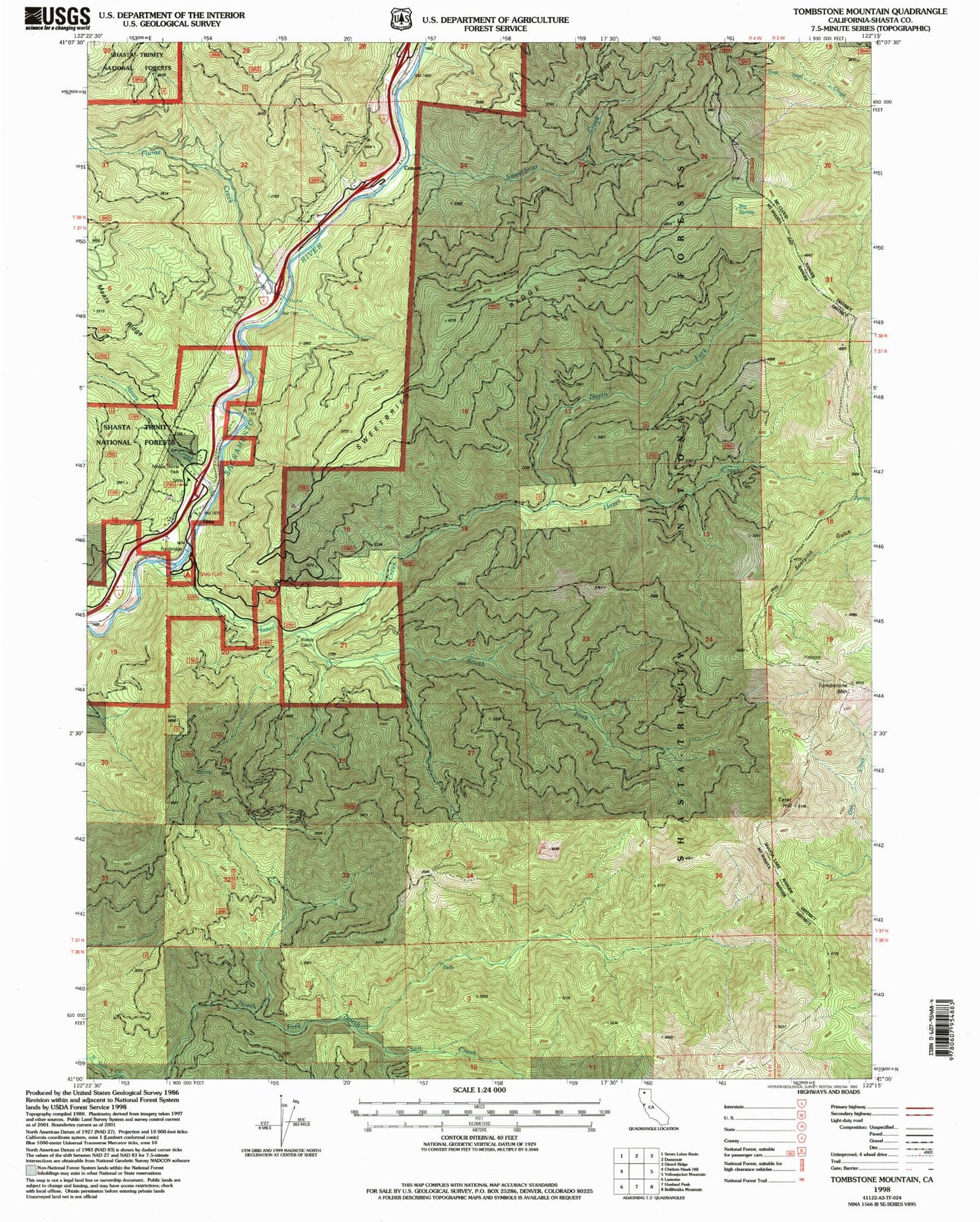
Classic USGS Tombstone Mountain California 7.5'x7.5' Topo Map
Couldn't load pickup availability
Historical USGS topographic quad map of Tombstone Mountain in the state of California. Map scale may vary for some years, but is generally around 1:24,000. Print size is approximately 24" x 27"
This quadrangle is in the following counties: Shasta.
The map contains contour lines, roads, rivers, towns, and lakes. Printed on high-quality waterproof paper with UV fade-resistant inks, and shipped rolled.
Contains the following named places: Big Spring, Conant, Flume Creek, Hazel Creek, Mears Creek, North Fork Hazel Creek, Sims, Sims Cemetery, Sims Flat, Sims Flat Campground, Sims Lookout, Sims Station, South Fork Hazel Creek, Sweetbrier Creek, Sweetbrier Ridge, Tater Hill, Tombstone Mountain, Wards Cabin, Wards Upper Cabin, ZIP Code: 96017