MyTopo
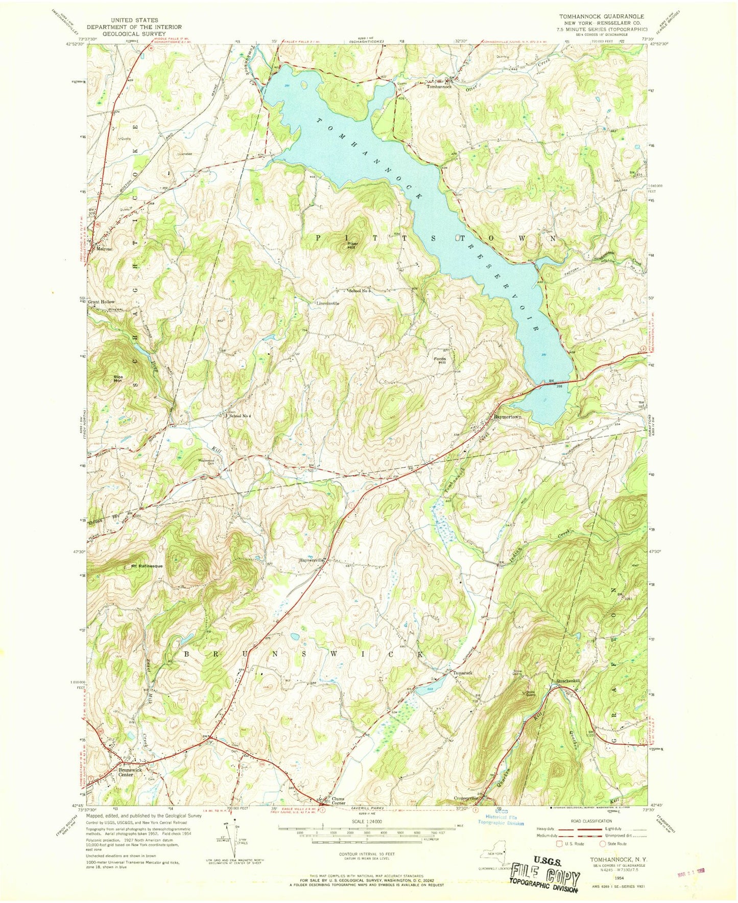
Classic USGS Tomhannock New York 7.5'x7.5' Topo Map
Couldn't load pickup availability
Historical USGS topographic quad map of Tomhannock in the state of New York. Map scale may vary for some years, but is generally around 1:24,000. Print size is approximately 24" x 27"
This quadrangle is in the following counties: Rensselaer.
The map contains contour lines, roads, rivers, towns, and lakes. Printed on high-quality waterproof paper with UV fade-resistant inks, and shipped rolled.
Contains the following named places: Bornt Family Farms, Brunswick Center, Brunswick Town Hall, Center Brunswick United Methodist Church, Center Brunswick Volunteer Fire House, Clums Corner, Fords Hill, Gilead Lutheran Church, Gooseberry Honey And Herb Farm, Haynersville, Herrington Farms, Hillside Organic Farm, Indian Creek, Kingdom Hall of Jehovahs Witnesses, Lincolnville, Maplewood Cemetery, Melrose, Melrose Post Office, Misty Hills Farm, Mount Rafinesque, Mountain Gardens Tree Farm, Otter Creek, Piser Hill, Quackenkill, Quackenkill Sandstone Quarry, Raymertown, Raymertown Fire District, Rice Mountain, Schaghticoke Town Hall, School Number 12, School Number 4, School Number 5, School Number 6, Sunkauissia Creek, Tamarac Elementary School, Tamarac Secondary School, Tamarack, Tarbox Farms, Terrace Haven Mobile Home Park, Tomhannock, Tomhannock Reservoir, Town of Brunswick, Town of Pittstown, Viewmere Farm, ZIP Codes: 12121, 12185