
MyTopo
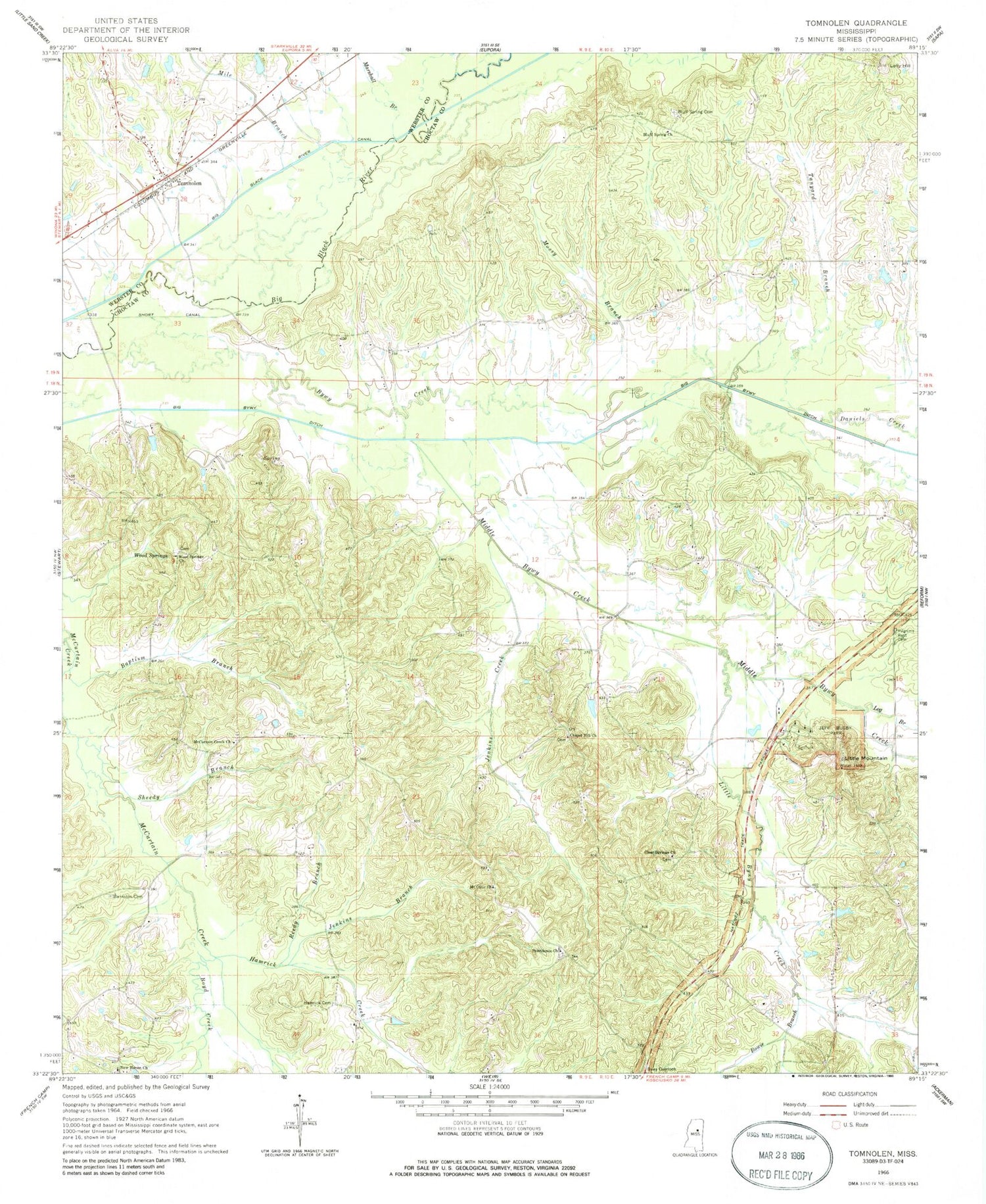
Classic USGS Tomnolen Mississippi 7.5'x7.5' Topo Map
Couldn't load pickup availability
Historical USGS topographic quad map of Tomnolen in the state of Mississippi. Map scale may vary for some years, but is generally around 1:24,000. Print size is approximately 24" x 27"
This quadrangle is in the following counties: Choctaw, Webster.
The map contains contour lines, roads, rivers, towns, and lakes. Printed on high-quality waterproof paper with UV fade-resistant inks, and shipped rolled.
Contains the following named places: Ada, Bankston, Bankston Cemetery, Bankston School, Baptism Branch, Big Bywy Ditch, Blaine Store, Bluff Spring Cemetery, Bluff Spring Church, Bluff Springs School, Bowie Branch, Boyd Creek, Boyd School, Bywy Creek, Bywy School, C E King Lake Dam, Chapel Hill Cemetery, Chapel Hill Church, Chapel Hill School, Clear Springs Cemetery, Clear Springs Church, Coxs Store, Daniels Creek, Hamrick Cemetery, Hamrick Creek, Hogan Chapel School, Jeff Busby Park, Jenkins Branch, Jenkins Creek, Little Bywy Creek, Little Mountain, Log Branch, Lolly Hill, Marshall Branch, McCurtain Creek Church, McCurtin Creek Cemetery, Middle Bywy Creek, Mile Branch, Mossy Branch, Mount Olive Church, New Haven Church, Pilgrims Rest Cemetery, Pine Bluff School, Progress School, Providence Cemetery, Providence Church, Reedy Branch, Rockport Church, Saint John Church, Salt Creek, Sheedy Branch, Short Canal, Simpson Store, Tanyard Branch, Tomnolen, Tomnolen Baptist Church, Tomnolen Volunteer Fire Department, Union School, Watsons Mill, Watsons Store, White Mill, Wood Springs, Wood Springs Cemetery, Wood Springs Church


