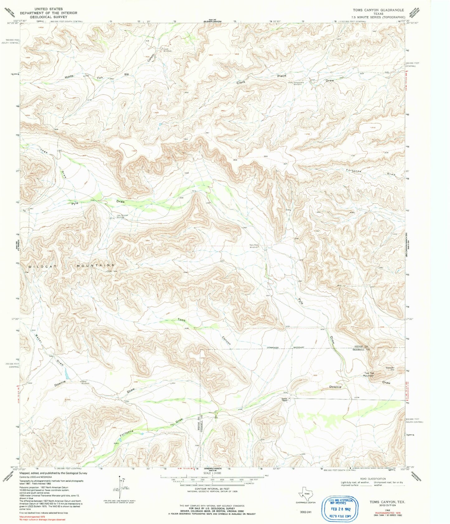
MyTopo
Classic USGS Toms Canyon Texas 7.5'x7.5' Topo Map
Regular price
$16.95
Regular price
Sale price
$16.95
Unit price
per
Couldn't load pickup availability
Historical USGS topographic quad map of Toms Canyon in the state of Texas. Map scale may vary for some years, but is generally around 1:24,000. Print size is approximately 24" x 27"
This quadrangle is in the following counties: Pecos, Terrell.
The map contains contour lines, roads, rivers, towns, and lakes. Printed on high-quality waterproof paper with UV fade-resistant inks, and shipped rolled.
Contains the following named places: Baker Draw, Baker Windmill, Cliett Windmills, Downie Ranch, Fortyone Draw, Joes Booster Windmill, Pyle Draw, Rock Pens Windmill, Standifer Gap, Toms Canyon, Two Top Mountain, Vega Draw, Yerbabuena Windmill