MyTopo
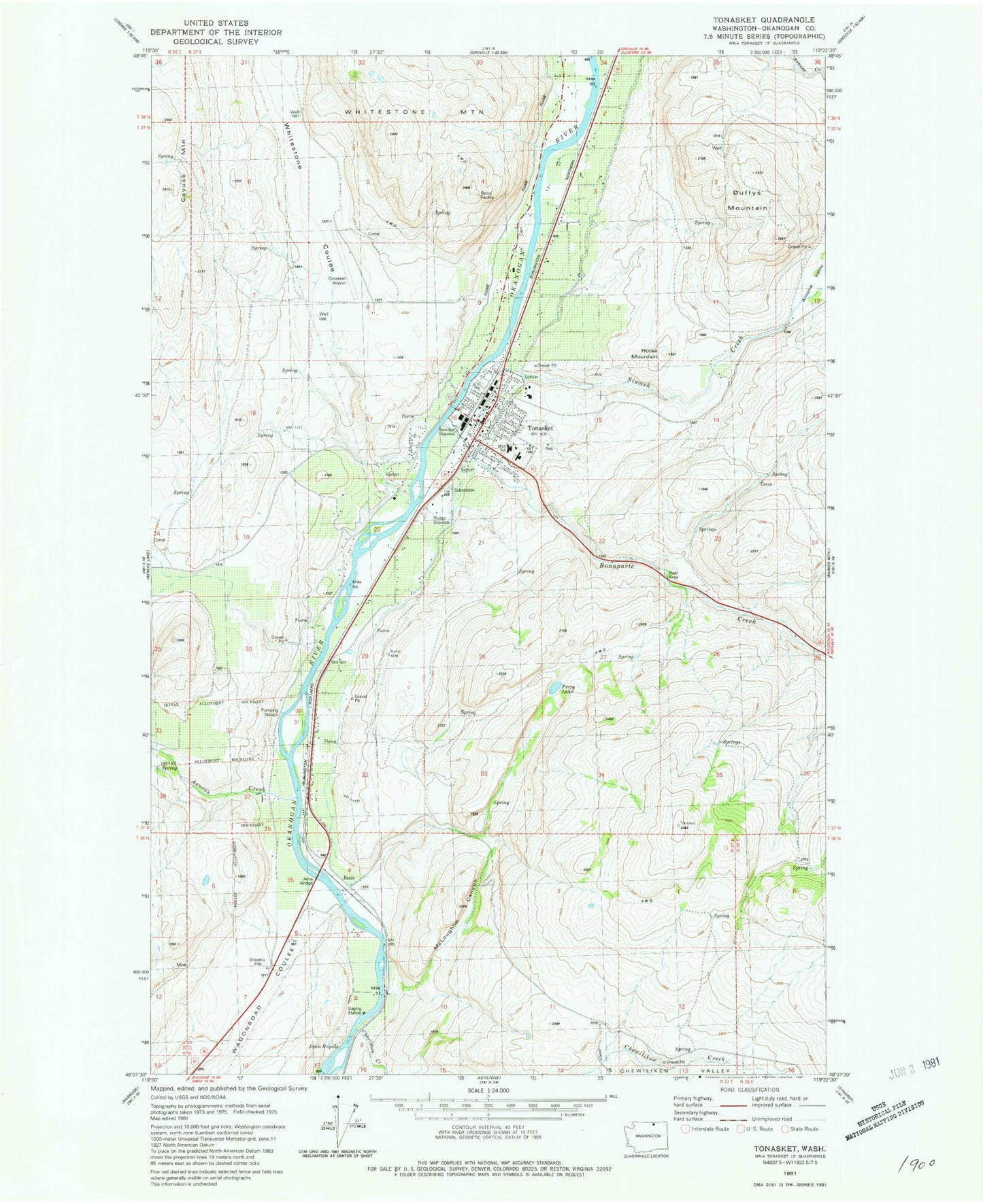
Classic USGS Tonasket Washington 7.5'x7.5' Topo Map
Couldn't load pickup availability
Historical USGS topographic quad map of Tonasket in the state of Washington. Map scale may vary for some years, but is generally around 1:24,000. Print size is approximately 24" x 27"
This quadrangle is in the following counties: Okanogan.
The map contains contour lines, roads, rivers, towns, and lakes. Printed on high-quality waterproof paper with UV fade-resistant inks, and shipped rolled.
Contains the following named places: Aeneas Creek, Antoine Valley, Bonaparte Creek, Bonaparte Creek Bridge, Chewiliken Creek, City of Tonasket, Duffys Mountain, Hope Lutheran Church, Horse Mountain, Janis, Janis Bridge, Janis Rapids, John's Landing Mobile Home Park, McLoughlin Canyon, North Valley Hospital, Okanogan County Fire District 4 Tonasket Fire Department, Perry Lake, Siwash Creek, Tonasket, Tonasket Adventist Church, Tonasket Community Library, Tonasket Elementary School, Tonasket Emergency Medical Services District, Tonasket Free Methodist Church, Tonasket High School, Tonasket Middle School, Tonasket Municipal Airport, Tonasket Police Department, Tonasket Post Office, Tonasket Sewage Treatment Plant, Tonasket Town Hall, Whitestone Airport, Whitestone Coulee