MyTopo
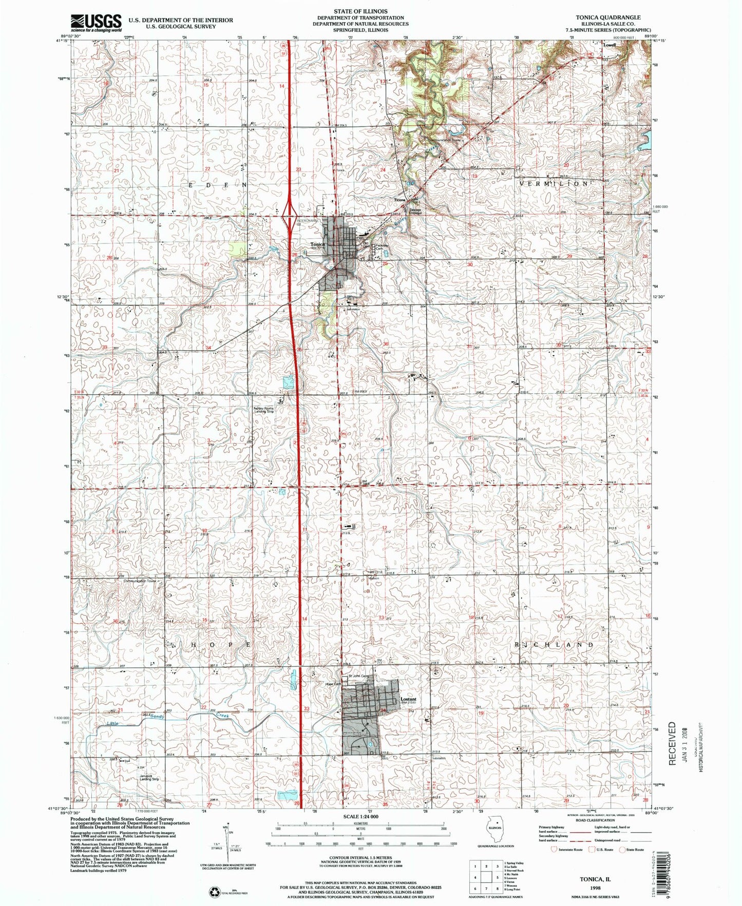
Classic USGS Tonica Illinois 7.5'x7.5' Topo Map
Couldn't load pickup availability
Historical USGS topographic quad map of Tonica in the state of Illinois. Map scale may vary for some years, but is generally around 1:24,000. Print size is approximately 24" x 27"
This quadrangle is in the following counties: LaSalle.
The map contains contour lines, roads, rivers, towns, and lakes. Printed on high-quality waterproof paper with UV fade-resistant inks, and shipped rolled.
Contains the following named places: Alleman Lake, Alleman Lake Dam, Ashley Farms Landing Strip, Burgess School, Eden Center School, Fairview Cemetery, Foote School, Hope Center School, Hope Town Cemetery, Hull School, Janusick Airport, Knapp School, Lostant, Lostant Ambulance, Lostant Community Fire Protection District, Lostant Elementary School, Lostant Post Office, Old Tonica Cemetery, Pflibsen School, Pitts School, Prairie Center School, Saint John's Cemetery, Ticona, Tonica, Tonica Grade School, Tonica Post Office, Tonica Volunteer Fire Department, Township of Eden, Township of Hope, Township of Richland, Trout School, Village of Lostant, Village of Tonica, ZIP Codes: 61334, 61370