MyTopo
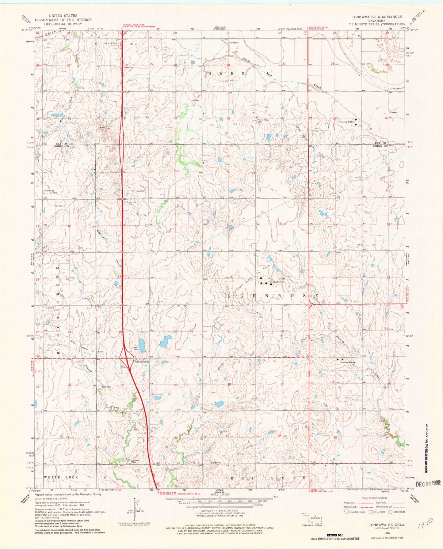
Classic USGS Tonkawa SE Oklahoma 7.5'x7.5' Topo Map
Couldn't load pickup availability
Historical USGS topographic quad map of Tonkawa SE in the state of Oklahoma. Map scale may vary for some years, but is generally around 1:24,000. Print size is approximately 24" x 27"
This quadrangle is in the following counties: Kay, Noble.
The map contains contour lines, roads, rivers, towns, and lakes. Printed on high-quality waterproof paper with UV fade-resistant inks, and shipped rolled.
Contains the following named places: Billings Division, Floral Ridge Cemetery, Freedom Church, Oknoname 103010 Dam, Oknoname 103010 Reservoir, Prairie View Cemetery, South Tonkawa Gas Field, Tonkawa Oil Field, Township of Glenrose, Upper Red Rock Creek Site 3 Dam, Upper Red Rock Creek Site 3 Reservoir, Upper Red Rock Creek Site 5 Dam, Upper Red Rock Creek Site 5 Reservoir, Upper Red Rock Creek Site 6 Dam, Upper Red Rock Creek Site 6 Reservoir