MyTopo
Classic USGS Tony Hill Bay South Carolina 7.5'x7.5' Topo Map
Couldn't load pickup availability
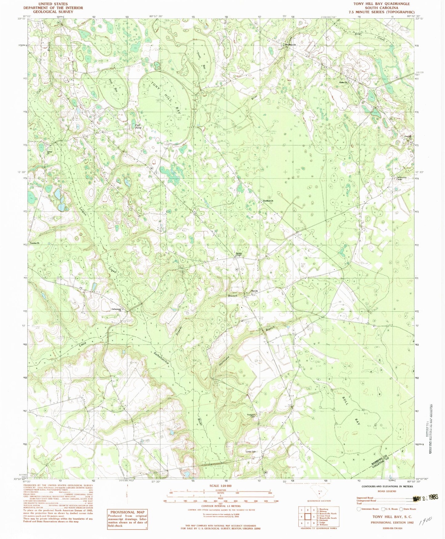
Historical USGS topographic quad map of Tony Hill Bay in the state of South Carolina. Map scale may vary for some years, but is generally around 1:24,000. Print size is approximately 24" x 27"
This quadrangle is in the following counties: Bamberg, Colleton.
The map contains contour lines, roads, rivers, towns, and lakes. Printed on high-quality waterproof paper with UV fade-resistant inks, and shipped rolled.
Contains the following named places: Bamberg Division, Bethel Church, Bull Bay, Butlers Pond Dam D-2824, Camp Branch School, Carter Cemetery, Claflin Church, Claflin School, Colt Branch, Cowpen Ford, Crooked Pond, Drawdy Branch, Edisto School, Fish Pond, Fish Pond Church, Free Gift Baptist Church, Gethsemane Baptist Church, Goodland Baptist Church, Hog Bay, Hunters Chapel Baptist Church, Hunters Chapel Fire Department, Hunters Chapel School, Hurricane Branch, Lemon Creek, Little Swamp, Millersville, Oak Grove School, Pine Grove School, Piney Bay, Piney Grove Church, Poplar Grove School, Prospect Cemetery, Prospect Church, Schofield Swamp, Shiloh Plantation Airport, Tony Hill Bay, Truevine Church, Woodlawn Cemetery, Woodlawn School, Zion Church